

Kalindi Khal Trek
The high adrenaline trek which reaches to almost 6,000 m, kalindi khal expedition ( gangotri to badrinath hidden trail), attractions of kalindi khal trek.
Customize Your Trek:
Day 1 dehradun to gangnani.
Altitude: 2,100 ft (640 m) – 6,430 ft (1,960 m)
Accommodation: Guest House / Homestay / Hotel
Meals: Dinner
Day 2 Gangnani to Gangotri
Drive: 52 km, 2 hrs
Altitude: 6,430 ft (1,960 m) – 10,000 ft (3048 m)
Meals: Breakfast + Lunch + Evening Snacks + Dinner
Day 3 Gangotri to Bhojwasa
Trek: 14 km, 6-7 hrs
Altitude: 10,000 ft (3048 m) – 12,467 ft (3,800 m)
Accommodation: Camping (Alpine Tents)
Day 4 Bhojbasa to Gaumukh to Tapovan
Trek: 13 km, 6-7 hrs
Altitude: 12,467 ft (3,800 m) – 12,795 ft (3,900 m) – 14,640 ft (4,462 m)
Day 5 Tapovan rest day
Altitude: 14,640 ft (4,462 m)
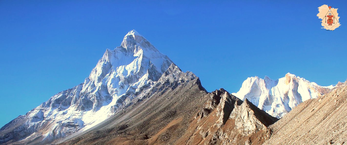
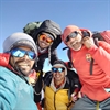
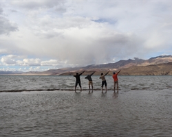
This day is free for us to acclimatize, relax and enjoy the magnificent snow-capped peaks, flora, fauna, and mountain landscape. This land is frequented by some of the greatest contemporary mountaineers. The Shivling peak stands tall in front of us. Behind Shivling, towards the right is Meru . A little towards the left of Shivling, is Sumeru. The Bhagirathi peaks are visible further to the left. Bhagirathi III, Meru (Central Peak) and Sumeru have some of the hardest climbing routes in the world. We can visit the Meru Glacier and return to our campsite.
Day 6 Tapovan to Nandanvan
Trek: 8 km, 6 hrs
Altitude: 14,640 ft (4,462 m) – 15,780 ft (4,810 m)
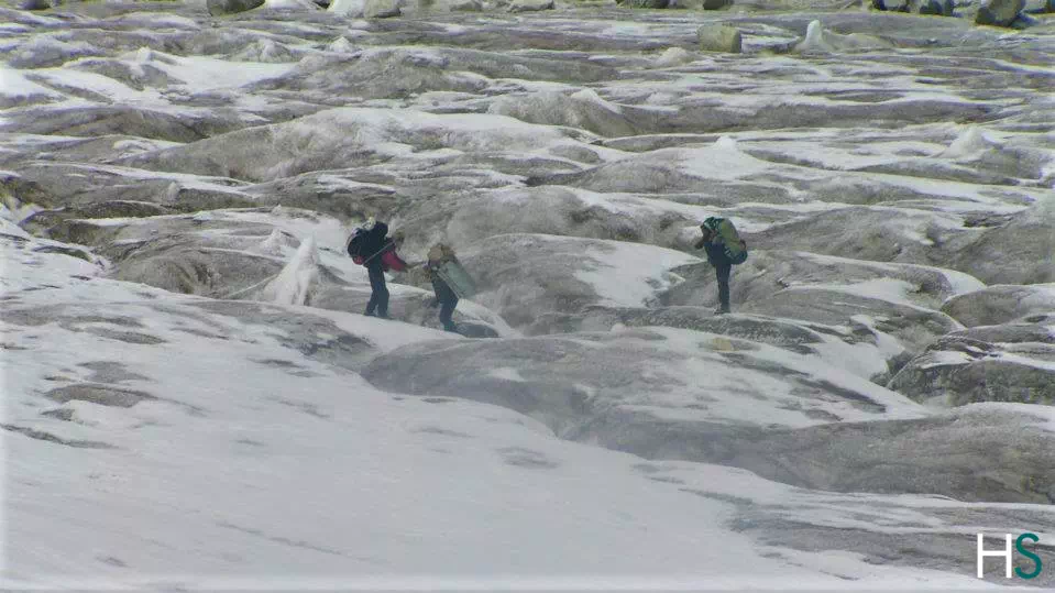
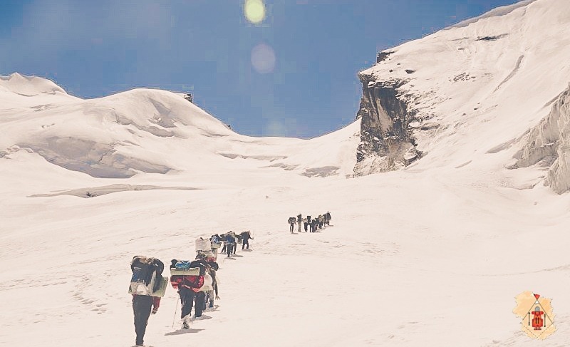
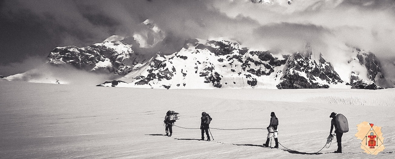
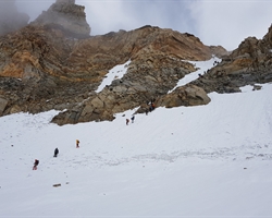
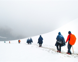
On this day, post-breakfast, our trek begins with a descent onto the glacier. The glacier, nestled between two ranges, often features a layer of rocky moraine due to landslides, facilitating somewhat easier walking conditions. However, staying together as a group is crucial on the glacier, as veering off the trail is common. Keeping a watchful eye on cairns, or stacked rocks, helps maintain the right path. Walking on the glacier demands caution due to its slippery surface. Even a momentary lapse in focus can pose risks, given the presence of large crevasses scattered throughout. After covering about a kilometer, the trail ascends vertically, navigating through substantial boulders alongside. Dinner and overnight camping await us at the Nandanvan campsite.
Day 7 Nandanvan to Vasuki Tal
Trek: 6 km, 4-5 hrs
Altitude: 15,780 ft (4,810 m) – 15,748 ft ft (4,800 m)
Day 8 Vasuki Tal to Khara Pathar
Trek: 6 km, 5-6 hrs
Altitude: 15,748 ft ft (4,800 m) – 17,060 ft (5,200 m)
Day 9 Khara Pathar to Sweta Glacier
Trek: 8 km, 5-6 hrs
Altitude: 17,060 ft (5,200 m) – 17,880 ft (5,500 m)
After breakfast, our trek continues towards Sweta Glacier, reaching an altitude of 5,500 meters. This leg of the journey is relatively shorter in duration, leading us to a campsite nestled in the moraine, characterized by an expanse filled with rocks and boulders.
Day 10 Sweta Glacier to Kalindikhal Base Camp
Altitude: 17,880 ft (5,500 m) – 18,372 ft (5,600 m)
Day 11 Kalindikhal Base Camp to Raj Parav via Kalindi Khal
Trek: 13 km, 8-9 hrs
Altitude: 18,372 ft (5,600 m) – 19,500 ft (4,945 m) – 16,076 ft (4,900 m)
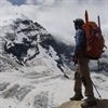
On this day, our trek spans a distance of 12 kilometers towards Kalindi Pass, standing at an elevation of 5947 meters. Upon reaching this breathtaking spot, we’ll indulge in some time to absorb the beauty before descending to camp at Rajparav. The ascent to the pass is undoubtedly challenging, demanding a consistent and steady pace until we reach our destination. However, the moment you stand atop the pass, the realization dawns that every ounce of effort was truly worthwhile. The panoramic vistas of Mt. Kamet, Mt. Mana, Chandra Parbat, Vasuki Parbat, and, on clear days, even glimpses of the Tibetan Plateau, unfold before you, offering an awe-inspiring reward for your toil and determination.
Day 12 Raj Parav to Arwatal
Altitude: 16,076 ft (4,900 m) – 12,830 ft (3,910 m)
We commence the trek early in the morning, heading towards Arwatal at an altitude of 3,910 meters. The journey encompasses a lengthy traverse across glacier terrain, ultimately leading us to the stunning Arwa Tal.
Day 13 Arwatal to Ghastoli
Trek: 7 km, 4-5 hrs
Altitude: 12,830 ft (3,910 m) – 12,435 ft (3,790 m)
We set out early for a 16-kilometer trek to Ghastoli (3796 m), departing from Arwatal. The journey entails a considerable walk across moraines, showcasing a striking transition in the terrain from stark grey to lush greenery as we approach Ghastoli. This location is a breathtaking meadow, a visual delight, offering a serene and picturesque respite along the trek.
Day 14 Ghastoli to Mana to Badrinath
Trek: 6 km, 3 hrs
Drive: 10 km, 30 min
Altitude: 12,435 ft (3,790 m) – 10,500 ft (3,200 m) – 10,826 ft (3,300 m)
Day 15 Badrinath to Dehradun
Drive: 327 km, 8-9 hrs
Altitude: 10,826 ft (3,300 m) – 2,100 ft (640 m)
After breakfast, we’ll embark on a drive to Dehradun. The journey traces along the Alaknanda River until we reach Devprayag, where it merges with the Ganges.
Day 2 How difficult is the trek & what are the challenges?
FAQ's about Kalindi Khal Trek
What is kalindi khal trek.
The Kalindi Khal trek is a challenging high altitude trek in the Indian Himalayas known for its beauty and challenging terrain.
Where is the Kalindi khal Trek?
This trek is in the Indian state of Uttarakhand, specifically in the Garhwal Himalayas. It starts from Gangotri and ends at Badrinath.
How long is the Kalindi Khal Trek?
It usually takes about 14 to 15 days to complete, covering about 122 kilometers (75 miles).
When is the best time to walk Kalindi Khal?
The best time to start trekking Kalindi is during the summer months, from May to June, and then back again in September. During these times, the weather tends to be stable and the roads less frequent.
What is the difficulty of Kalindi Khal’s journey?
The Kalindi River trek is considered very challenging and suitable only for moderately experienced trekkers. The route involves climbing and descending, crossing ice and crossing challenging terrain.
What are the essentials to carry for the Kalindi khal trek?
Essentials include sturdy walking shoes, warm clothing, waterproof gear, sleeping bags, walking sticks, high-fiber foods, first aid and a water purification system for the surrounding areas.
Are permits required for the Kalindi River cruise?
Yes, a permit is required to visit Kalindi Falls, as it passes through protected areas. These permits can be obtained from the Forest Service or from authorized leasing agencies.
Is it necessary to hire a guide for the Kalindi River trek?
Although experienced hikers can try the walk on their own, hiring a local guide is highly recommended for safety reasons. Guides know the terrain and weather and can provide valuable assistance in an emergency.
What are the highlights of the Kalindi Khal Trek?
This trek offers breathtaking views of several Himalayan peaks like Shivling, Bhagirathi and Meru. This includes crossing the famous Kalindi Canal Pass at an altitude of over 5946 meters (19,511 feet), making it a truly unforgettable experience for adventurers
Is altitude sickness a concern on the Kalindi Khal Trek?
Yes, mountain sickness can be a concern because of the high altitudes encountered while hiking. When symptoms of altitude sickness such as headaches, nausea and dizziness occur, it is important to be in good shape, stay hydrated and get off.
What is the best time to do the trek and how is the weather?
What are the top highlights of the trek.
- Transport support from Dehradun to Dehradun
- Pick-up location: Prince Chowk, near Dehradun Railway Station Pick-up Time: Around 7:30 am
- All vegetarian meals starting from dinner on day 1 to breakfast on the last day
- Professional Guide, Cook and Support staff
- First-Aid kit with Oximeter and Portable Oxygen Cylinder
- Kitchen tents, common tents, toilet tents with portable toilet seats
- Rent for camping equipment like Clean sleeping bags and foam mattresses, Good quality ‘A’ shaped or dome tents, Camping stools, Table and Crampons and gaiters if required
- Forest entry charges for Indian nationals (Additional charges will be applicable for international tourists)
- Porter and mule support to carry camping equipment and NOT personal luggage
- Accommodation throughout the trek on a triple-sharing basis
- Guesthouse accommodation on the first and second last day on a triple-sharing basis
- All applicable taxes
- Your designated hotels may not reopen by the time you reach there. While we are making alternate arrangements, do understand that things may not be as “tip-top” as our designated hotels.
- The gurudwara, Hemkund Sahib may not be open. While we are trying to take permission to go to Hemkund Sahib, if it does not happen, then do understand that the pandemic has put restrictions beyond our control.
- Personal expenses like tips, personal medicines, phone calls etc.
- Any transport support during the trek apart from what is included above
- Any cost or services not mentioned in the Inclusions
- Accommodation in Dehradun
- Adventure Insurance
- Cost arising due to unforeseen incidents like bad weather, medical evacuation, roadblocks etc
- Porter and mule support to carry personal Luggage can be arranged at an additional cost of INR 500 per bag per day (weighing up to 12 kg)
- Please carry a lunch box for packed lunch/breakfast to avoid using polythenes and Aluminium foils. Keeping the Himalayas clean is our own responsibility. Reduce the use of Plastic when you are in the abode of the Sacred Himalaya. 🌱
Upcoming Treks
- 17-07-2021 to 23-07-2021 open
- 17-07-2021 to 23-07-2021 close
Send Request
Your query has been successfully registered. we will contact you within 24 hours., something went wrong.try after sometime..
You will receive an email containing a link allowing you to reset your password to a new preferred one.
Verification mail has been sent.
Please check your mail to verify your account.
Click Here to Login
- How To Reach
- Dates & Price
30°56'10.0"N 79°16'40.1"E
- Kalindi Pass Trek

May-June, Sept-Oct
Gangotri, Uttarakhand
Pickup Point
Railway Station, Dehradun
Minimum Age
- Expeditions
The most testing and exciting of all the treks in the Garhwal Himalayas.
Treat yourself to lofty perspectives on the neighboring behemoths like Mt. Shivling, Satopanth, and the Bhagirathi I, II, III pinnacles! Additionally, the conversion of the ice sheets Kalindi, Sweta, and Chaturanga is a once in a blue moon incredible sight.
You find a beautiful little town Mana, the last Indian town before the Chinese frontier.
Kalindi Pass , a high altitude trek of 19,488 ft. demanding ultimate level mountaineering techniques and skills is one of the most famous, adventurous and challenging treks in Garhwal Himalaya starting from Gangotri to Badrinath and is considered to be the highest trekkable mountain pass. Be it the mesmerizing rivulets and peaks of Shivling, Baghirath, Meru or the challenging route that includes boulders, moraines, rough and crevassed glaciers; Kalindi Pass offers one of the most beautiful and arduous trekking destinations in India. It's a 16 days long trek with the best time to visit in summers from June to mid- July and then again during the post-monsoon months of September and October.
Talking about the exploration of the route of going to Badrinath from Gangotri across the Kalindi, it hushes up troublesome around 100 km of the trek that begins at Gangotri goes through Gaumukh, Nandanvan, Vasuki Tal, Kalindi Base, Kalindi, and afterward slides to Arwa Tal, Ghastoli, and finishes at Badrinath. The course goes through one of the most stunning mountainscapes under the shadow of incredible pinnacles of Garhwal-Bhagirathi 1, 2 & 3 Shivlinga top, Vasuki top, Kedar arch, Meru Peak, Sudershan Peak, Chandra Parbat, and Satopanth, etc. One can encounter a wide range of trekking as the course goes through boulders, snow and glacial paths.
Kalindi Pass Trek with Trekmunk assures you the best of experiences and knowledge during the trek. A group of accomplished, certified Trek Leader and professional guides, will guide you for the trek with a suitable itinerary for all. It will cost you Rs. 1,35,000 for a 16 days trek which includes accommodation, transportation from Rishikesh, trek leader, and professionals, meals, safety equipment, and a lot many to experience. Don't miss the chance of experiencing this adventurous and thrilling trekking journey of Kalindi Pass.
Best Time to Visit
Best time to venture out to Kalindi trek is in between summer (June to mid-July) and post-Monsoon (September to early October).
Summers : The climate of Kalindi Trek stays lovely during summers. The Himalayas are beautifully noticeable and the cool wind adds appeal to the feel.
Post monsoon : The rainfall improves the excellence of the trek. The forest becomes rich green and the blossoms exceed in number. The climate stays moderate and lovely.
Brief Itinerary
Detailed itinerary, day 1: drive to uttarkashi from dehradun.
This will be the first day of this trek. You will have to reach Rishikesh on your own. From here, we will start our journey from Rishikesh and drive to Uttarkashi. The drive is actually very scenic with picturesque views around the region. After 6 hours of drive, you will finally step into Uttarkashi. You can roam around, embrace the local culture, and enjoy the ecstatic cuisine. The sleepover will be arranged at a hotel or lodge.
Day 2: Drive from Uttarkashi to Gangotri
Covering a distance of 100 km, we will move forward to Gangotri with about 5 hours of drive and we will reach Gangotri. You can roam around, embrace the local culture, and enjoy the ecstatic cuisine. The sleepover will be arranged at a hotel or lodge.
Day 3: Trek from Gangotri to Bhojbasa
We'll begin our trek to Bhojwasa after an early breakfast at Gangotri. The whole path towards Bhojwasa experiences thick elevated woods and crosses the tree line of Chirbasa. After Chirbasa, the land is barren till Bhojwasa. At the same time, river Bhagirathi goes with us and as we progress further we will find a workable place with the delightful sight of the Bhagirathi gathering of pinnacles.
Day 4: Trek from Bhojbasa to Tapovan via Gaumukh
The trek from Bhojbasa to Gaumukh experiences pine and birch backwoods and rough landscapes. Gaumukh is the mouth of the Gangotri Glacier and the spot from where River Ganga streams down from the ice sheet. After a lofty move from Gaumukh, you'll reach Tapovan. A high-height glade set at a rise of 14,642 ft, Tapovan is a gift for trekkers. Incorporated with wildflowers, wonderful streams, and crowds of blue mountain goats (bharals), with the snow-clad mountains transcending in the background, Tapovan is a flawless campground to investigate and rest.
Day 5: Rest & Acclimatise at Tapovan
This will be the fifth day on the trek. This day will be reserved for the purpose of rest and acclimatization.
Day 6: Trek from Tapovan to Nandanvan
The course from Tapovan to Nandanvan experiences the rough edges, crevasses, frosty sheets, streams, and wonderful rich green bright valley. The 3 km long and 1.5 km wide Nandanvan fields give perhaps the best perspective on the grand Shivling, Bhagirathi, Sudarshan, and The top.
Day 7: Trek from Nandanvan to Vasuki Tal
On our approach to Vasuki Tal, we will cross the Chaturanga Glacier and go over excellent perspectives on Meru and Bhrigupanth. Vasuki Tal is a little half-solidified lying at the base of Mt. Satopanth and Mt. Vasuki Parbat.
Day 8: Trek from Vasuki Tal to Khara Patthar
The path to Khara Patthar is loaded up with moraines and thick snow beds, Khara Pathar/Suralya Bamak too is surrounded with moraines and we will camp among them.
Day 9: Trek from Khara Patthar to Sweta Glacier
Despite being a short trek, the elevation makes the walk very extreme. After covering steep moraine tracks, we'll reach Sweat Glacier, situated relaxingly in the midst of breezy mountains and encompassed by the grand pinnacles of Gangotri gathering, Bhagirathi gathering, and Shivling.
Day 10: Trek from Sweta Glacier to Kalindi Base
This will be the tenth day on this beautiful trek to Kalindi Pass. On this day, we will make our way from Sweta glacier to Kalindi Base. A progressive move through mountains and ice sheets will give you breathtaking views throughout the trek.
Kalindi Base is one of the most beautiful campsites in the whole Himalayas. It proves to be a heaven for photographers. Roam around and entice yourself in the beautiful ambiance of this place. Dinner will be served at night and fun activities will be organized. Overnight stay will be set up in camps.
Day 11: Trek from Kalindi Base to Kalindi Peak
Then comes a climb of distance 3 km through glacial mountains to reach Kalindi Peak. This is the highest point of the whole journey. The feeling of overcoming all the ordeals on the way to reach the summit is exceptional.
Day 12: Trek from Kalindi to Raja Parav
Pass begins promptly in the first part of the day at around 1-2 am and experiences an extremely testing trail loaded up with a day off, precipices climbs, and plunges. In any case, the self-importance of the pass makes each drop of perspiring and perhaps fears, justified, despite all the trouble. The overwhelming perspectives on the terrific pinnacles directly before you and the incomprehensibility of the whole territory will make us expand in wonder. Subsequent to getting a charge out of the excellence of Kalindi Pass, you will start your plummet to Raja Parav which is set at a height of 16,108 feet and camp there.
Day 13: Trek from Raja Parav to Arwa Tal
The declining Arwatal experiences chilly landscapes and it is prescribed that you start the trek promptly toward the beginning of the day prior to the cold water level ascents. Arwatal is a delightful outdoor area beside a lake, set at a height of 12,828 feet.
Day 14: Trek from Arwa Tal to Ghastoli
Ghastoli is a quiet knoll at a rise of 12,454 feet, filling in as the Indo-China fringe. As it is a military station, ITBP camps are set up here. Having seen just greys for such a long time, seeing the lavish green valleys of Ghastoli gives a feeling of satisfaction. We will go through our night getting a charge out of the tranquil view and camp at Ghastoli.
Day 15: Trek from Ghastoli to Mana; Drive to Badrinath
From here we will begin to trek to Mana town which is the last Indian Village in the Indo-china border. A 6 hrs simple stroll of 18 km will take us to Mana Village. 3 km from Mana Village lies the sacred town of Badrinath from where we will drive to Badrinath and visit Badrinath temple.
Day 16: Drive to Dehradun
The next day we will drive back to Dehradun from Badrinath.
We will arrange a cab for you from the pickup point in Dehradun. For communications purposes, we will create a Whatsapp Group before the departure date of the trek and will share the details regarding the transportation. The drop at Dehradun after the trek will be arranged in a similar way.
How to reach Kalindi Pass Trek Base Camp (Gangotri) :
Jolly Grant Airport is the nearest airport to Dehradun and is easily accessible, it is just 25 km away from the city. Daily flights from New Delhi are available to this airport. You will have to take a bus or a cab to reach Gangotri.
Dehradun railway station. Overnight trains that hail from Delhi are Nandadevi Express and Dehradun Express. People often prefer railways over airways because with trains you get to see the landscape in its full glory, it is also cheaper and you will definitely enjoy your way till Dehradun. You will have to take a bus or a cab to reach Gangotri.
Regular bus service is available from Delhi ISBT Kashmere Gate which plies government buses that are safe and you can rely on them more than the private buses. You will have to take a bus or a cab to reach Gangotri.
Latest Stories
Why trek with us .

Trek Calendar All
Get yourself fit, nutrition tips, things to take, health & safety.
- Accommodations at Trek: All accommodations on the trek will be on twin sharing basis in Tents or Homestays. Any accommodation in a hotel/guest house/hostel will be in a budget hotel.
- Trek Leader and Guides: An experienced and certified Trek Leader , as well as a professional guide, will accompany you for the trek. The team will have years of experience and well equipped for any emergency situation.
- Transportation from Dehradun to Gangotri and Badrinath to Dehradun is included in the package.
- Services of a Professional Trekking Team: A team of an experienced Cook, Camp Staff, Porters/Mules will accompany you for all the arrangements on the trek .
- Meals: All Meals on the Trek are included. We will serve Vegetarian Indian food on the trek which will be cooked by our high altitude chefs. It will be a five-course meal plan.
- Camping and Safety Equipment: All the camping equipment such as Tents, Sleeping bags, Toilet Tents, Dining Tent, Mattresses, and other things will be provided by us and we guarantee the quality. Safety Equipment including Medical kit, Oxygen Cylinder, Oximeter, Crampons & Gaiters(if required) will be provided by us. We recommend you to bring your own sleeping bags if possible.
- Trek Permits and Forest Camping Charges: Only for Indian Clients, All the applicable trekking permits, Camping Charges, Forest Entry Fee, etc will be paid by us. Foreigners have to pay these charges if not mentioned.
- A Life-Changing Experience: We assure you that by trekking in the Himalayas you will have a life-changing experience and we will do everything we can to provide you with the best services and make your venture in the wild an unforgettable one.
Note: Prior to booking any adventure with Trekmunk, it will be mandatory to sign the waiver form and get a medical certificate from a doctor in due time, without these, you will not be allowed to start the trek. All this will be done online without using any paper.
- GST and Other Taxes: The goods and services tax is not included in the price mentioned with the trek. They are subjected to change according to the government rules of India.
- Accommodation and Food in Dehradun: Food and stay in Dehradun and during transit are not included in the package. You can book your hotels or homestays in Dehradun, we can recommend a few good options.
- Flights and Transportation to Dehradun: Flights or other means of transport are not included in the package.
- Personal Equipment: Your Rucksack, personal clothing, shoes, trek poles, and other personal trekking gear is not included in this package. You have to bring your own gear according to the weather and difficulty of the trek.
- Portage of Personal Bags(Offloading): We highly advise you to carry your own burden (your rucksack) but due to any reason, if you wish to not carry your rucksack, we can arrange for a porter/mule to carry it. For this service, you will be charged over and above the trek cost. The charges for offloading vary with every trek.
- Travel Insurance: Travel Insurance is not included in this package. We recommend you to have travel insurance before opting for such adventures. You can buy insurance from us while booking the trek, it is optional.
- Personal Expenses: Any personal expenses incurred (Laundry, Bottled Water, Beverages, Snacks, Orders at tea houses or dhabas, Tips for guides, Camera fees, etc) are not included in the package.
- Emergency Expenses: Any costs arising out of unforeseen circumstances such as accidents, bad weather, landslides, road conditions and any other circumstances beyond our control are not included in the package.
- Anything not mentioned in Inclusions of the package.
Cancellation Policy And More Information
Booking Terms:
1. Confirmation Policy :
Upon Booking, An invoice will be sent to your mail & within 12 to 24 hours the booking confirmation with additional details will be sent to your mail.
2. Cancellation Policy:
Note: Following Cancellation policy will be followed for departures booked on or before 31st May 2021-
1) Cancellation up to 7 days before the start date of the trek: Get a complete cash refund (minus 5% transaction fee). The money is refunded to the same bank account, credit, or debit card from where the payment was made.
2) Cancellation during the last 6 days before the start date of the trek, and not counting the day of the trek: Full refund with 100% of the trek fee in the form of a Trekmunk Trek Voucher. Valid for 1 year from the date of issue. Can be used on any Trekmunk trek.
3) Cancellation on the start day of the trek, or no show on the start day of the trek : Unfortunately, no refund.
For more details, go to https://www.trekmunk.com/cancellation-policy
3. Refund Policy:
Any refund applicable will be processed within 10 to 15 business days as per the company policy.
4. Postpone/Transfer of a booked trek:
1. You can postpone your booked trek for a period of two months (61 days) but we will charge a 20% processing fee. The last date for the postponement will be 15 days before the start of the trek. Failing to book the slot in 2 months (61 days) time, would be considered a cancellation with no refund of any kind. Postpone of a booked trek can only be done once.
2. You can transfer your booked slot for the trek to any fit person till 15 days before the trek. You just have to mail us the request and rest we will handle. The new person has to get all the mandatory documents duly signed for the trek.
More Information:
1. We Trek for a Cause : For overall development of the areas we run our operations in, we donate Rs 100/- per booking from our profits which are used for the upliftment of the local people and conserving nature. We have named this initiative as - Trek for a Cause. For more details, follow: https://www.trekmunk.com/trek-for-a-cause
2. We are paperless : We are focusing on Sustainable Tourism and to do that we are trying all measures to convert our trek operations to be Eco-Friendly. Going Paperless is one step closer to our aim.
3. Single-Use Plastic : Trekmunk does not encourage the use of single-use plastic items. We are ensuring that our team is working together to reduce the problem and educate those around them. We will send you instructions on how to go plastic-free on your adventures.
4. Preparing for your Holiday : Getting some additional exercise makes a lot of sense to spend time before coming on a trekking adventure. The fitter you are, the more enjoyable you will find the experience. Hiking in the hill country is the best training but jogging, squash and swimming are also good for developing cardiovascular fitness and stamina. To read more on how to get fit, follow: https://www.trekmunk.com/get-fit-for-trek
5. Electricity Supply & Plug : You will get electricity supply till the starting point of the trek. If not Indian, We recommend you check if you require an adaptor for your electrical items at: http://www.worldstandards.eu/electricity/plugs-and-sockets/
6. Currency: The unit of currency in India is the Indian Rupees.
7. Health & Vaccinations:
Severe Allergies : If you have a severe allergy please inform the Trekmunk office before you travel. We will do all we can to help, but we cannot guarantee an allergy-free environment on trekmunk trips. You will need to carry your own treatment for the allergy with you, as 'adrenaline auto-injectors' are not carried as standard by our leaders and staff. You should inform your leader on the arrival of your allergy, and let them know where you keep your adrenaline pen.
Vaccinations : You should contact your doctor or travel clinic to check whether you require any specific vaccinations or other preventive measures. You should be up to date with routine courses and boosters as recommended e.g. diphtheria-tetanus-polio and measles-mumps-rubella, along with hepatitis A and typhoid. Malarial prophylaxis is not usually required for trips in the mountains, however, if you are visiting rural and remote low lying areas then they might be necessary.
8. Passport & Visas/Identity Proofs : If foreigner, Validity for 6 months, should have blank pages, and should be kept with yourself all the time.
9. Water : If you are on a trekking or cycling holiday, water is supplied to fill up your individual bottles. This will be boiled or filtered. Additionally, you should take purification tablets or a filter bottle (such as a LifeStraw, Sawyer Filter) to treat your water when in towns or where water is not supplied. We do not encourage the purchasing of single-use plastic bottles.
10. Altitude : This adventure involves going to a very high altitude. This is not something that you should worry about; the human body is quite capable of adapting to a very wide range of altitudes, but it is important that we follow some simple rules in order to acclimatize successfully. We will send you the information in your mailbox about Acute Mountain Sickness and trekking in high altitudes. On this trip, we carry bottled oxygen for use in emergencies.
11. Guidance on Tipping : Tipping is the accepted way of saying thank you for good service. Normally the guide and any other trek staff are given their tips at the end of the trek and this is best done as a group. The main guide will make sure that the tip is appropriately distributed among all the staff members on the trek.
12. Spending/Emergency Money : Approximately Rs. 8000-10000/- (in Indian Currency)should be carried for miscellaneous expenses including porter and trek crew tips, drinks, soft drinks, etc. We recommend that you carry your travel money in the form of cash as the availability of ATM is less in these remote areas. This can also serve as your emergency spending money.
13. Travel Insurance : It is recommended to have travel insurance for these kinds of adventures. When taking out insurance please ensure the policy you choose covers you for the activities and altitude included in your itinerary. We will ask for the Travel Insurance Details over a mail. Indians can buy insurance from us while booking the trek.
We were a group of 12 friends and booked a trek to Kedartal with Trekmunk, it was an amazing experience..even though it was our first trek to the Himalayas and Kedartal being a difficult terrain trek we were guided excellently by the Trekmunk team. They served us nutritious food, ...
I and my friends went to Markha Valley trek with Trekmunk and we all had a great time. Walking up and down the hill, coming across some beautiful sites was mesmerizing. Staying in tents was so much fun. And our guide had all the knowledge about the trek. Trekmunk is really good w ...
I had the best time of my life at Sandakhphu Phalut trek arranged by Trekmunk. Literally I felt like I was in heaven and I was soo very happy. I will recommend everyone to opt for Trekmunk. I was a solo woman traveler and was a bit worried, but things went very smoothly and I en ...
We were a group of 12 friends and booked a trek to Kedartal with Trekmunk, it was an amazing experience..even though it was our first trek to the Himalayas and Kedartal being a difficult terrain trek we were guided excellently by the Trekmunk team. They served us nutritious food, took complete care of our safety and health and gave us the right advice to overcome AMS. Eagerly awaiting our next trek with them.
I and my friends went to Markha Valley trek with Trekmunk and we all had a great time. Walking up and down the hill, coming across some beautiful sites was mesmerizing. Staying in tents was so much fun. And our guide had all the knowledge about the trek. Trekmunk is really good with its food and accommodation facilities. I highly recommend Trekmunk. Kudos to their Team.
I had the best time of my life at Sandakhphu Phalut trek arranged by Trekmunk. Literally I felt like I was in heaven and I was soo very happy. I will recommend everyone to opt for Trekmunk. I was a solo woman traveler and was a bit worried, but things went very smoothly and I enjoyed it a lot. I miss my fellow trekkers too. I am very satisfied with their arrangements.
I chose (after a lot of research) Trekmunk for my first trek - The Hampta Pass and Chandratal Trek. And I am so really glad I did so. The trekker needs to only focus on the trek and the beautiful landscape around him/her. The rest of everything is taken care of by Trekmunk from day 1 till the end of the trek. Scrupulously managed logistics; no compromise on safety and security; experienced, intelligent and knowledgeable trek leaders; scrumptious meals; contingency and backup plans; etc. make Trekmunk an ideal choice to go trekking with. My trek was lead by Ashish Pathania, Prashant Reddy and Sanjay Thakur. The three are were thorough professionals. They were jolly, very helpful, experienced, knowledgeable, organized, and needless to say polite yet strict when needed. They played the most important roles in making sure our overall trekking experience was a wonderful one. Thank you Trekmunk for one of the most beautiful experiences I have had till date. Will see you guys soon.
Traveling with these people is surely an insanely enthralling experience. This is my second backpacking trip with these people and the way I had imagined backpacking to be has been fulfilled by them and they have given me surely more. The best thing about travelling with these people is that you understand the true meaning of travelling and experience it very closely. You are given great freedom but at the same time taking care of. You participate in the process of backpacking. You have a trip leader with you but he acts more like a friend as the days pass by! We attended the hornbill festival and did a wonderful trek to Dzukuo valley in Nagaland with the leadership of this group. You break the boundaries of yourself when you travel like a true traveller and that is possible with these people.

Related Blogs
Related Tours
Auden's Col Trek
Chadar Trek
Gaumukh Meru Glacier Trek
Gaumukh Tapovan Trek
Panpatia Col Trek
Pin Parvati Pass Trek

"Trekmunk is changing the indian trekking industry"

"10 Most Promising Adventure Sporting and Trekking Companies - 2020"

" Things you do for the Passion for Travel"
Hello there, How can we help you ?
Timing: 10 am to 6 pm IST (GMT +5:30)
Whats App Us

Kalindi Khal Trek | One of the Hardest Trek in India
Region: Uttarakhand
Base Camp: Gangotri
Grade: Difficult
Distance: 86 Kms
Min Age: 18 Years+
Best Season: Summer and Autumn
Trek Description
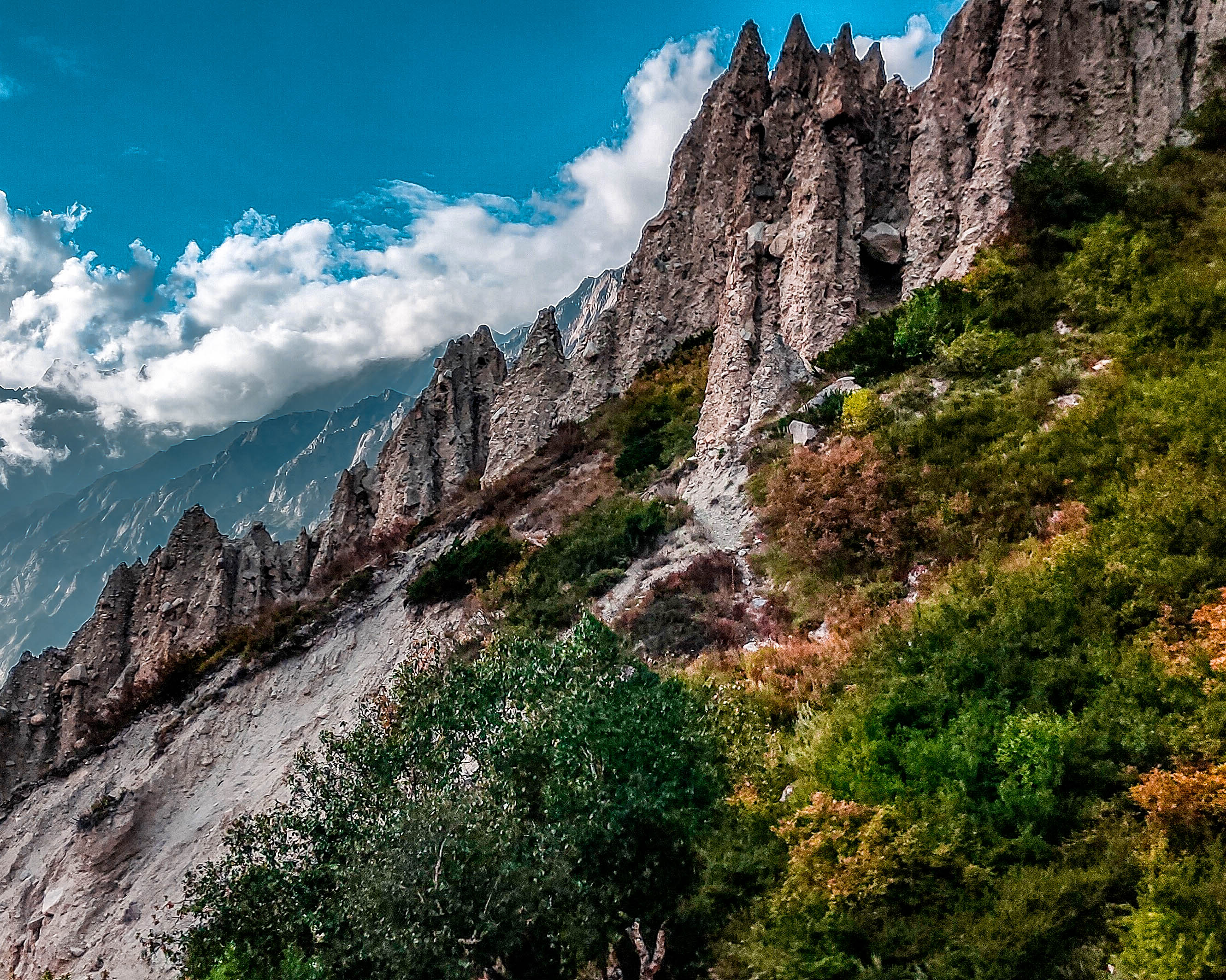
Nestled in the heart of the majestic Garhwal Himalayas, the Kalindi Khal Pass Trek is a journey of adventure, spirituality, and nature’s grandeur. It is a challenging odyssey that beckons those with a thirst for the extraordinary, taking trekkers on an unforgettable quest through some of the most mesmerizing landscapes and glacial terrains in the Indian Himalayas.
Your expedition commences at Gangotri , a revered site near the holy waters of the Ganges. Here, you can seek the blessings of the Gangotri goddess, and from there, your journey to Gaumukh , the birthplace of the sacred Ganges River, begins.
This is where your adventure truly ignites. The trek envelopes you in the serene charm of Tapovan’s lush green grasslands and introduces you to the dance of brooks and the glorious peaks of Shivling, Bhagirathi, and Meru.
As you venture deeper into the heart of the Garhwal Himalayas, you’ll be greeted by close-up encounters with Himalayan giants, including Mt. Shivling, Mt. Meru, Mt. Bhagirathi (I, II, and III), Kedar Dome, Mt. Satopanth, Mt. Vasuki, and Chandra Peak . The treacherous path of the Kalindi Khal trek allows you to witness the breathtaking grandeur of glaciers such as the Gangotri Glacier, Chaturangi Glacier, Shweta Glacier, and Kalindi Glacier.
The trail is characterized by moraines, crevasses, and boulders, making the journey an exhilarating challenge. Crossing the ever-changing Gaumukh Glacier, you’ll find no visible trail, demanding your full commitment to the adventure.
Kalindi Khal is the pinnacle of this trek, a high-altitude mountain pass sitting at a lofty 5,942 meters (19,495 feet) . This geographical marvel connects Gangotri and Ghastoli, and its significance in the Garhwal Himalayas is undeniable. The pass is heavily glaciated, with the glacier west of the pass feeding into the Gangotri Glacier, the source of the sacred Ganges.
The roots of this iconic trek date back to 1936 when John Bicknell Auden mentioned the col in his survey of the Garhwal Himalaya. Auden’s account served as an inspiration, leading to the first Indian expedition to cross this pass in 1945, under the leadership of Swami Probodhananda and the guidance of Dileep Singh.
The Kalindi Khal trek is not for the faint-hearted. It is typically undertaken from mid-June to mid-September. An innerline permit is required to embark on this extraordinary adventure.
The Kalindi Khal Pass Trek weaves together history, mythology, and the allure of uncharted territories. This 86-kilometer trail connects two sacred shrines: Gangotri and Badrinath. It unfolds over glacial passes, moraines, and deep crevasses, offering glimpses of high-altitude wildlife and picturesque glacial lakes.
This is a journey that transcends the ordinary, where every step reveals the ancient soul of the Himalayas. It’s a challenge, an adventure, and a spiritual awakening that will etch unforgettable memories into the fabric of your being. The Kalindi Khal Pass Trek awaits those daring enough to tread its extraordinary path, offering an experience like no other.
Average Elevation : 00 m
Your adventure begins with an early morning drive from Dehradun to the sacred town of Gangotri. This picturesque route follows the Bhagirathi River, offering glimpses of charming villages, cascading waterfalls, and the evergreen valleys of Uttarakhand. This day is designed for you to acclimatize to the higher altitude and explore the serene town.
Trek Distance : N/A
Altitude Gain : N/A
Acclimatization is crucial at this stage of the trek, so you’ll spend a day leisurely exploring Gangotri. Visit the ancient Gangotri Temple, a place of devotion dedicated to the goddess Ganga. Take short walks around the town to become accustomed to the thin mountain air.
Altitude : N/A
The real trekking begins as you embark on the trail to Bhojbasa camp. Following the banks of the Bhagirathi River, you’ll pass through enchanting forests and scenic landscapes. After covering approximately 9 kilometers, you’ll reach Chirbasa at an altitude of around 3,600 meters, where a break for lunch awaits.
Continue the journey through the captivating terrain, and after about 5 kilometers, you’ll arrive at Bhojbasa, perched at an elevation of about 3,800 meters. The campsite here offers stunning views of the Bhagirathi peaks.
Drive Time : N/A
Today’s trail leads you to the iconic Gomukh, the sacred source of the Ganges River. The route winds through rugged terrain, providing awe-inspiring views of the massive Gangotri Glacier. After visiting Gomukh, your journey continues towards Nandanvan, a pristine high-altitude meadow.
This segment of the trek, spanning approximately 9 kilometers, concludes at an altitude of about 4,600 meters.
The trek continues as you make your way from Nandanvan to Vasuki Tal, a stunning high-altitude lake. This part of the journey is known for its challenging terrain, including steep ascents and rocky trails. The distance covered today is approximately 10 kilometers, and Vasuki Tal, situated at an altitude of about 4,800 meters, provides a breathtaking campsite.
A well-deserved rest day awaits at Vasuki Tal. This break is vital for acclimatization, considering the high altitude. Spend your day exploring the surroundings, capturing the mesmerizing views of the nearby peaks, indulging in photography, or simply enjoying the tranquility by the pristine lake.
The trail today leads to Khara Patthar, another picturesque high-altitude campsite. This part of the trek, spanning approximately 7 kilometers, treats you to sweeping panoramic views of the Bhagirathi peaks, including the majestic Shivling and Meru. Khara Patthar is perched at an altitude of about 5,000 meters, underscoring the need for complete acclimatization.
This day’s journey takes you to the awe-inspiring Shweta Glacier, a segment known for its demanding terrain, including glacier crossings and rocky landscapes. The Shweta Glacier presents a dramatic contrast to the lush meadows and serene lakes you’ve encountered earlier in the trek. We will set up a camp at the glacier amidst this untouched landscape.
- Your journey proceeds to the Kalindi base, the launch point for your ultimate challenge: the Kalindi Khal Pass. This base camp stands at an altitude of about 5,200 meters and serves as your final stop before tackling the formidable pass.
Dedicate an extra day at the Kalindi base for acclimatization. Rest, stay hydrated, and ensure you’re in prime physical condition for the demanding pass crossing awaiting you tomorrow.
Today marks the climax of your trek as you conquer the formidable Kalindi Khal Pass, standing at approximately 5,950 meters. This segment demands physical endurance and mental fortitude. The rewards, however, are indescribable.
The pass offers sweeping views of the surrounding peaks and glaciers, a sight few are privileged to witness. After crossing the pass, you’ll descend to Arwatal, your campsite for the night.
Trek from Arwatal to Ghastoli camp, continuing through rugged terrain and challenging landscapes, while reveling in awe-inspiring vistas of the surrounding mountains. Ghastoli camp is situated at an elevation of around 4,000 meters, providing a serene atmosphere.
Your expedition proceeds towards Mana, the last inhabited village on the Indo-Tibet border. This unique village offers insights into local culture and traditions. After exploring Mana, you’ll trek to Badrinath , a significant Hindu pilgrimage site. Here, you will visit the revered Badrinath Temple to seek blessings.
Conclude your extraordinary Kalindi Khal Trek by driving back to Dehradun, reflecting on the incredible journey you’ve just completed. This journey not only tested your physical limits but also allowed you to connect with the untamed beauty of the Himalayas.
What’s Included?
Price inclusion.
- Transportation : Transportation from Dehradun to the basecamp and back to Dehradun is included in the package.
- Accommodation : Enjoy comfortable stays during your trek with accommodation in hotels, guesthouses, or dormitories, offered on a twin, triple, or dormitory sharing basis. When camping, rest in spacious tents on a double or triple sharing basis.
- Meals : We provide nourishing and delicious vegetarian meals. Our meals are designed to keep you energized throughout the trek.
- Camping Fees/Permits : All necessary trekking permits and woodland camping fees are included in the package, ensuring a hassle-free experience.
- Trek Equipment : We provide essential trekking equipment, including dining tents, kitchen tents, sleeping tents with mattresses, and sleeping bags. Utensils, ropes, micro-spikes, and gaiters (if required) are also part of our equipment offerings.
- Mules and Porters : Mules and porters are available to carry central equipment, easing your load and allowing you to focus on the trek.
- Qualified Team : Our team comprises experienced and qualified guides, cooks, helpers, and porters who are dedicated to making your trek safe and enjoyable.
- First Aid : First aid kit with an oxygen cylinder and a helmet (if required) is available to address any potential health concerns during the trek.
- Expert Assistance : You can always reach out to our experts for any queries or assistance during your trekking journey. Simply contact us at +91-8089693825.
Price Exclusion
- Emergency Costs : Any expenses arising from emergencies during the trek are not included in the package.
- Tips : Tips for the trekking team are optional and not included in the package.
- Items Not Mentioned : Any expenses or items not mentioned in the inclusion section are not covered.
- Stay at Dehradun : Accommodation and meals in Dehradun on the last day of the trek are not included.
- Meals During Transportation: Meals during transportation are not included.
- GST : A 5% Goods and Services Tax (GST) is applicable and not included in the package.
Things to Carry
- 45-60 Ltr Bag Pack With Rain Cover & Comfortable Straps
- Hot & Cold Water Bottle Like Borosil & Milton
- Energy Bar, Dry Fruits & ORS
- Personal Medical Kit
- 2/3 Full Sleeves (Non-Cotton)
- 1 Full Fleece T-Shirt
- 1 Fleece Jacket (Woollen Or Sweater)
- 1 Down Feather/Hollofil Jacket
- 1 Waterproof Jacket/Poncho
- 1 Pair Thermal Inners (Upper And Lower)
- 2 Trek Pants (Avoid Shorts & Denim Pants)
- 1 Pair of Waterproof Gloves
- 1 Pair of Woollen Gloves
- Woollen Cap
- 4 Pairs Of Cotton Socks
- 1 Pair Of Woollen Socks
- 1 Pairs Of Sunglasses (U/V Protected)
- 1 Neck Gaiters (Buff)
- 1 Waterproof & High Ankle Trekking Shoes
- 1 Pair Of Floaters
- Hand Sanitizer & Sunscreen Lotion
- Toothbrush And Toothpaste
- Toilet Paper And Wet Wipes
- Quick Dry Towel
- Lip Balm & Antibacterial Powder
- Moisturizer
How To Reach Gangotri
The nearest airport to Dehradun is the Jolly Grant Airport, located approximately 25 kilometres from the city centre. Several domestic airlines operate regular flights to and from Dehradun. Upon landing at the airport, you can hire a taxi or take a pre-booked shuttle to Dehradun.
Dehradun is well-connected to major Indian cities by train. The Dehradun Railway Station is the primary railway station serving the city or you can also come to Haridwar Railway Station. You can book tickets on various trains connecting Dehradun to places like Delhi, Mumbai, Kolkata, and more.
You can opt for a road trip to Dehradun also. National highways connect Dehradun to major cities like Delhi and Chandigarh. The road journey offers beautiful views of the Himalayan foothills.
Raithal is the point where we start our Dayara Bugyal Trek in Uttarakhand. It is approximately 183 kilometers away from Dehradun, which takes around 6 to 7 hours by public transportation. To reach Raithal you have to reach Uttarkashi first.
The bus to Uttarkashi leaves early in the morning around 5:30 am from Dehradun Hill station. You can also book your ticket online via the UTC portal. The average cost of the ticket is around 350 to 400 INR. Shared taxi option is also available.
If you are traveling via taxi, you will be charged around 400 to 500. You can hire a taxi from Rispana Pul and Parade Ground to Uttarkashi. Upon reaching Uttarkashi, you can rent another taxi to Raithal from Uttarkashi Taxi Stand. You must pay 100 to 150 INR to hire the taxi.
Difficulty Level of Kalindi Khal
The Kalindi Khal Pass trek, is undeniably a challenging and demanding expedition in the Garhwal Himalayas. The difficulty level of this trek is notably high and is best suited for experienced trekkers and mountaineers who are well-prepared both physically and mentally. Several factors contribute to its demanding nature.
First and foremost, the trek involves reaching altitudes of over 6,000 meters, which puts trekkers in the realm of high-altitude mountaineering. Altitude sickness and acclimatization become significant concerns, and those attempting this trek must be well-versed in acclimatization techniques.
Furthermore, the terrain is rugged and includes glacier crossings, steep ascents, and challenging crevasses. Technical knowledge of navigating such terrains is invaluable, highlighting the need for prior experience in high-altitude treks.
The unpredictability of weather in the Himalayas adds another layer of complexity. Trekkers must be adept at reading nature’s signals and making crucial decisions to ensure safety.
The best times to undertake the Kalindi Khal Pass trek are during the months of May, June, September, and October. These months offer the most favourable weather conditions and stunning landscapes for this challenging Himalayan adventure.
May and June mark the early summer season in the region. During these months, the weather is relatively stable and pleasant. The high-altitude areas are still covered in snow, which adds to the scenic beauty of the trek.
The blooming alpine flowers and the lush green meadows make this a picturesque time to visit. However, snow and ice conditions on the Kalindi Khal Pass may still pose challenges. September and October signify the post-monsoon and early autumn period.
These months are considered one of the best times for the Kalindi Khal trek. The monsoon rains have rejuvenated the landscape, and the skies are generally clear, offering stunning mountain views.
The snow on the higher reaches of the trail has usually melted, making it more accessible. This is a perfect time to witness the transition from the vibrant greenery of the meadows to the golden hues of autumn foliage.
The Kalindi Khal Pass, situated in the Garhwal Himalayas of Uttarakhand, India, is not only a marvel of nature but also carries immense historical and cultural importance. Over the centuries, the Kalindi Khal Pass has served as a vital trade route connecting the Indian subcontinent with Tibet.
This pass played a pivotal role in facilitating the exchange of goods such as salt, textiles, and other commodities between these two regions. Traders and merchants from diverse parts of India and Tibet have traversed this route, leaving behind a historical imprint.
The roots of this iconic trek date back to 1936 when John Bicknell Auden mentioned the col in his survey of the Garhwal Himalaya. Auden’s account served as an inspiration, leading to the first Indian expedition to cross this pass in 1945, under the leadership of Swami Probodhananda and the guidance of Dileep Singh.
The region surrounding the Kalindi Khal Pass is steeped in religious and spiritual significance. Pilgrims and trekkers embarking on the Kalindi Khal Trek often view it as an integral part of their spiritual journey. Many of them visit nearby temples and shrines in places like Gangotri and Badrinath, making it a part of their cultural and spiritual exploration.
The Himalayas, including the Kalindi Khal region, are deeply entwined with Indian mythology. It’s believed that the source of the Ganges River, Gaumukh, is a place where the sage Bhagirath meditated to bring the Ganges down to the Earth. The journey to Kalindi Khal is infused with the profound Hindu mythology that envelops these sacred mountains.
The region surrounding Gangotri and the Mana Valley in the Garhwal Himalayas is a haven for diverse flora and fauna.
Flora: The lower altitudes, where the journey commences, are adorned with lush forests of deodar, pine, oak, and rhododendron trees. As you ascend on your trek towards higher elevations, the landscape undergoes a transformation.
Alpine meadows come into view, dotted with vibrant wildflowers, particularly in spring when rhododendrons bloom in various shades. You’ll encounter a variety of high-altitude plants, such as the hardy saxifrages and gentians, which thrive in the rocky terrains near glaciers.
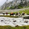
Fauna: The Garhwal Himalayas offer a diverse range of wildlife. In the lower regions, you may come across langurs, leopards, and Himalayan black bears, although they tend to remain elusive.
As you ascend, you might spot the Himalayan tahr, a sturdy mountain goat adapted to steep terrains. The region is also home to the elusive snow leopard, a rare and highly sought-after sighting for wildlife enthusiasts.
The colourful Himalayan monal, Himalayan griffon vulture, and various pheasants, such as the koklass and cheer pheasants, add to the region’s charm.
- Goddess Ganga Temple: Begin your journey in Gangotri, where you can visit the revered Goddess Ganga Temple. This sacred shrine dedicated to the river Ganges is an embodiment of spirituality and offers a serene environment for reflection.
- Harsil: A picturesque hamlet near Gangotri, Harsil is known for its stunning apple orchards and pristine landscapes. The serene beauty of Harsil is a tranquil escape from the bustle of city life.
- Gaumukh: The origin of the Ganges River, Gaumukh, is a significant pilgrimage site and a must-visit during the trek. Witness the magnificent glacier that feeds the holy river. For those interested, we also offer a Gaumukh Tapovan Trek to explore this remarkable area.
- Kedar Tal: For those looking to extend their Himalayan adventure, a trek to Kedar Tal is a rewarding choice. This glacial lake, surrounded by snow-capped peaks, is a sight to behold and a challenging trek for enthusiasts. You can also check out our Kedartal Trek for an unforgettable experience.
- Badrinath Temple: A pilgrimage to the sacred town of Badrinath is a spiritual journey in itself. Visit the Badrinath Temple, one of the Char Dham temples, and seek blessings in this revered Hindu shrine.
- Tapovan: Nestled in the Garhwal Himalayas, Tapovan is a hub for meditation and yoga enthusiasts. The serene surroundings and the Bhagirathi peaks in the backdrop create an ideal setting for spiritual pursuits.
- Vasudhara Falls: A trek to Vasudhara Falls is a thrilling adventure. This pristine waterfall, surrounded by lush greenery, is a refreshing stop to witness the marvels of nature.
Map of Trail
The Kalindi Khal trek covers a total distance of approximately 97 kilometers from Gangotri to Badrinath.
The highest point on the Kalindi Khal trek is the Kalindi Khal Pass, which stands at an elevation of around 5,950 meters (19,550 feet) above sea level.
The best times for the Kalindi Khal trek are May, June, September, and October, when the weather is relatively stable, and the pass is accessible.
Yes, the Kalindi Khal trek is known for its high difficulty level. It involves trekking at high altitudes, crossing glaciers, and challenging terrains. This trek is recommended for experienced trekkers and adventurers.
The temperature during the trek varies with altitude and time of the year. During day it remains from 1°C to 8°C and in night it can fall as low as -10°C.
The Kalindi Khal Trek is not suitable for beginners. It requires prior high-altitude trekking experience, physical fitness, and familiarity with challenging terrains.
The nearest ATM to Gangotri is located in Uttarkashi, which is approximately 97 kilometers away from Gangotri. However, cash availability can be limited, so it’s wise to make cash withdrawals in Dehradun.
Mobile network reception is limited along the trek. After Gangotri you won’t find signal connectivity. Charging points are scarce; it’s recommended to carry power banks or Solar charger.
During the Kalindi Khal trek, you can witness stunning views of prominent peaks like Shivling, Meru, Bhagirathi, and other peaks of the Garhwal Himalayas.
Yes, there is a risk of high altitude sickness due to the high elevations reached during the trek. Trekkers should acclimatize properly and be aware of the symptoms of altitude sickness.
The Kalindi Khal Pass trek involves crossing several glaciers, including the Gangotri Glacier, Chaturangi Glacier, and Sweta Glacier, among others.
/ Per Person
Cancellation Policy
Available Dates
Similar Treks

Kuari Pass Trek

Gidara Bugyal Trek

Dayara Bugyal Trek

Kedartal Trek
Leave a comment cancel reply.
Save my name, email, and website in this browser for the next time I comment.
Call us at 8089693825 for Booking
Subscribe to our newsletter
Get news and discounts straight to your inbox
We are Associated With

Himalayan Dream Treks
We believe in making the Himalayas more than just a destination; we see them as a life changing experience. Whether you seek spiritual enlightenment, have a passion for trekking, or simply crave adventure, we're here to accompany you on your journey.
Important Links
Why Choose Us?
Advance Payment
Cancellation Policy & Refund
Privacy Policy
Terms & Condition
Career At HDT
Contact Details
+91-80896 93825
+91-94565 46051
Join Our WhatsApp Group
Office Address
Dehradun Office :
10 B, Mothorowala Rd, Dharampur, Ajabpur Kalan, Dehradun, India, Uttarakhand, 248121
© All Rights Reserved 2024 Himalayan Dream Treks
(To the Himalayas and Beyond) — Designed & Developed by DeveloSquad
- Article & Blogs
Kalindi Khal Trek - A Dangerous Thrill
Published on: 24/08/2024

Kalindi Khal trek is an extremely difficult and thrilling trekking destination. This trekking spot is situated in the Himalayas at a high altitude of about 600 meters. There are many common to difficult trekking routes in this area and many such inaccessible places, which are surrounded by dense forests, where the going really fills the adventure. The high-altitude trekking route from Gangotri-Badrinath, covering a total distance of 99 kilometres, is known as Kalindi Khal.
Kalindi Khal 99 km trekking starts from Uttarkashi via Gangotri (3048 m), Gaumukh (3892 m), Nandavanavan (m MT), Vasuki Tal (5300 m), Kalindi Base (5590 m), Kalindi Khal ( 5948 m). After reaching Kalindi Khal, the trekking ends at Badrinath (3100 m) via Arwa Tal (3980 m), Ghastnol (3600 m) to come down from the top.
The entire route of Kalindi Khal trekking is surrounded by the most breathtaking hills under the shadow of the great peaks of Garhwal-Bhagirathi Shibalinga, Basuki, Chandraprabhat, Satopanth etc. It is very important to have an experienced person during this trekking because the trail is difficult and a small wrong step can be life-threatening. Make sure to have a proper experienced trek guide or book to go with well known companies with expert guides who can handle any emergency situations.
You will witness vast peaks around the lake during trekking, its surface shines like a pearl and is the source of the Vasuki Ganga River which flows into the Mandakini River. During this trekking, you can also see the last village of India - Mana.
The trekking ends at Badrinath. Rishikesh - Uttarkashi (170 km / 5 -6 am) Uttarkashi Situated at a distance of 145 km from Rishikesh and at an altitude of 1158 meters, Uttarkashi is a city located in the vast Bhagirathi valley and is famous for learning and religion since the days of the Vedas.
There has been a centre. The name of the city refers to the city of Kashi (Varanasi) as its similarity and location (as the north). Similar to Varanasi, the city of Uttarkashi is situated near a hill called Varunavrit Parvat, and at an altitude of 1158 meters on the banks of the river Bhagirathi, the famous Vishwanath Temple is dedicated to Lord Shiva.
In front of the temple are the unique Mahadev-ka-Vishal Trishul or the great trident of Shiva, which is made of eight major metals (Ashtadhata). It is believed that Lord Shiva killed Vakasura with this trident. Other important temples are dedicated to Lord Parashurama, Lord Ekadash Rudra and Goddess Kali. Trekkers can easily reach Uttarkashi by car from Rishikesh and start trekking the next day.
First day - Uttarkashi - Gangotri
After breakfast in the morning, Trekkers reach Gangotri's holy settlement at around 4-5 am 5 km reach 25 km before Gangotri (3048 m). Trekkers can relax in Gangotri by trekking 25 km.
Second day - Bhojwas (3792 m / 12440 ft) trek (14 km / 5-6 hrs)
The next day the morning trek starts from Gangotri to Bhojawas by taking a light breakfast. The distance from Gangotri to Bhojawas is around 14 km. The trek around the high altitude of Himachal mountain and the stunning snowfall is filled with lush scenery. Trekkers can rest here after reaching Bhojvas
Third Day: Bhojwas - Gomukh (3890 mts / 12760 ft) - Tapovan (4463 mts / 14640 ft)
On the third day in the morning in the Bhojwas amidst the hills. Enjoy a hot tea and then proceed to the next stop. Gomukh means where the Ganges water goes down from the glaciers. The sages called it ‘Gomukh’, explored the Tapovan region and trek one of the finest high-altitude alpine meadows in the area. The Gaumukh Tapovan Trek has to be traversed over the Gomukh glacier, and as we climb, the view of the surrounding peaks becomes clear. Tapovan is known for its beautiful Mayans that encircle the base camp of the Shivalinga peak, Tapovan is a very pleasant stunning spot, complete with large grassy ridges, wildflowers and painted camp. Trekkers can relax on their own camps by reaching Gomukh in the evening.
Fourth Day: Tapovan - Nandanvan (4500 m)
Trekking for the fourth day is scheduled from Tapovan to Nandwan. The route to Tapovan leads from the top of the meadow and down to the glacier. From Gomukh one leads to Nandanvan and comes on top of a Gangotri glacier on the right-hand side. It is extremely difficult to walk on the glacier. Trekkers need to be very careful in walking on it, with a little bit of concentration on it. The deficiency may prove to be dangerous. After walking for about a kilometre there is a vertical climb which is not too difficult but trekkers still need to be cautious.
The fifth day Nandanvan - Vasuki Floor (4880 m / 16000 ft) trek (6 km / 4-5 hrs)
The next day trekking begins with the mountains running along the stream from Tapovan to Vasuki Tal like Meru and Offers a close-up view of the fraternity. About 4 km Later, bypassing the valley heading towards Bhagirathi valley, Gaddeda Formed by Su Glacier. There is a lake ahead of the glacier which is also a lake near the Vasuki mountain, which is known as the Vasuki lake.
Sixth Day: Vasuki Tal - Khara Pathar (Surya Bamak) (5480 m / 17975 ft) Trek (6 km / 5-6 Hours)
Sixth day after breakfast Trekking begins from Vasuki Tal to Khara Pathar It is ... The candid stone is located at a distance of about 6 km from Vasuki Tal. However, trekking of these six km is a bit dangerous, so trekkers have to complete this trek with an alert.
Day 7: Khara Pathar - Sweta Glacier (5500 m) Trek 4 km / 5-6 pm
Trekking begins on the seventh day, from candid stone to Sveta Glacier ... which is in the middle of 4 km. At 5500 meters, the Swita Glacier is a very beautiful mountain, where you will feel relaxed after reaching, you can admire the mountains from here.
Eighth Day: Sweta Glacier - Kalindikhal Base
On the eighth-day trekkers have reached very close to their destination i.e. Kalindikhal Base . On the eighth day, trekkers begin trekking from Sweta Glacier to Kalindikhal Base. Finally, you will reach Kalindikhal base by doing glaciers and mountains.
Ninth Day: Kalindi Base - Kalindi Peak (Kalindi Pass (5947 m)
After breakfast at Kalindi base in the morning to reach Abri Kalindi Peak. After reaching here, your trekking is finally complete. Trekkers can rest here. PC: flickr.com Tenth day Kalindikhal - Raja Parva (4910 m / 16105 ft) trek (12 km / 6-7 hrs). After trekking in Kalindi, now the turn is to come back down. Trekkers to come back down One has to trek to Raja Parva ... The trekking downhill is steep. Hence, caution is very important.
Eleventh Day Raja Parva - Arva Floor (3910 m) Trek 14 km
There is a great need to pay attention when starting trekking, as the flow in the river increases when the glacier melts, which can cause some problems. This day trek lasts for about 14 km and a total of 6-7 hours. Takes time, ends on the banks of the river.
Twelfth Day: Arva Tal - Ghastanoli (3796 m / 12450 ft) Trek (15 km / 6-7 Hours)
Arva Tal - Ghastano Lee's trekking is about 15 km which goes through dense forests. The trekkers here appear to be settlements in the Indo Tibetan Border Guard (ITBP) camps as the area is close to the China border. Shepherds, their animals, and green patches of grass are a welcome sight.
Thirteenth Day: Badrinath - Rishikesh
Trekkers can drive the next day via the winding hills of the Bhagirathi valley (290 km) and reach Rishikesh. On arrival check-in for an overnight stay in the hotel and enjoy Ganga Aarti in the evening, as well as Laxman Jhula, must also visit, and can leave from Rishikesh to Delhi the next day.
Your Comments and suggestions are presious for us. If you have anything you want to ask or share with us regarding this blog post or any other trekking experience. Feel free to coment below
Write your Comment:

Kushagra Bhatanagar
Fill the enquiry form to get all detail, recent blogs.
- Why Har ki Dun Ruinsara Tal Trek is the Best Trekking Option
- Best of Phulara Ridge Trek - An unusual Himalyan Trek in 2022
- Best Winter Trek in Uttarakhand
- The Best Winter Trek in India for Beginners - KedarKantha
- Phulara Ridge Trek - Top Rated Himalayan Trek in India
- Trekking Guide
- KedarKantha
- Trekking Locations
2021-05-01 13:45:38
I have visited this place last year its really awesome trek.

Kalindi Khal Expedition
The Toughest Expedition of India
Available Batches
September 2024.

Brief Description

Brief Itinerary
Detailed itinerary.
Tapovan to Nandanvan (14,271 ft) - 8 km
On this day we start early. The route from Tapovan leads from the upper section of the meadow till down and onto the glacier. From Gomukh turn towards Nandanvan (4340m) and steering on right one will be on top of the Gangotri glacier. The glacier runs between two ranges and the landslides make a layer of rocky moraine on the ice which makes the walking easier. The glacier walk is very slippery and a slight lack of concentration would be dangerous. Huge crevasses gaped here and there. After walking for about a kilometer there is a vertical ascent. Big rocks en route offer grips and footholds but many of them are deceptive too. Dinner and overnight stay in tents.
What's Included
- Food as per menu on the trek starting breakfast on Day 3 till lunch on Day 13
- Forest Permits/Camping Charges, if any (upto the amount charged for Indian nationals)
- Tents, Sleeping bags, Sleeping mats
- Safety Equipment includes static rescue rope, seat harness, carabiners, pulleys
- Trek guide, cook, helpers, and porters for carrying common supplies
- Mountaineering course certified Trek Leader with Wilderness Emergency Responder & Rescue. course from NIM Uttarkashi
What's Not Included
- Portage of personal bags during the trek
- Cost of any kind of Travel Insurance.
- Any Expense of personal nature.
- Any Expense not specified in the inclusions list.
- Meals during hotel stay & road journeys
Are you Eligible for this Adventure?
Max Altitude

BRS Level Required
Kalindi Khal Expedition is a level 6 adventure on the Bikat Rating Scale.
This makes it mandatory for you to have high-altitude experience of preferably multiple treks marked at level 5 on the BRS. The altitude, the terrain and the nature of the climb demand a certain level of skill and a need for you to be aware of how your body reacts to the various features of high altitude environment.
If you do not know what level of BRS trek would suit you best, worry not! Fill out this Form:

we will send you a progression chart to help you comfortably get out of your comfort zone in order to level up and ultimately reach your highest potential in the big, bad world of outdoor adventure.
Packing List
This is a list of essential items for individuals doing the trek with Bikat Adventures. This list contains only those items which the participants are required to bring with them. The list excludes those items which are provided by Bikat Adventures on the trek. We have divided the items into five categories. All the items in the list are essential except for those marked as optional.
Trekking Gear
- Ruck sack bag with rain cover. Qty -1
- Day Pack Bag - Recommended for treks with summit day
- Head Torch with spare Batteries. Qty -1
- U V protection sunglasses. Qty -1 Here is how you can choose the best sunglasses for trekking.
- Water Bottles: 2 bottles of 1 liter each
- Non-skid, deep treaded, high-ankle trekking shoes Qty -1
- Pair of light weight Slipper/Sandals Qty -1
- Quick Dry Warm lower or Track Pants. Qty - 2
- Full sleeves T-shirts/ Sweatshirts. 1 for every 2 days of trekking
- Pair of thick woolen socks. 1 pair for every two days of trekking
- Thermal Body warmer Upper & Lower. Qty-1
- Undergarments. Qty - 1 for every day of trekking
- Warm jacket closed at wrist & neck .Qty-1
- Full sleeves sweater. Qty -1
- Rain wear ( Jacket & Pants ) . Qty-1
- Pair of waterproof, warm gloves. Qty-1
- Woolen cap. Qty-1
- Sun shielding Hat. Qty -1
- Personal toiletries kit (Small Towel, Toilet paper, paper soap, Bar soap, toothbrush, toothpaste, cold cream, etc.)
- Sun screen lotion small pack. Qty -1 Here is your Sun Protection 101 to stay safe in the bright sunny outdoors.
- Lip Balm small pack. Qty-1
- Small size, Light weight & Leak proof lunch box. Qty-1
- Plate. Qty- 1
- Spoon.Qty-1
- Tea/Coffee (plastic) Mug.Qty-1
Miscellaneous
- Camera (Optional)
- Carry your medicines in plenty in case you have any specific ailment. Consult your doctor before joining the trek.
- Dry fruits, Nuts, Chocolate bars (Optional)
Frequently Asked Questions
Eligibility, is this adventure good for me, what’s a good fitness benchmark for this adventure, what skills do i need to complete this adventure, what is the minimum and maximum age limit, about the activity, where is it located, what are some of its highlights, what are some of its challenges, what is the best season for this, what is the accommodation type, what is the temperature like here, is it technically challenging, connectivity, how do i reach the starting point, is there cellular network available throughout, where is the nearest atm, if i choose to travel to the base with you, what is the pick-up point, what time is the drop-off on the last day, what are the nearby attractions that i can explore, equipment & gear, what equipment is provided to us, what can i rent from you, where will i receive the rented items, where do i have to return the rented items, what gear do i need to bring, are there local shops to rent/buy equipment, facilities & additional services, can i offload my bag, can i leave any extra luggage i carry at the base of this adventure, what are the meals like, what are the washroom/ toilet facilities like, what should i do if i get my period on this adventure, what are the medical facilities available to me on this adventure, are there any electricity charging points on this adventure, mandatory documents, what documents do i need to carry, do i need insurance for this, do i need a permit for this, certification, do you provide a certificate of completion, when and how will i get the certificate of completion, international travel, will i need a visa, when should i apply for the visa, what kinds of insurance do i need to travel here, what is the specialty of this when compared to other mountain ranges, till which month can i make a booking for this, what is the qualification of the outdoor leader provided to us, how do you choose your outdoor leaders, is it safe for women, what is the ratio of outdoor leader to participants, what do you do in case of an emergency, what are the rescue options on this adventure, how do you choose your equipment, can i attempt this adventure if i have a specific medical condition, sustainability, what kind of camping do you practice on your outdoor adventures, why are you against fixed camping in the outdoors, how do you manage overcrowding on certain trails, what are some things to remember when using a dry toilet, why should i avoid wet wipes in the outdoors, where should i dispose of my sanitary waste if i am on my period, why should i carry my own utensils on an outdoor adventure, booking process, what happens after i make the payment, do you create a whatsapp group of participants before the start date of the activity, do i need to submit a medical certificate, do i need to submit an undertaking form.
Small Group Size
Our batch sizes are capped at 15 for smaller treks with the trek leader and trekker ratio of 1:8. This ratio, in our years of experience, has proven to deliver the best trekking experience for individuals as well as groups. Capping the size of the group ensures individual attention to each trekker so that no signs of distress or need during the trek go unnoticed. It also helps to form a more cohesive cohort with better group energy which helps define the rhythm and pace of days on the trek. As you go higher up on the BRS scale, since the stakes are higher, expeditions have an even smaller group size with the ratio of expedition leader to climber set at 1:2.
Qualified Expedition Leaders
We follow a rigorous regime of hiring and training our experts in the field. Each trek leader is a certified mountaineer with years of experience in the field. In addition to their qualification, they also go through practical and situational training to tackle any and all kinds of sudden conditions that may present themselves on the ground. Being unpredictable is the core nature of the mountains but being ready for any circumstance as best as possible is a controllable asset that we try to nurture. Our field experts are also trained in basic medicine and first-aid response. Watch: Forerunners - The Making of A Trek Leader At Bikat Adventures
Guided Progression
Since Bikat Adventures is a learning-based organization, we help you climb up the ladder of difficulty within the sphere of outdoor adventure systematically. Our on-ground training modules are designed to handhold you through the upskilling process so that you are ready to take on bigger challenges.
Equipment Quality and Check
All the gear used on our treks and expeditions is tried and tested, maintained for good quality, and is overall top-notch in quality and condition. We are continually looking to obtain the best of everything there is in the market so as to ensure optimum safety.
Support Systems
Along with the staff you see on-ground, we have a team of superheroes working in the background to give you the best experience possible. Our background team also comprises local staff from each area who know the region best. Having local support helps with studying the area, pre-planning, execution, and in receiving timely support in case of emergencies in these remote locations.
Communication
Our on-field staff is in constant contact with our teams based in primary locations so as to eliminate any avoidable delay in reaching additional help and support when required. We try to use the best tools for communication available, including satellite phones, in regions where they are not restricted.
What our customers Say

Cancellation Policy
Cash refund
Cancellations up to 30 days prior to departure date
5% deduction
Cancellations between 30 days to 15 days prior to departure date
50% deduction
Cancellations within 15 days prior to departure date
Voucher refund
Cancellations up to 5 days prior to departure date
No Deduction
Cancellations within 5 days prior to departure date
- Cash refund is applicable only in case of bookings made without using any promotional offer code or vouchers
- This is only a brief of cancellation terms. For finer details please refer Detailed Cancellation Policy.
Subscribe for latest updates & offers
Similar adventures.
Auden's Col Expedition
A stunning cross-over from gangotri to kedarnath - not for the faint-hearted.
Uttarakhand
Pin Parvati Pass Expedition
The wildest cross-over trek of india.
Parang La Expedition
An ancient trade route between spiti and ladakh, enter your email, events by categories.

Mountaineering

Scuba Diving
Events by months.
- January July
- February August
- March September
- April October
- May November
- June December
Events By Nights
- 5 & More Night
- Environmental Policy
- Privacy Policy
- Term & Conditions
- Work With Us
- Address: 303, 3rd Floor, Tower B4, Spaze Itech Park, Sector 49. Gurgaon
- Pre Sale - 7838148127 , Post Sale - 8588878499, 9667639126
Bikat Adventures
- Cancellation & Refunds
- Content Sharing

© 2024 Bikat Adventures - All Rights Reserved
Powered by: novel knett software solutions, submit enquiry.
Kalindi Pass Trek
Kalindi pass expedition (6000 meter).

Description
Reviews (0), things to take, available dates, include / exclude, kalindi pass trek is the difficult trek in india himalaya.
Kalindi Pass Trek is 6000 meters above the sea level which lies in the Great Himalayas. The exhilarating trails demand enthusiasm and deep knowledge of trekking in high altitude treks. It is a connecting pass of Gangotri and Gastoli village or Badrinath Valley.
It starts from Gangotri base camp, Gangotri is a holy city and famous pilgrimage site; it is one of the Char Dhams. Glaciers are the famous attraction of this place which makes this trek thrilling. The other attraction is sight of Mt. Shivling and Bhagirathi peaks , the views will accompany you from the base till summit.
This expedition covers some very remote and famous areas which are popular amongst the trekkers. First is from where the River Ganga originates Gomukh, explore the green landscapes of Tapovan with streams around and the remote area Vasuki Tal .
Extraordinary Panorama views in Kalindi Pass Trek
To successfully complete the Kalindi Khal Pass trek , past experience of high altitude trekking and proper application of knowledge and skills should be known by the trekker. The risks are uncounted and you have to conquer the challenges, it is only possible when you come fully prepared.
Mana is the endpoint of this expedition and the last village of India. This place holds adventure and thrill, if you know proper skills and application then nothing can be better than conquering the challenges thrown in front and experiencing the adventure in Indian Himalayas.
Explore the Himalayas Beauty of this Remote Region Kalindi Pass
The Kalindi Khal trek is an Enthralling Gangotri valley or Badrinath Valley in the Garhwal Himalayas of Uttarkashi district in Uttarakhand India, this trek come under Gangotri National park .
No doubt, the Himalayas have enchanting beauty, bracing climate, and desirable soothing green meadow. So, what else can be better than spending some days here in the serenity!
Best Time to Do Kalindi Trek ?
Kalindi pass trek is a very beautiful and an uphill Difficult trek in the Uttarakhand Himalayas, The Kalindi pass Trek is great for those people who have a great passion for Expedition mountaineering or Difficult trek and consider it a special purpose in their life. Kalindi pass is such a trek where you get to see more than one Himalayan mountain range.
We are the local people in uttarakhand District of Uttarkashi who are doing Kalindi khal trek for years, we have every experience related to this trek.
The right time to do Kalindi pass trek is from May 3st week to the last of June and then from the last of August to the 2nd week of October. every year
specially in the months of may, and June, snow is found in abundance here, which makes your trek very memorable and also a difficult after Gaumukh Glacier. So this trek should not be considered too easy
Kalindi pass trek in May to June ?
Kalindi pass Trek Month in May and june gives a slightly different experience to Trekkers because in May you start getting snow Gaumukh or Nandanvan Camps
The Kalindi khal trek starts from Gangotri in Uttarakhand which comes in Gangotri National Park Range and end of trek Badarinath near mana village
In May and June, you get a combination of both greenery and snow, which makes the trek very spectacular. The weather in May and June is quite good and trek friendly, which makes trekking a lot of fun.
During the day the temperature of Kalindi pass trek is around ( 3°C to 8 °C and during the night the temperature comes down to -5 °C to -10 °C which is not easy trek
Views and treks in Kalindi pass trek provide a lot of peace to the mind during the day, while you wake up from one wake to another, Kalindi pass trek can always be one of the most close treks in your heart.
You will never consider yourself boring in Kalindi pass Trek, this trek can give you nothing but joy, You will get to see the Garhwal culture in this trek which will always keep you connected towards the mountain. Himalayas
Kalindi pass trek in September or October
Kalindi Pass Trek is a difficult trek, it should never be taken as a joke and never put yourself in trouble, In the month of September or October this trek is very great snow becomes very solid after Shweta Glacier it is easy to walk on top of snow, at this time there is a lot of rock and mud and walk in base snow
But the beauty of the trek will not be lacking, the trek and nature adorn themselves with time and in different colors. Month of September and October are very good days to trek, at this time total greenery and at the end of October sometimes you can get to see live snow fall.
During the day the temperature of Kalindi pass trek is around Day time 5°C to 12 °C and during the night the temperature comes down to -05 °C to – 08 °C which is very confirmable,
At this time the weather here will be very good for you , At this time it is even safe to trek here and there is no rain.
How Difficult is Kalindi pass Trek
Kalindi pass trek is Difficult trek , this trek comes in a moderate to Difficult level, I myself have done this trek sometimes with me, people who are trekking for the first time, we have done the entire trek, they used to need help somewhere, which we and our team used to help.
Kalindi pass is a uphill trek but if your fitness is good and you have it in your mind that I want to trek then you can do it absolutely. Where help is needed, our guides will support you, you just have to be strong and capable of the trek. One thing is that all you can do is to have courage and I myself am passionate.
Note : – Kalindi pass trek should be done by those people who have experience of high altitude trek and are physically and mentally fit otherwise, this trek may be difficult for you. Before leaving, take care of experienced people, don’t make your life difficult.
Kalindi pass trek safe for Beginners ?
No, No Kalindi pass Trek is a not safe for beginners trekkers, if you are going with a good trekking team which you must know before booking yourself, It is important for you to know that the bow trekking organization with which we are going is right or not,
And if possible, trek with local trekking organization, you can do the same help all the time. then your trek can be very good and memorable
Do this trek only with those who have experienced Sherpa guides, porters, all Team and High altitude experienced
The minimum age required to trek Kalindi pass is 25 years and maximum 50 years. The rest depends on your fitness .
Why you should choose us Kalindi pass trek
We’re here to give you the greatest experience possible through the eyes of highly skilled and qualified specialists who have a passion for adventure sports. We are community members attempting to promote our favorite adventure sports while also supporting local businesses. We, at Himalayan hikers, dedicate ourselves to providing you with an unforgettable experience.
Himalayan Hikers always make the trek from Trekkers memorable, I insist that you do not face any problem in any trek and you can always have a pleasant experience. Himalayan hikers 30 years old safest trekking team in Uttarakhand Himalaya
Read more about Kalindi Pass Trek
Level: – Difficult trek
During the trek, proper conditioning & training of body is required.
Also, need of proper gear & clothing for sub-zero temperature
Furthermore, shoes are the single most important equipment.
High Altitude requires proper acclimatization.
Beautiful landscapes so carry good photo gear & Extra battery backup.
In addition, the backpack should not exceed 12 kg.
Alcohol and smoking is not allowed in during the Expedition
need to proper knowledge of High altitude trek
Why to choose Kalindi Pass Trek ?
Before heading towards the itinerary, it is really essential to perceive the reason behind choosing Kalindi pass trek.
See firstly, the trekking distance is a total of by taxi 636 Km both sides and on foot 68 km which is to be covered into 14 days. Dehradun to Dehradun Kalindi pass trek is a high altitude mountain trek Altitudes is 6,000 Meter
The Starting trail is moderate as compared to other treks this is a difficult trek. So this trek is not for beginners
Need proper gear & clothing for sub-zero temperature?
You got to see so many heavenly bodies at one place like the panoramic view of the Himalayan ranges Gangotri, or Badrinath valley you can see pine forests, Gomukh, Nandanvan, Vasuki Tal, animals, or much different variety of flora and fauna surpassing through bona fide Garhwali culture.
I think Do spare time in Interaction with our local’s team, and you will get to know about some of the ancient tales of Indian mythology and our local cultures, this is good ideas for trekkers
Beautiful landscapes so carry proper photo gear & Extra battery backup.
Weather conditions
Weather conditions depend on the time of the year trekkers are travelling.
Months from May, June to September experience moderately good temperatures during the day with substantially colder nights accompanied,
Key Points of Kalindi Pass Expedition
Duration: – 13 Nights 14 Days – from Dehradun to Dehradun
Base camp: – Gangotri
Summer Temperature: – Day (5°C to 10°C) Night (-2° C to – 6° C)
Kalindi pass – Altitude: – 19,685 feet (6,000 Meter)
Best Time: – May, June, September, October
Trek Level: – Difficult
Weather – Kalindi pass trek is one such trek which can be done 20th June to 2nd week of October the year, Here the weather changes every month, But where the weather is very nice and favorable during the day, the night or morning is also cold according to the time.
Trek distance: – On foot 68 Km – By taxi 636 km
Group Size: – minimum 05 / maximum -10 people
Short Itinerary of Kalindi Pass Trek
Day 1- Pick up to you from Dehradun railway station – Drive to Gangotri – 258 km) (10/11 Hours) (3415 Meter
Day 2- Rest Day + Acclimatization
Day 3 – Trek from Gangotri to Bhojbasa camp via Chirbasa (14 km) (7/8 Hours) (3775 Meter)
Day 4 – Trek from Bhojbasa camp to via Gomukh to Nandanvan camp (8 km) (5/6 Hours) (4810 Meter)
Day 5:- Trek from Nandanvan to Vasuki Tal (06 km) (4/5 Hours) (4978 Meter)
Day6– Acclimatization Day at Vasuki Tal
Day7– Trek from Vasuki Tal to Khara Patthar (06 km) (4/5 hours) (17979 feet)
Day 8– Trek from Khara Patthar to Shweta Glacier (05 km) (4/5 hours) (18044 feet)
Day 9– Trek from Shweta Glacier to Kalindi base (04 km) (4/5 hours) (183722 feet)
Day 10– Acclimatization Day
Day 11– Trek from Kalindi base to Kalindi Pass (19685 feet) and descent to Arwatal (07 km) (8/9hours) (13057 feet)
Day 12– Trek from Arwatal to Ghastoli (08 km) (5/6 hours) (12454 feet)
Day 13– Trek from Ghastoli to Mana (09km) (5/6 hours) Drive from Mana to Badrinath

Your Travel Plan for Kalindi Pass Trek
You can book the train, air flight, and bus tickets for your journey only according to the information given by us.
The Kalindi Khal trek will be of 11 days and 02 days of your journey total of 13 Days from Dehradun to Dehradun in Uttarakhand.
First of all, all the trekkers will have to book their flight and train bus according to our time table as our pick up is from 6 am to 7 am, you will have to reach Dehradun in the morning.
A taxi from Himalayan hikers will link you to the Dehradun railway station.
Himalayan Hikers organize transport to Gangotri base camp from Dehradun railway station. Our vehicles leave at 6:00 am to 7:00 am sharp from Dehradun. The taxi costs include your package for a Tempo Traveler.
At Dehradun railway station you will get our staff that will arrange transport for you. The contacts no Transport coordinator or our office team will give you a week ago to your departure.
Please you guys book your transport facility according to your own time table, after Himalayan Hikers take all the responsibility of Dehradun from Dehradun, that you will not face any problem.
How will You Reach the Kalindi Pass?
If you are traveling from Kolkata, Bengaluru, Chennai, Pune, Mumbai, or Gujarat any other city, so you will have to come to Delhi, you will get a train from Delhi for Dehradun comfortably.
Option 01:- By Train
All trekkers booked yourself the –
Nanda Devi Express to Dehradun (Train no is 12206 Departure 11:30 pm: – Reached Dehradun 5:45 am.
Dehradun Express- to Dehradun (Train no is 12687 Departure -9:10 pm: – Reached Dehradun 5:00 am.
Take both overnight trains Dehradun to from new Delhi- Dehradun Special A/C train from Hazrat Nizamuddin railway station the best option for you.
The train reached Dehradun railway station morning 5:45 to 6:30 am if you Meet to Our office Member – joining to our upcoming batches and Group.

Option 02:- By Air
Jolly Grant airport is the nearest airport in Dehradun. Located about 27 km for the Dehradun city. There are flights available from all states to Dehradun, you can go online and book your tickets. These are easy and easy ways for you and you also save your time, Taxis are available from the airport to Dehradun at all time costs Rs. 800/* one-way pay to directly.
Option 03:- By Bus
You can reach Dehradun from Delhi by a bus, board it from (Delhi) Kashmiri Gate ISBT, it is good if you are booked the seats.
(Reach Dehradun Railway Station between 5:00 am to 6:00 am and the vehicle will be arranged from there.)
ATM Point and Mobile Connectivity in Kalindi Pass
Before starting the journey to Kalindi Khal trek, make sure that you need payments, and then take out the cash on the way, Uttarkashi market is the last place where you can withdraw cash from ATM, (If you want to withdraw money then do it in Dehradun).
Mobile Connectivity
The phone does not work on this trek. Therefore, you should ensure that you do not have to make any important calls. So make sure you finish all your important work and calls before starting the trek. Last Gangotri base camp, your device will receive good networks
Will there be electricity in Kalindi khal pass trek
Let me tell you that there is no electricity in the forest area of Kalindi pass trek. Here we use Stobe Light and or Solar Light, candal light at the nights
If you come on this trek, then you should bring your own head light and your camera with full charge, if possible, it would be good to bring extra battery backup, and also bring the phone after full charge, today people most of the phone use the same
Note :- Day 1 Electricity available at Gangotri base Camp
Self-Certificate of Emergency Breakout
What we do during an emergency breakout in the kalindi khal trek trekking.
Trekking in the Himalayas is not a cup of tea but it is a rewarding experience. However, it’s important to keep things in mind when it comes to Safety. One must know about the weather conditions, the altitude gain, fitness and other factors that can wreck your experience. In such adverse conditions, you are solely responsible for your well being and act maturely.
Also Read About – Safety Tips For Safe Trekking.
Preparations before the Trek
You’ve to understand that treks are away from cities and medical help is not always easily available. So, if you are heading for an adventurous trekking trip, stick to certain trekking guidelines and tips. Following these simple tips will help make the trek more fun and experiential for you as well as your fellow trekkers.
These tips and guidelines cater to useful and requisite information about your fitness training, packing and health precautions to be taken before and during the trek.
- Firstly, when you start, target 5 km in 40 minutes
- Then gradually increase your pace by running at least 4 times a week. Then try to bring it down to 5 km in less than 37 minutes
- If you are a person who prefers cycling over running then your target must be 22 km means you should be able to cover 22 km in 60 minutes.
- Walking is a great exercise that gives great shape to your legs and your body. It helps in burning calories and cut down excess weight and strengthens the heart.
- Jogging is effective in increasing the human lifespan and makes your lungs stronger. It is an aerobic activity that requires a lot of oxygen. This is a great exercise for fighting obesity and staying healthy.
- Squats are the best form of functional exercises to improve stability. They also strengthen your legs, thighs, hips, and hamstring.
- Another great cardiovascular exercise is pushing your body upstairs after stairs. This is regarded as the best exercise for increasing strength and power
What to pack for Kalindi khal trek
Warm clothes, sleeves, wind shelter, comfortable clothing, and extra warm clothes so that you can enjoy trekking. A raincoat is the necessary
Footwear: A well-fitted trekking footwear shoes are highly recommended. If you wear an uncomfortable pair of shoes, your feet will be hurt.
What we do during an emergency breakout in the Kalindi khal trek
First of all, the safety of trekkers is much more for us, if you see in the trek, then there are all the risks, which I do not think about.
Himalayan Hikers worry more about you that no one should ever have any problem in the trek.
What should we and you keep more safety in the trek
- Whenever you are going for any high altitude trek, it is very important that you go completely fit and ready.
- The trek is not difficult, if you make your feet and your mind calm and strong, you will find the trek very easy.
- While trekking, keep in mind that you are walking on the right route or not always with your guide.
- Most people look somewhere and where they are walking, this can cause twitching in your legs, which can ruin your entire trek.
- It is important to ask your doctor if you have any medical problems
- I should always keep my medical kit with me, it is very important.
- Himalayan Hikers always keep a medical kit with you, such as oxygen cylinders, Diamox ablate , medicine to be given in emergency on the trek
- If any trekkers have any more problems, then they are brought back to the base camp by laying them in the stretcher.
- Our camp in Kalindi khal trek around the 9000 feet to 17000 feet where you can not have any problem of oxygen
- In case of any medical problem, the help of your guide or a well-informed trekkers should be taken
- If there is major health problems in Kalindi khal pass , then Nearest Hospital is in Uttarkashi which is about 140 Kms away from Kalindi pass trek
- Along with the trek we keep getting acclimatization
Day 1 : Pickup from Dehradun Railway Station and Drive to Gangotri
Total distance – 258 km – 10/11 Hours journey
Mode of journey – – By taxi
Altitude – Gangotri – 3415 Meter
Night stay – Our Mandakini Hotel – on twin share basis
Himalayan Hikers organizes transport for trekkers from Dehradun Railway Station in the morning which will leave for Gangotri around 6:00 am to 7:00 am.
Get in the vehicle from Dehradun and enjoy the picturesque journey along Bhagirathi River’s bank and forest stretches to reach Gangotri base camp. It is the base camp of Tapovan trek
Dehradun is the capital of Uttarakhand and one of the most beautiful places in India. The main attraction of this place is Rajpur road go through it and get a glimpse of Dehradun’s beauty. Reach Mussoorie after an hour which is also known as “Queen of Hills”. People visit it heavily during vacations with their family and friends.
After half an hour, stop at Suwakholi Have breakfast there and witness people from different parts of the world. The break will be of maximum 1 hour. Ahead the peaks are visible and further you will come close
Further you will cross the small Chinyalisaur of Dharasu Reach Uttarkashi around 1:30 pm and take a break there for lunch. After having Go through the picturesque zig- zag road to Gangotri via Harshil
Freshen up and enjoy evening snacks in the open Garden with great views. You will be provided some details after which you can go for evening walk but be at the hotel, Mandakini at Gangotri for dinner.
Day 2 : Rest Day + Acclimatization
Today all the equipment will be checked and then go for short hikes nearby and rest for the night.
Day 3 :Trek from Gangotri to Bhojbasa camp via Chirbasa
Trek Distance – 14 km – 7/8 Hours journey
Mode of journey – On foot
Altitude – Bhojbasa – 3775 Meter
Night Stay – Camp – on twin share basis
The trek to Bhojbasa is long so start the day early. Go through the market then the trail is through forested area. Ahead reach a valley with pine trees, cross it and trek through boulder zone. On the way have a glance of Bhagirathi peaks Gomukh glacier.
The trail is wide and easy now. Pass through many landslide prone areas and encounter the breath-taking views of Bhagirathi peaks, and Mt. Shivling. Here Sanyasis and Sadhus can be seen in the caves. Cross ridges, and now the trail becomes rocky and barren. Bhojbasa is the widest point in the valley. Campsite is in a plain terrain from where you can get magnificent views of snow covered peaks and Bhagirathi River flows beside.
Bhojbasa has a small temple, explore the area in the afternoon. In the evening witness the sun setting behind the Bhagirathi group of Peaks which makes them look glorifying and extremely beautiful.
Relish the beauty, enjoy incredible scenery and sight of Mt. Shivling and retire for the night.
Day 4 : Trek from Bhojbasa camp to via Gomukh to Nandanvan camp
Trek Distance – 08 km – 5/6 Hours journey
Altitude – Nandanvan – 4810 Meter
Today the trail is steep and the climb is difficult from Gomukh to Nandanvan is a steep ascent and it will take 2 hours to reach there. You will be crossing Gangotri glacier to reach Nandanvan. Cross Akash Ganga stream, reach Gangotri Glacier and find a way to descent.
On glacier there is thick ice, remains of rocks and big boulders. Trekking on Gangotri glacier is difficult because of its slippery parts and the rocks can fall. Descent and climb up 100 meters to reach Nandanvan, the climb is through a landslide prone area.
This meadow is at the base of Bhagirathi. Reach Nandanvan and witness clear views of Mt. Shivling, Mt. Meru and Kedar Dome. Setup your tents here and retire for the night.
Day 5 : Trek from Nandanvan to Vasuki Tal
Trek Distance – 06 km – 4/5 Hours journey
Altitude – Vasuki Tal – 4978 Meter
Night Stay – Our campsite – on twin share basis
After breakfast trek from Vasuki Tal is the base camp of Mt. Satopanth and Mt. Vasuki. Today, you will be trekking along Chaturangi glacier to reach this sacred pristine lake, it is believed that Lord Vishnu took bath in it.
The aura here is divine, many of the places in Uttarakhand are of great significance to Hindus and Vasuki Tal is one of them. Pass through rocky terrain, ascent isn’t very steep but the distance is long so you may get tired. On the way get entrancing views of Chaturangi glacier.
Vasuki Tal lies amidst snow covered mountains and it remains frozen in winters. Witness rare Himalayan Brahma Kamals and other flowers growing in abundance around this exciting lake. Explore this and relish the beautiful views offered.
Setup your tents near nearby and enjoy your meal there afterwards retire for the night.
Day 6 : Acclimatization Day at Vasuki Tal
Let your body adjust according to the environment to prevent altitude sickness, you can relax today or go for a short hikes nearby. From tomorrow the difficult part of this expedition starts. Have healthy food and retire for the night early.
Day 7 : Trek from Vasuki Tal to Khara Patthar
Trek Distance – 10 km – 4/5 Hours journey
Mode of journey – On Foot.
Altitude – Khara Patthar – 17979 feet
Night Stay – Our camp – on twin share basis
The trek today is through moraine area and boulder zone, the views of mountains chain will be the phenomenal part of the journey. Some parts will need energy so be sure you have healthy breakfast for good energy.
The chain of mountains will not leave your side until you reach Khara Patthar. From this campsite Mt. Satopanth the second biggest mountain in Gangotri siblings will be visible. Setup your camps here and retire for the night.
Day 8: Trek from Khara Patthar to Shweta Glacier
Distance – 05 km – 4/5 Hours journey
Altitude – Shweta Glacier – 18044 feet
Night Stay – Camp site – on twin share basis
The trek will be challenging because of the glaciers and moraines, but they can be crossed using technical skills.
The landscapes will change and setting of these will show you different sides of the places, you can experience the thrill and adventure both.
Reach your campsite Shweta glacier and find a place where you can set your tents and retire for the night.
Day 9: Trek from Shweta Glacier to Kalindi base
Distance – 04 km – 4/5 Hours journey
Altitude – Kalindi base – 18, 372feet
Today you have to reach Kalindi Base Camp, the trails are thrilling and scary but the glaciers and chain of mountains will accompany you because it is all glaciated.
Have glimpse of Chaturangi glacier (4 colors) en route and most of the time you will be trekking through the moraine area. After a long hike reach Kalindi Base Camp.
From the Base Camp you can catch the views of Kalindi Peak, this sight will energize for the trek further. Pitch your tents here and get the briefing for tomorrow, the safest route and techniques will be discussed. After having food retires for the night.
Day 10: Acclimatization Day
Go on short hikes, acclimatization prevents altitude sickness. Overnight stay in camp
Day 11: Trek from Kalindi base to Kalindi Pass (19685 feet) and descent to Arwatal
Distance – 07 km – 8/9 Hours journey
Altitude – Kalindi Pass – 19,685 feet
You have come to the main day of this expedition and today is going to be the longest and toughest day. Get up early and leave for Kalindi Pass (19685 feet). Keep one thing in mind that weather can change so you need to be prepared and add up extra day in the itinerary for summit attempt.
Ascend through the thrilling trail and you will see some crevasses which are not visible, use the ropes for ascending and descending both and be aware and very careful. Use your skills and follow the instructions of professional guide and you can reach the summit.
Standing at the top of Kalindi Pass will be joyous and ecstatic because of the successful climb. The mountain views will be very close and mind boggling. Do not spend much time there because descent is going to be time consuming.
Your campsite is Arwatal, descend using ropes when you reach the levelled part, take rest breaks and come to the campsite. Celebrate the success of traversing this huge pass, it will boost your confidence to next level fill your heart with happiness and joy.
Wait for the food to be served and retire for the night.
Day 12: Trek from Arwatal to Ghastoli camp
Distance – 08 km – 5/6 Hours journey
Altitude – Ghastoli camp – 12,454 feet
The trek will surprise you with three to four rivers you have to cross on the way to reach Ghastoli. The hike is surely going to be amazing and it will offer new rewards.
Ghastoli has an Army establishment and the security level is high there because it is the border between Tibet and China. Your campsite is beside River Arwa.
The camps will be pitched at peaceful setting and in the reviving environment. So set up the tents, have food after relaxing and retire for the night.
Day 13: Trek from Ghastoli to Mana (5/6 hours) Drive from Mana to Badrinath
Distance – 09 km – 5/6 Hours journey
Altitude – Badrinath – 10,830 feet
Leave Ghastoli and descent to India’s last village Mana. Reach there and vehicles will be arranged.
Drive is towards Badrinath and you can visit Lord Vishnu’s Temple which is a famous pilgrimage site and one of Char Dhams. Arrangements will be made in a hotel there.
Day 14: Trek from Badrinath to Dehradun
Distance – 380 km – 11/12 Hours journey
Mode of journey – By Taxi
The expedition ends here, post breakfast depart to Dehradun.
Mandatory Documents
Please carry the documents given below.
Original and photocopy of government photo identity card- (Aadhar Card, Driving License, Voters ID, etc, Passport and Visa important to foreigners Medical Certificate (First part should be filled by the Doctor and Second part by the Trekker) Declaration Certificates
Note: – Many trekkers commit the same mistake of carrying unnecessary items on a trek which only makes the backpack heavy. It is important to know the right items to carry. It differs from season to season if you are trekking in summers then carry less layers of warm clothing and if you are trekking in winters carry enough layers to protect yourself against chilly cold.
Necessary Items for trekkers

Backpack (50 to 60 liters) A strongly built backpack with good support is compulsory for a trek. (Rain cover is important)
Sturdy Trekking Shoes The shoes should be strong enough with good support. The people ask if sports shoes would be comfortable but it is good to bring the right trekking shoes.
The Clothes You Should Bring On a Trek Avoid keeping extra clothes because it only makes you backpack heavy.
Trek Pants – The jeans are never suitable for a trek so you need at least 2-3 trek pants for treks carry more for longer treks.
Jacket – Jackets are very important to carry on a trek it protects you against the chilly weather. So carry 2 jackets on a week long trek.
Layers of warm Clothing Carry warm woolen layers or fleece. Carry more layers during winter season (at least 2 to 3) and less during summer.
Thermals – The Temperature decreases at night so you might be need thermals for Night.
T- Shirts – Bring those t shirts which dry fast.
Poncho –They are needed if you are trekking on a Rainy day to keep you dry.
Hiking Pole
Water Bottle 2
Cap or Balaclava
Woolen and Waterproof Gloves
Socks (Woolen and Regular)
Torch head light
Personal Toiletry Items – (toothpaste, toothbrush, toilet paper, sanitizer etc.)
Carry Personal Medical Kit
Personal Medical Kit (Carry minimum 5 tablets and maximum 10)

Diamox – (Prevents altitude sickness)
Digene – (It cures discomfort in stomach, acidity)
Crocin Advance – (Cures fever and headache)
Aspirin/Combiflam – (Pain reliever)
Disprin – (Cures headache)
Avomine – (Prevents motion sickness)
Avil – (It treat allergies)
Norflox TZ & Lomofen – (Prevents Diarrhoea)
Ranitidine – (Reduces the amount of acid in stomach)
Volini/Moov spray – (For sprains)
Betadine/Savlon – (Antiseptic cream)
Stretchable/Elastic bandage
Note:- Use medicines only when prescribed by the doctor. In case you face any problem during your trek, discuss and take advice from the Professional guide.
Sorry! Here are no Available dates right now. For Any Queries you can Email us with [email protected] and Call Us +91 9756197558
What is included in this Expedition?
Transport facility from Dehradun to Dehradun
Forest Permit and entrance fee including camping charges
Accommodation in Hotel; Gangotri
Accommodation in tents on twin share basis
All meals: breakfast, packed lunch, tea, coffee, snacks, soup and dinner
Expertise Trek Leader, fluent in English and Hindi certified in basic and advance, Search & Rescue , Method of Instructions mountaineering courses from NIM, IMF or Hanifl Centre outdoor Education
Experienced local guide and Sherpa, permanent technical guide
Kitchen team
High quality camping tents, sleeping bags, mattress liner etc
Dining Tent
Gaiters, Koflach Climbing shoes
Ice Axe, Screw gate
Carabineers, rock pitons, ice pitons, snow stakes
Rescue Ropes, Climbing Ropes, Snow bar
Harness, Descended, Ascender, figure of 8, Ice Screw
Radio Willkie Talkie for Communication
Medical Kit
Oxygen Cylinders
What is not included in this Expedition?
Items that is not included in the cost of tour price. ❌ Personal Insurance ❌ Personal toiletry Items ❌ Trekker carry your Photo ID , Adhar card , Passport , Visa , Medical certificate , Declaration from for entry at forest check posts on the trek it is very important
There are no reviews yet.
Your email address will not be published. Required fields are marked *
Name *
Email *
Save my name, email, and website in this browser for the next time I comment.
Related Tours

Khimloga Pass Trek
Khimloga Pass lies at Dhauladhar Range Uttarakhand, India

Char Dham Yatra
Char Dham Yatra – Yamunotri, Gangotri, Kedarnath and Badrinath are the four pilgrimage sites.

Darma Valley Trek
Darma Valley Trek a Picturesque Valley in Kumaon
Price: ₹ 74,000.00
Book the tour
Send a quick enquiry.
- Overview Itinerary Dates Include/Exclude

- Meaning of Advenchar
- Customer Reviews
Adding item to wishlist requires an account
Already a member, don't have an account create one., why book with us.
- Free Adventure Insurance
- No-hassle best price guarantee
- Customer care available 24/7
- Hand-picked Treks and Expeditions
Got a Question?
Do not hesitate to give us a call. We are an expert team and we are happy to talk to you.
+91 8078656096

Kalindi Khal Trek
Kalindi Khal Trek is an incredibly challenging and awe-inspiring expedition-style traverse of the Kalindi Khal Pass that connects Gangotri and Badrinath in the sensational Garhwal Himalayas.
The trek embarks from Gangotri and takes you halfway around Garhwal, from the Bhagirathi Valley to the Alaknanda Valley, over a period of approximately 16 days. Brace yourself for a rocky trek over rough glaciers, giant boulders, and crevassed snowfields. But it’s worth the effort when you catch the first glimpse of stunning views of the highest and most majestic peaks of the Indian Himalayan range.
The trek is a visual delight: prepare to witness the Shivling at 6,543 m, Meru at 6,630 m, Kedar Dome at 6,808 m, Bhagirathi group at 6,856 m, Satopant at 7084 m, Kamet at 7756 m, Mana at 7274 m, Nilkantha at 6,506 m, Chandra Parvat at 6,728 m, Avalanche Peak at 6,413 m, and many more.
But the real prize lies at the destination, the Kalindi Khal Pass, a high-altitude pass in the Garhwal Himalayas at 5950 m at the base of Kalindi peak, connecting Gangotri and Badrinath Dham. An accomplishment that will stay with you for a lifetime.
The trek may be arduous and challenging, but it is an experience that every trekker should have. The Kalindi Khal Pass Trek is widely celebrated for its awe-inspiring route, breathtaking views, and spiritual destination of Badrinath Temple.
Departure & Return Location
Dehradun I.S.B.T ( Google Map )
Departure Time
Price includes.
- Activity: Trekking, Camping, etc
- Accommodation during Trek (Camping)
- Meals during Trek (Veg)
- All season Camping tents on twin sharing basis, Sleeping bags with adequate sub-zero temperature rating, comfortable mattress
- Safety Equipment includes static rescue rope, seat harness, carabiners, pulleys, ice-axe, micro-spikes, slings
- Forest Permits/Camping Charges/Permits, Trek Permit Fee/IMF Permission – up to the amount charged for Indian Nationals.
- Mountaineering course certified Trek Leader with First Aid knowledge
- Experienced Local guide, cook, helpers
- Porters or mules for carrying common luggage
- Exhaustive First Aid kit including portable oxygen cylinder, oximeter
Price Excludes
- Transportation from Dehradun
- Meals during the road journey
- Any expenses of personal nature
- Mules or porter to carry personal luggage. (extra luggage, if any can be left at the base camp with the authorities)
- Cost Escalation due to natural reasons
- Any expense not specified in the inclusion list
Highlights of Kalindi Khal Trek
- Majestic views This Kalindi Khal pass trek tour has everything from camping beside the Vasuki Tal to breathtaking sceneries that include moraine, glaciers, and majestic peaks. You need to gear up to encounter the many splendors of nature. Kalindi Khal is one of India's most offbeat and incredible trekking destinations.
- Challenging Trek The Trek is regarded as one of the most challenging treks of Uttarakhand and yet is also widely known owing to its route leading to the pious Badrinath Temple. Although prior climb experience is not required, this trip is one of the most challenging treks suited to only those who want to be a part of a reconnaissance-style expedition.
- Unpredictable Terrain and Weather The trail through the Kalindi pass is rugged and challenging to cross. Aside from endless peaks, the trek covers raw nature at its best. The treeline already forms receding just after Gangotri, and the oxygen level is significantly lower on this trail. At above 19000 ft above sea level, the oxygen level is deficient. Paired with moraines, crevasses, and boulders, tackling glaciers almost daily is no easy feat, as they keep moving and changing shapes. No visible trail exists, and unpredictable weather conditions at such altitudes make the trek more challenging.
Kalindi Khal Trek Itinerary
Day 1 dehradun to gangotri.
Distance: 290 km Time Taken: 12-hour drive Gangotri Altitude: 3,200 m (10,500 ft)
The excitement is palpable as we embark on our Kalindi Khal adventure from Dehradun to Gangotri, a majestic mountain town nestled in the Greater Himalayan Range. The town, located at an altitude of 3,200 m, is home to the origin of the holy river Ganga, which according to Hindu mythology, Goddess Ganga descended upon when Lord Shiva released the river from his hair’s locks. As we traverse the winding mountains that lead to Gangotri, we can’t help but marvel at the beauty and mystery of the region.
Our journey begins at the crack of dawn if you’ve booked your transportation with us from Dehradun to Gangotri. The drive through narrow, labyrinthine roads that wind around the intricate hills of the mountain range can be challenging, but our drivers navigate them with ease and safety. As we make our way toward Gangotri, the landscape changes dramatically, and we find ourselves surrounded by the breathtaking view of snow-capped peaks and lush green valleys.
Reaching Gangotri well before nightfall is crucial to avoid any unforeseen delays and roadblocks, and to ensure we have sufficient time to rest and recuperate for the adventures that lie ahead. The meticulously planned itinerary by Advenchar takes care of everything, accounting for any unforeseen delays so that we can soak in the beauty of the region and indulge in its rich and vibrant culture.
On arrival at Gangotri, you will feel the pure mountain air and a sense of spirituality that is often locked away from the hustle-bustle of city life. It’s the perfect place to rejuvenate your soul and escape into a world of profound beauty. And you’ll appreciate the comfortable accommodations selected by Advenchar, allowing you to relax in comfort and recharge your batteries.
Day 2 Rest and Acclimatization
To make sure you have a safe, enjoyable, and immersive experience, it is essential to take a rest day on the second day of the trek for acclimatization to the high altitude.
During your rest day, your body will get a chance to adapt to the environment, reducing the chances of health complications. You can explore the vibrant market of the high-mountain town and experience the rich local culture. Taste the local cuisine, immerse yourself in the colorful and picturesque market, and connect with other members of the group during the briefings.
Later on, take a short but exciting acclimatization walk to explore the beautiful surroundings and keep your body in tune with the environment. The serene and peaceful mountains at such altitudes are truly hypnotic, and you wouldn’t want to miss out on the experience.
Use your downtime wisely to go through all your checklist to make sure you’re prepared, both physically and mentally. Don’t forget to get any last-minute supplies you might need for the trek ahead. This way, you can be confident and fully prepared for what lies ahead as you embark on the challenging trek through Kalindi Khal.
Day 3 Gangotri to Bhojwasa
Distance: 14 km Time Taken: 7 hours Altitude: 3,800 m (12,467 ft)
We’ll start our trek in the morning after breakfast. Our destination for the day is Chirbasa, located at an altitude of 3600 meters. The trail follows the Bhagirathi River, which can be heard roaring in the distance as we trek. We’ll stop in Chirbasa for a packed lunch before continuing our moderate trek to Bhojwasa.
Once we leave Chirbasa, the terrain quickly becomes barren and desolate. It’s so isolated and barren that many experienced trekkers compare it to the Arctic Tundra. However, don’t let the lack of vegetation fool you. You’ll have plenty of reasons to keep going, including the stunning views of the surrounding mountains, including the Bhagirathi group of peaks.
As we trek towards Bhojwasa, we will pass through densely forested areas, eventually coming to a charming temple and a potential campsite near the river. This spot is the perfect place to relax for the evening and admire the stunning sunset on the Bhagirathi group of peaks.
Day 4 Bhojwasa to Nandanvan
Distance: 10 km Time Taken: 7 hours Altitude: 4,600 m (14,092 ft)
Today we start the thrilling trek from Gomukh to Nandanvan where the trail is steep and the climb is difficult, but the reward is worth the effort. After a demanding ascent that will take around 2 hours, you will cross the magnificent Gangotri glacier to reach Nandanvan, providing a unique opportunity to witness the awe-inspiring natural beauty of the region.
As you cross the Akash Ganga stream and make your way along the glacier, you will encounter thick ice, remains of rocks, and big boulders that add to the challenge of this trek. The slippery parts of the glacier need to be tackled with caution, and the rockfall areas on this trail will increase the level of intensity even more.
Once you make the climb of up to 100 meters to reach Nandanvan, you will be rewarded with an incredible meadow, located at the base of Bhagirathi. The clear views of Mt. Shivling, Mt. Meru, and Kedar Dome from Nandanvan will leave you breathless.
As the day winds to a close, set up your tents at Nandanvan and retire for the night, surrounded by the peaceful ambiance of one of India’s most beautiful regions.
Day 5 Nandanvan to Vasuki Tal
Distance: 5 km Time Taken: 5 hours Altitude: 4,910 m (16,110 ft)
The fifth day of your trek from Nandanvan to Vasuki Tal will undoubtedly be one of the most exciting and unforgettable experiences of your life. After enjoying a delicious breakfast, you’ll embark on a trek to one of the most awe-inspiring and sacred pristine lakes in Uttarakhand, Vasuki Tal.
As you walk along Chaturangi glacier, you’ll encounter rocky terrain, but don’t worry, the ascent is not too steep. You’ll be enchanted by the entrancing views of the glacier all along the way. But the real highlight of the day will be your arrival at Vasuki Tal.
Situated amidst the snow-capped mountains, Vasuki Tal is a glacial lake that remains frozen during the winter months. The aura here is divine, and you’ll feel a strong sense of peacefulness and tranquility enveloping you as you explore the area. It’s believed that Lord Vishnu himself bathed in this sacred lake, adding to its spiritual significance.
But that’s not all, the rare Himalayan Brahma Kamals and the abundance of other flowers around the lake are truly a sight to behold. As you set up your tents near the lake, take your time to savor the beauty of this magical place. Enjoy a sumptuous meal with stunning views and then retire for the night.
Day 6 Rest and Acclimatization at Vasuki Tal
Kalindi Khal is on the horizon and adjusting to the environment is the key to preventing altitude sickness. Take it easy today by relaxing and going for short acclimatization hikes nearby before tackling the difficult part of the expedition starting tomorrow.
A healthy meal and retiring for the night early will ensure you are well-rested and ready for the challenge of Kalindi Khal. With its breathtaking views and challenging terrain, you’ll be glad you prepared properly.
Day 7 Vasuki Tal to Khara Pathar
Distance: 5.5 km Time Taken: 6 hours Altitude: 5,200 m (17,060 ft)
As you leave Vasuki Tal, brace yourself for an incredible trek through the winding paths of moraine and boulder-flecked terrain. Perseverance is key in traversing these parts, but the astonishing views of the mountain range will make every step worth taking.
Make sure to start the day with a hearty breakfast, as good energy is essential for the journey ahead. As you progress, take some time to admire the majestic views of the snow-clad peaks that surround you. Then, descend further into the enchanting valley, captivated by the breathtaking views of the tall mountains around you.
This steady and rigorous trek will lead you to Khara Patthar, where you can catch a glimpse of the second biggest mountain in the Gangotri siblings, Mt. Satopanth. Take a moment to relax and rejuvenate on this campsite and prepare for the next leg of your adventure.
Day 8 Khara Pathar to Shweta Glacier
Distance: 5 km Time Taken: 5 hours Altitude: 5,410 m (17,750 ft)
The trek begins from Khara Patthar and takes you to the picturesque Shweta Glacier.
Starting with the challenging glaciers and moraines to cross, the trek quickly becomes a test of technical skills. The ever-changing landscapes will keep you engaged throughout the journey, from the rugged terrains to the lush greenery, each setting offers a unique perspective.
As you proceed towards Kalindi Khal, the trek turns more exciting and adventurous. But the jaw-dropping views of the surroundings, including the towering Himalayas and the calm blue sky will accompany you throughout the journey.
Finally, as you reach the campsite near the Shweta Glacier, find a perfect spot to set up your tents and embrace the peacefulness of the surroundings. Spend a soulful night under the stars, amidst the tranquility of the raw Himalayas.
Day 9 Shweta Glacier to Kalindi Base Camp
Distance: 4 km Time Taken: 5 to 6 Hours Altitude: 5,660 m (18,569 ft)
We’re in for an early start today as we make our way from Sweta Glacier to Kalindi Base Camp. While the trek is relatively short, we’re heading into a moraine area which means that having extra time is always a good idea.
En route, we’ll encounter Chatrungi Glacier – named for the breathtaking array of colors on display (think pink, yellow, brown, and green). This glacier also happens to be a major tributary of Gangotri Glacier.
As we continue on towards our camping site for the day- Kalindi Bhamak, we’ll find ourselves in awe of the snout of Kalindi Glacier. The beauty and majesty of this area are unparalleled.
Here’s a pro tip – keep your eyes peeled for Kalindi Khal/Pass – an opening between Avalanche and Kalindi Peak that promises to be a sight to behold!
Day 10 Kalindi Base to Rajaparav via Kalindi Khal
Distance: 13 km Time Taken: 10 Hours Kalindi Khal Altitude: 5,942 m (19,495 ft) Rajaparav Altitude: 4,900 m (16,076 ft)
The day we’ve all been waiting for has finally arrived – it’s D-Day! And today, we set off on an ascending trek from Kalindi Khal Base Camp to Rajaparav via Kalindi Khal.
The climb to the top of this mighty Himalayan pass is not an easy one, by any standard. It takes a toll on your body and requires continuous pacing till you reach the top. But let me tell you, the breathtaking views of Mt. Kamet, Mt. Mana, Chandra Parbat, Vasuki Parbat, and the magnificent Tibetan Plateau on a clear day, make every second of the toil and hard work worth it.
As we start our ascent, we trek through the tricky patches and crevasses before reaching the Kalindi glacier. We must be well-equipped to handle the climb and the descent, and most importantly, be cautious of the snow and hidden crevasses along the way.
After a tasking climb, we will finally arrive at the top of the 5,942 m high Himalayan pass – The mighty Kalindi Khal. At this point of the trek, we can marvel at the jaw-dropping views of the mountains like Kamet, Mana, Chandra, etc. And Kalindi and Avalanche Peak on either side.
Once we’ve congratulated each other on reaching the top, it’s time to head downhill through the glacial terrain with patience and concentration, carefully negotiating the crevasses to reach our campsite at Rajparav. Don’t forget to take in the view before we move forward.
Day 11 Rajaparav to Arwa Tal
Distance: 13 km Time Taken: 8 hours Altitude: 4,500 m (14,463 ft)
Today, you’ll find yourself amidst the breathtaking moraine fields surrounding the mighty Arwa Glacier. But that’s not all, Arwa Tal lies in wait, inviting you to a serene camping experience. Look to the north and you’ll see the towering Mana Pass (5600 meters).
Imagine what those Jesuit explorers must have felt like when they first laid eyes on it! In 1624, Antonio de Andrade and Manuel Marques explored this uncharted terrain on their quest to reach Tibet through this route.
You’re finally on your way down to Arwa Tal. Brace yourself for a strenuous but rewarding descent through the challenging glacial terrain. Navigating moraines and boulders and crossing freezing streams of Arwa Nala, make sure to take in the mesmerizing surroundings that will leave you in awe.
And when you finally make it down to Arwa Tal, expect to be entranced by the natural beauty of the more accessible and green pastures.
Day 12 Arwa Tal to Badrinath via Ghastoli
Distance: 12 km (Trek), 20 km (Drive) Time Taken: 6 Hours (Trek), 1 hour (Drive) Ghastoli Altitude: 3,980 m (13,058 ft) Badrinath Altitude: 3,090 m (10,138 ft)
Today, get set to embark on an incredible journey from Arwa Tal to Badrinath via Ghastoli. Brace yourself as the terrain suddenly changes, with the glacial moraine making way for the gushing glacial streams. You’ll be crossing plenty of rivers, including the legendary Saraswati River. Keep your eyes peeled for the lush vegetation that awaits you.
As you start trekking, expect a gradual descent while following the Saraswati River downstream. The river’s origin lies at the slopes of the mighty Mana Pass, towering at 5600 meters, leading to Tsaparang in Tibet. Along with the awe-inspiring views of Mt. Kamet measuring 7756 meters and Mt. Mana towering at 7272 meters, you’ll truly be in for a visual treat.
After the scenic trek, meet your vehicles at Ghastoli, which will transfer you to Badrinath, one of the most sacred shrines for Hindus. Brace yourself for an unparalleled atmosphere of devoted spiritual pilgrimage, which promises to be an emotional experience for many Hindus. And just above Badrinath lies the spectacular Mt. Nilkantha, shaped like a breathtaking cone and measuring 6596 meters, earning the literal translation of “Blue Throat” – just one of Lord Shiva’s famous 1008 names.
Day 13 Badrinath to Dehradun
Distance: 328 km Time Taken: 12 hours Dehradun Altitude: 640 m (3,000 ft)
Our last day of the Kalindi Khal trek begins with a heartwarming breakfast in Badrinath before we bid farewell to its enchanting beauty.
We will then board a vehicle that will take us on the scenic drive to Dehradun, running alongside the Alaknanda River until it meets the Ganges at Devprayag. You’ll have plenty of opportunities to take in the natural wonders around you while enjoying the comfortable ride.
Day 14 Reserve Day
The Reserve Day is a contingency plan that we’ve put in place to deal with unforeseen circumstances like inclement weather during the trek. We highly recommend adding a buffer day to your travel plan to ensure that you can take full advantage of the trek experience.
If, however, we end up having to use the Reserve Day, there will be an additional cost of Rs. 4,500 per person (INR) + 5% GST, which will be collected by your reliable Trek Leader.
Rest easy, though – our experienced team comes fully prepared to make sure that your trek is a smooth, fun, and unforgettable adventure!
Kalindi Khal Trek Map
Kalindi khal trek photos.
")
Frequently Asked Questions
What is the best time to do the kalindi khal trek.
The best time to do the Kalindi Khal Trek is during the months of June and September. During these months, the weather is relatively stable, with clear skies and warm temperatures. However, it is important to note that the weather in the mountains can be unpredictable, so it is important to be prepared for all kinds of weather conditions.
What are the requirements for participation?
Kalindi Khal is one of the most arduous treks in the Himalayas, spanning over two weeks. Though not technical yet is very hostile and unpredictable in terms of terrain and weather. You got to spend a week above 4000 m, and the trek tops at an altitude of 5950 m, so the challenges must not be underestimated.
Kalindi Khal is meant for seasoned trekkers having experience hiking at altitudes above 4500 m and with no altitude-related health issues. All participants are expected to be confident that they are physically and mentally fit and able to complete the itinerary of their chosen event as defined in the itinerary.
How to make a booking with us?
You can make your booking at our website www.advenchar.com or you can contact us at [email protected] .
You must be at least 18 years old to make a booking with us. After the booking, our team will send you a confirmation of the booking.
We understand that you may have to change your travel plans due to the Covid-19 situation, so considering this we have introduced a Book Now, Pay Later facility for all the participants. However, you will be required to pay the full amount at least 15 days prior to the departure date.
How do I cancel/modify my booking?
If you wish to cancel/modify your existing booking, you can do so by logging in to www.advenchar.com, and pay through the dashboard or you can drop us a mail at [email protected] with all the details of your booking, and we’ll cancel it for you.
What is cancellation policy?
You can claim a 100% refund if you choose to cancel your booking before 15 days. The refund will primarily be in the form of a voucher valid for 12 months. You can also opt for a cash refund provided the booking is not part of a promotional offer or a coupon code provided by Advenchar.
- Before 15 days from departure date – 100% refund.
- Between 15 days and 7 days from departure date – 70% refund.
- Less than 7 days from departure date – You can modify your trek free of cost, and transfer it to a friend/family member.
Home » Shop » Kalindi Khal Trek
- getting there
- Detailed itinerary
- cost inclusions
- CANCELLATIONS
- Difficult Treks
- Garhwal Treks
- More than 15 Days
- Summer Treks
- Trekking Expeditions
- Uttarakhand
Kalindi Khal Trek:
If you are an avid trekker on Indian Himalayas and hanging around for some time, Kalindi Khal trek (same as Kalindi Pass trek ) has been surely ringing in your ears by now. Maybe you have already this in your bucket list too, as this is probably the “most sought-after trek in Indian Himalayas” . At the same time certainly you have heard scary incidents and challenges on this incredible route. A trek like Kalindi Khal has plenty of overwhelming reasons to venture out and at the same time needs detailed understanding of the trail, adequate experience, and last but not the least – a suitable weather window to safely complete this epic trek.
The below picture gives you an idea how it may look like on a clear day, looking towards north from the pass. The view from the pass is surely unparalleled and unique.

This 100 Km long trail (shortest motorable route is 425 Km!) connects two holy shrines of Gangotri and Badrinath over a glaciated pass almost at 6000 m. Undoubtedly it is the very core of Himalayas, rugged, arid, raw nature at its best. Unpredictable weather, difficult terrain, awkward campsites and acclimatisation challenges will surely test your physical and mental endurance.

Apart from endless peak panorama, this trail literally traverses through the very base of high Himalayan peaks, e.g. Shivling (6543 m), Vasuki Parbat (6792 m), Satopanth (7075 m), Chandra Parbat (6728 m), Avalanche peak (6196 m) and more. Green patch of Nandanvan meadows set a contrast in the barren landscape.

Initially the trail from Gangotri to Bhojbasa is gentle, along Bhagirathi, upstream. After Bhojbasa the glacier valley features abruptly. From Gaumukh onward sometime inside Gangotri glacier and higher glacial valleys.
Treeline already starts receding just after Gangotri and oxygen level is significantly less on this trail. At above 19000 ft above sea level Oxygen is as low as 50% that of mean sea level.
This is a also a trail to follow glaciers and hopping on moraines. You will witness dangerously beautiful glaciers in all forms and colours possible from rocky debris and black ice to pristine blue ice. The major glaciers enroute are Gangotri, Raktavarna, Chaturangi, Suralaya, Shweta and Raj Parav.

Kalindi Khal trek – Prerequisites:
- A trekker must have completed at least 5 high altitude treks going above ~ 4500 m/15000 ft.
- A minimum of 2 Difficult grade treks reaching beyond 5000 m/16500 ft e.g. Pin Parvati Pass, Ronti Saddle, Parang La etc.
- A trekker must be in excellent physical condition along with NO prior acclimatisation issues on high altitude.
Itinerary for the Kalindi Khal Trek:
Day 1: Drive from Dehradun (least by 6 a.m.) to Gangotri ( 3100 m/1017 ft.) – 250 Km – 12 hours Lodge accommodation. Day 2: Trek to Chirbasa ( 3580 m/11750 ft) – 9 Km, 3/4 hours. Camp. Day 3: Trek to Bhojbasa ( 3780 m/12400 ft)—5 km—2/3 hours. Camp. Post lunch, we hike to(wards) Gaumukh (4050 m/13285 ft) for an acclimatisation walk. This is a return trip of approximately 3 hours. Day 4: Trek to Tapovan (4350 m/14270 ft)—8 Km—4/5 hours. Day 5: Trek to Nandanvan (~ 4450 m/14600 ft) , 4–5 hours. From today, we will walk primarily on moraine till the pass base and the trail keeps changing from season to season. Day 6: Rest and acclimatisation at Nandanvan. Day 7: Trek to Vasuki Tal (~ 4900 m/16070 ft, 6 Km, 4 hours). Day 8: Trek to Khara Patthar – 4/5 hours. Day 9: Trek to Shweta Glacier, 4/5 hours. Day 10: Trek to Kalindi base camp – 5/6 hours. Day 11: Ascent to Kalindi Pass (~ 5945 m/19500 ft) and descent to Raj Parav (13 Km, 8–10 hours). Day 12: Trek to Arwa Tal/Arwa Nala (13 Km, 5-6 hours). Day 13: Trek to Ghastoli, 12 Km, 5- 5/6 hours. Camp. Day 14: Trek to Mana village (about 15 Km, 5 hours) and then trek to Badrinath 3 Km – Lodge accommodation. Day 15: Drive to Rishikesh/Haridwar (10/11 hours). Day 16: Buffer/Reserve Day (mandatory and will be utilised if required during the trek).
Important Notes:
- You need to reach Dehradun on Day 1 latest by 6 am . Arrange your return train/bus tickets from Haridwar on Day 16 evening after 7 pm.
- It maybe particularly helpful to use a Day 0 at Uttarkashi town or Gangotri due to paper works/permit/acclimatisation etc.
- Distance on the moraine is hard to assess plus the trail keeps changing year over year. Estimated Trekking trail length is ~ 90 Km.
Seasons for Kalindi Khal trek:
Like all high altitude treks you can do Kalindi Khal trek in following two seasons:
- Summer: Mid May to Mid June
- Post Monsoon/Fall: September
Access to trek base (Gangotri, 250 Km from Dehradun):
Depending upon the number of trekkers we may arrange a car pickup from Dehradun to Gangotri and return from Badrinath. This will get equally divided amongst the trekkers opting. You pay directly to the driver. At present a Tata Sumo/Maxx type vehicles charge ₹ 8000 for drop from Dehradun to Gangotri. This can accommodate 5-7 persons. Similarly Badrinath to Haridwar is ₹ 9000. Approximately this comes around ₹ 3000 to ₹ 4000 per person (includes pick up and drop) when you share with fellow trekkers.
Alternatively if you wish to reach Gangotri on your own by public transportation then:
- There is a direct bus from Haridwar (Roadways bus stand, opposite to railway station) to Gangotri starting at 4 am. These depends on season and road conditions. Almost 300 Km tiring journey can take 13/14 hours.
- From Dehradun take morning bus at 5 am (just beside railway station) for Uttarkashi town or you can get shared vehicle/Tata Sumo. Reach Uttarkashi by latest 2 pm. There is a bus from Uttarkashi to Gangotri which starts 2/2:30 pm. Also you will get shared vehicle/Tata Sumo to Gangotri.
Download the list of things to carry in Kalindi Khal trek or check here
Duration: 12 days of trekking; Dehradun to Dehradun in 15 days. Additional one day of mandatory reserve/buffer, total 16 days.
Prerequisite: Prior multiple high altitude trekking experiences along with good physical fitness and no reported acclimatisation issues.
Grade: Difficult, often referred “Trekking Expedition”
Physicality: 9/10
Trail Length: 100 Km
Highest Point: Kalindi Khal ~ 5950 m/ 19500 ft
Seasons: May/June (summer) and September (Post monsoon/fall)
Further Option: Side trip to Tapovan plateau, Kirti Bamak or Sumeru Bamak
Access: Trek starting point (trek base) is Gangotri, 245 Km from Dehradun.
Rail station: Dehradun (Station Code: DDN)
Airport: Delhi, Jolly Grant in Dehradun (Airport Code: DED)
Upcoming scheduled dates for Kalindi Khal trek:
- You can check the scheduled Fixed Departure dates in the calendar available inside Booking Form or inside REGISTER NOW form. Tour starting Dates are highlighted as per our itinerary ( Day 1 of 16 days itinerary ).
- At present BOOK NOW functionality is disabled . You can get all the information in your email by submitting the REGISTER NOW form.
- If you are a group of people and available dates are not matching then you may select Custom date mode (by clicking the Select your custom date) and fill in the displayed form.
- You can also check all the available dates at a glance in our TREK CALENDAR .
- Trekkers need to reach Dehradun on Day 1 morning (latest by 9 am) or the previous night. Return to Haridwar/Dehradun on Day 16 evening (around 8/9 pm). Arrange your tickets for inward journey and return accordingly.
How to reach Gangotri (The trek base):
Nearest Rail station: Dehradun (Station Code: DDN)
Nearest Airport: Delhi, Jolly Grant in Dehradun (Airport Code: DED)
Based upon your request we will arrange a pick up and drop from Dehradun to Gangotri and back. This will be shared equally by the team members on actual basis. You pay directly to the driver/transporter. The fare is Rs 7000 for a Tata Sumo/Mahindra Maxx one way. This can accommodate 6 to 8 people. A Tempo Traveller charges Rs 11000 (12-14 seat) one way. This is NOT included in TREK FEE and to be payable directly to the driver/owner.
If you wish to reach our Trek Base Sankri on your own by public transportation:
- There are 2/3 privately operated buses from Dehradun (near DDN railway station on Gandhi road) To Sankri. The 200 Km journey will take around 10/12 hours. The busses start at 5:30/6/7 am.
- While returning from Bhatwaria take the morning bus to Dehradun/Vikasnagar and reach by 7 pm.
How to reach Dehradun:
For the treks at Uttarkashi district in Garhwal , one has to reach the capital city of Uttarakhand, Dehradun, specially the trek starting from Sankri, Yamunotri etc. Haridwar, Rishikesh and Dehradun are 3 nearby cities in the area and one can move from one to another by public vehicles like bus or shared Jeeps.
For more options to reach Haridwar you can check here .
Haridwar to Dehradun: 55 Km and may take one and half to 2 hours.
Dehradun to Rishikesh: 45 Km and may take around one and a half hour.
You can fly or by train reach New Delhi as per your convenience from any part within India.
There are direct trains from Kolkata to Dehradun.
KUMBHA EXPRESS – Train No. – 12369 ( Very good option to reach Haridwar by 5 pm; You can take a bus from the terminus just opposite to the railway station referred as Roadways bus stand/ISBT and reach Dehradun in one and half hour. Spend the night in Dehradun and start your onward journey by car next morning.)
UPASANA EXPRESS – Train No. – 12327 ( Very good option to reach Dehradun directly by 5 pm; Spend the night in Haridwar and start your onward journey by car next morning)
DOON EXPRESS – Train No. – 13009 ( Don’t book this train when you plan a long onward journey immediately in the morning)]
Avoid booking wait listed (WL) tickets in AC classes (1A/2A/3A) or Chair Car (CC). Book Sleeper class (SL)/Second Sitting class (2S) tickets which have normally more seats/berths and hence much better chance to get confirmed.
You can reach Dehradun easily from New Delhi by train or bus (~ 6/7 hours) and is around 260 Km.
Following trains are good to reach Haridwar and run daily.
DDN JANSHTBDI – Train No. 12055 (Arrives DDN in the evening @ 9:10 pm, good choice when you stay the night in Dehradun and have a long drive ahead next day) NANDA DEVI EXP – Train No. 12205 (arrives DDN early morning @ 5:40 am)
Always avoid booking waitlisted (WL) tickets in AC classes (1A/2A/3A) or Chair Car (CC). Book Sleeper class (SL)/Second Sitting class (2S) tickets which have normally more seats/berth and hence much better chance to get confirmed.
Govt. Road Transport (Roadways of Uttarakhand, Uttar Pradesh, Delhi, Haryana, Punjab etc.) buses are frequently available in day time and night from Kashmiri Gate ISBT ( http://www.delhi.gov.in/wps/wcm/connect/doit_transport/Transport/Home/ISBT/Fare+Chart ). Tickets are available on board for these regular type buses. From Delhi Airport or Station you can reach ISBT Kashmiri Gate via Delhi Metro service ( http://www.delhimetrorail.com/metro-fares.aspx ). It is only 4 Km from NDLS and can be reached easily by booking an auto rickshaw.
For privately operated bus, you can book online from different portals. Select a boarding point suitably. Overnight Volvo/A.C/Push back buses are available. Normally these buses take up to 7 hours to reach Dehradun ISBT. You can book an auto rickshaw for Railway Station (5 Km away)/Hotel Drona (GMVN) or take a shared auto (Route No. 5) from ISBT.
[There are two major bus terminus in Dehradun. The buses from Delhi/Haridwar goes to the ISBT (Inter State Bus Terminus) and the other one is the Parvatiya Depot (Hill Depot, from where you can get the buses going up the hills like Uttarkashi, Barkot, Purola etc) located just beside the Railway station.
Nearest Airport Jolly Grant is 25 Km away from Dehradun. book a private taxi to reach Dehradun city. This airport is accessed from Dehradun, Haridwar and Rishikesh easily. The flights are mostly via Delhi.
For night stay in Dehradun:
Trekkers reaching on the previous day before the journey to the actual trek base need to stay the night in Dehradun. There are several options in Dehradun for spending a night while staying in Premium, Standard or Budget accommodation. Options vary from Privately operated Hotels/Lodges, to state run Tourist Rest Houses.
State run GMVN (Garhwal Mandal Vikas Nigam) operates Hotel Drona complex is 10 minutes walking from the railway Station. You can book an auto rickshaw. From ISBT it is around 5 Km. You can book an auto rickshaw to Hotel Drona (GMVN) or take a shared auto (Route No. 5) from ISBT (Inter State Bus Terminus). This is a reliable and a decent choice for Standard accommodation. The have restaurant and room service. Check the following for online booking of the above: http://www.gmvnl.com/newgmvn/tour/booktrh.asp You can call or visit GMVN nearest office or even send an email for more information.The information is available at: http://www.gmvnl.com/newgmvn/online_reservation/#
Return from Dehradun:
Normally you reach Dehradun from any trek base by 6/7 pm in the evening. You can take any train after 9 pm or regular bus service as mentioned above to reach Delhi or directly to your homeward journey in the same night.
Access to Gangotri (The trek base): Depending upon the trek members we can arrange a pick up from Haridwar to Gangotri and back to Haridwar. This will be shared by the team members on actual basis. Otherwise if a trekker wants to reach Sankri by public vehicle then here is how: 1)Take early moning bus from Haridwar to Uttarkashi from the Roadways/ISBT bus stand (opposite to Railway station) or a private one from G.M.O.U bus stand ( on the same main road, 2 minutes walk). This will take 7/8 hours. Change the bus to Gangotri (starts around 2 pm in the afternoon) from here, which will take 4/5 hours to cover the remaining 100 Km. 2) While returning from Gangotri take the morning bus to Uttarkashi and then then change to Haridwar/Rishikesh.
TREK FEE: ₹ 95,000 (Gangotri to Badrinath) per person + 5% GST
The above cost is based on an assumption of 5 members . You can choose any date as you prefer within the season window. For a group of 8 to 10 members, cost will be reduced to an extent.
In case of a published Fixed Departure date the above TREK FEE remains same as mentioned above. If 5 of you join a group departure, you will get a flat 10% off on the TREK FEE.
For custom or group departures, maximum group size will be up to 10 trek members.
Inclusions:
One night’s accommodation at Gangotri (Day 2) and one night at Badrinath (Day 14) in lodge on sharing basis and dinner. Uttarkashi accommodation and meals are NOT included .
All meals during the trek (starting from Day 2 lunch and ending with Day 14 dinner). Regular Indian style nutritious vegetarian food including eggs during the trek, breakfast packed/hot lunch (depending upon the time you reach a campsite), snacks, dinner along with coffee/tea/soup.
Excellent trekking guide, who will be a local to this particular area and has profound knowledge of the trekking trails around. We will provide one guide for every 5 trekkers. At least one guide will be mountaineering course(s) certified apart from on ground experiences.
Specialised Cook, Support staff, High Altitude Porters (HAP) for carrying the central logistics of the trek.
Stay in tents (2/3 persons dome shaped tents) on sharing basis during the trek.
Camping equipment like Sleeping bag, Carry mattress. (Bring your own sleeping if you have a high altitude specific personal Sleeping Bag. This is always better for hygienic reasons.). Any technical equipment like static/dynamic rope, carabiners, sling, ice axe, gaiters, micro spikes/crampon etc.
Kitchen tent and toilet tent as required during the trek.
All permit fee, camping charges, forest levy required for the trek.
Processing of Inner Line Permit (ILP).
Basic Medical & First Aid kit.
Travel and Medical insurance policy (covering illness, AMS, evacuation, accidents etc) covering high altitude trekking and mountaineering up to 6500 m. (For Indian nationals it is included in the TREK FEE, up to 60 years of age). It covers your trek as well as your return journey to Dehradun.
Mandatory insurance for all support staff.
Exclusions:
Transportation from Dehradun to Gangotri and return from Badrinath. (₹ 3000 – 4000 per person for the pick up and drop when shared with fellow trekkers)
Accommodation and meals at Uttarkashi.
Note that offloading of rucksacks is NOT permitted on this trek. You need to carry your own backpack along with all your personal belongings, sleeping bag and sleeping mattress (provided by HT or your personal one). This is mandatory for a difficult trek and is aimed at the safety of the trekkers individually. A trekker must be physically fit to carry a rucksack of 12 to 15 kg comfortably on high altitude.
Cost of buffer/reserve day, i.e. Day 16. If we use this during trekking, you need to pay additional ₹ 5000. This will be collected at Badrinath after the trek.
Any tip/gratuity to the HT supports staff.
Anything which is NOT mentioned in the “Inclusions” or personal in nature.
- We assume that you have read and understood our “Terms & Conditions” ( https://himalayatrekker.com/terms-and-conditions ) before Booking a trek/tour.
- To reserve your place in a scheduled Fixed Departure trek or a Customised/Private trek pay 25% of the TREK/TOUR FEE as the initial “Booking Deposit” . You can pay by Net banking/Draft/Cheque/Credit/Debit/AMEX cards. This will ensure your participation in the desired trek and we will reserve your place in the scheduled date. You need to pay the remaining amount at least 15 days before Trek Starting Date .
- If you book a Trek/Tour before 14 days or less from Trek/Tour Starting Date, you need to pay the full TREK/TOUR FEE .
Cancellations:
- “Booking Amount” i.e. 25% of the TREK/TOUR FEE is Non-Refundable at any stage.
- If in case you are not able to make it due to unavoidable reason(s), we provide you a very flexible choice of Shifting to another trek within next one year . One year is counted from the starting date of the trek/tour you booked initially with us.
- In case you postpone your trip you need to inform minimum of 15 days before the trek/tour starting date. (Though we suggest to inform us earlier if known)
- In case you postpone a trek/tour before 15 days of the scheduled Trek/Tour Starting date or prior , you may shift to another group of the same trek/tour scheduled in the same season or within next one year. You may shift to another suitable route also. For changing any, you need our approval first. Your request must be in written communication through your registered email with us.
- If you cancel/postpone a trek/tour from 14 days to 8 days before tour starting date , your Booking Amount is Non-Refundable. We will not take any request of shifting dates. We will charge 50% of the amount as Cancellation Charges and process refund of remaining 50%. You may also shift to another group within next year but 25% Booking Amount will be deemed as Cancellation Charge and the rest amount will be transferred to the shifted group.
- If you cancel a trek/tour 7 days (i.e. a week) before Trek/Tour Starting Date or later , there will be NO REFUND.
- In case of any unforeseen incident including but not limited to natural calamities like flood, earthquake, landslide, forest fire or any political unrest, if we are compelled to cancel the trek/trip, you will be entitled to redeem the full amount for the same/similar kind of trek/trip within next one year.
If you need more clarifications write in to [email protected]

Tour Reviews
There are no reviews yet.
Leave a Review
Cancel reply.
You must be logged in to post a comment.
You May Also Like

Marchoi Valley Trek

Sandakphu Trek

Pin Parvati Pass Trek
Submit this form that we can email you all the necessary details and call you to discuss., tour starting date: green boxed dates indicate starting of a scheduled fixed departure tour (day 1 of our tour itinerary). please check the calendar and choose a suitable fixed departure date (green boxed) unless dates are not matching or you are looking for a customised/private trip., i accept the terms & conditions.
Search form
- +91-11-41076073
There is no trip in the wishlist.
KALINDI KHAL TREK

India, Uttarakhand
- 12 MAX GROUP SIZE
- 1,01,250 START POINT TO END POINT

- 04 Sep - 21 Sep 2024
199900 / 2700
Select payment full-₹199900 advanced-₹45000 pending-₹154900.
- description
- cost details
What to expect
- photo gallery
The Kalindi Khal trek in Uttarakhand is a challenging and awe-inspiring journey that takes trekkers through some of the most remote and breathtaking landscapes in the Indian Himalayas. This high-altitude trek, situated in the Garhwal region, offers a thrilling experience for those seeking to test their endurance and revel in the natural beauty of the mountains. The trail leads through pristine alpine meadows, dramatic glaciers, and towering peaks, offering glimpses of the stunning Gangotri and Badrinath ranges. The highlight of the trek is undoubtedly the Kalindi Khal pass itself, a formidable and often snow-covered mountain pass that stands at over 5,950 meters (19,520 feet) above sea level. This journey is not for the faint of heart, but the reward is an indelible connection with the rugged, untouched wilderness of the Himalayas, making it a must-do for seasoned trekkers and adventurers.
Day 01: Arrive Dehradun, transfer to Kanatal
Day 02: drive to gangotri (3050m), day 03: acclimatisation day in gangotri (3050m), day 04: trek to chirbasa (3548m/ 5 hrs), day 05: trek chirbasa to bhojbasa (3784 m/ 2hrs), day 06: trek to nandanvan (4450m) 7-8hrs, day 07: acclimatisation day at nandanvan, day 08: trek to vasukital (4850m) 4hrs, day 09: trek to kharapathar (5200m), day 10: trek to sweta glacier (5450m), day 11: trek to kalindi pass base (5660m), day 12: cross kalindi pass (5941m) and descend to raj parav (4900m), day 13: trek to arwa tal (4500m), day 14: trek to ghastoli (3800m) & drive to badrinath (3000m), day 15 : contingency day for bad weather, day 16: contingency day for bad weather, day 17: drive to rudraprayag (5hrs), day 18: drive to dehradun airport and fly back home. trip ends, 199900 / 2700 , payment schedule.
₹ 45000 - Booking Amount
TRIP COST INCLUDES
- - All travel from Dehradun airport and back by road (by non AC SUV car or a Tempo Traveller Minivan)
- - All arrangements for overnight stay while on the trip
- - Accommodation on twin share basis in tents / rest houses / hotels
- - All group climbing gear like ropes, anchors, etc
- - All meals, tea/coffee and snacks
- - Professional guide fees, permit fees, camping fee and National Park/ Sanctuary fee.
- - All trekking arrangements with a highly experienced guiding team, camp staff, cook etc.
- - GST as applicable (Subject to change as per govt rules).
TRIP COST EXCLUDES
- - Sleeping Bag & Items of personal clothing
- - Any personal technical gear (crampons, gaiters etc - which are also available on rent)
- - Air Fares, Visas, Insurance, Airport taxes, laundry, phone calls, beverages and bottled water, souvenirs and other expenses of a personal nature.
- - Any tips for guides, cooks & porters
- - Any costs arising out of unforeseen circumstances such as bad weather, landslides, road conditions and any other circumstances beyond our control.
Cancellation terms
If it becomes necessary to cancel your trip, you must notify the office immediately in writing. The following terms would be applicable.
- - More than 60 days prior to departure - we will refund the entire amount received by us minus a processing fee.
- - Less than 60 days prior to departure - 25% of the Trip Cost as the cancellation charges and we will refund the balance.
- - Less than 45 days prior to departure - 50% of the Trip Cost as the cancellation charges and we will refund the balance.
- - Less than 30 days prior to departure - 50% of the Trip Cost as cancellation charges and the balance amount would be held as a credit towards a future trip taken within 1 year from the date of cancellation.
- - Less than 21 days - the entire amount would be forfeited.
On a Technical Trek the average day could involve more than 7 hrs of walking. These trips might cover difficult and glaciated terrain where use of ropes and technical mountaineering equipment like crampons, harness, carabiners, descenders etc could come into play. On these trips one is required to stay at high altitudes for lengthy periods of time and hence acclimatization is always a big concern. These treks can also throw a bit of surprise largely because of unpredictable nature of the terrain and the snow/ ice conditions in the high mountains and hence we always have a contingency day of two built into the plan.
These trips would last more than two weeks and go to wild, remote places completely cut off from civilization. Trekking peaks also come under the same category as the level of technicality required to climb a trekking peak is similar.

Similar trips

ACROSS DHUMDHAR KANDI PASS
11 sep - 23 sep 2024.

AUDEN’S COL
21 sep - 5 oct 2024.

MTN COURSE & FRIENDSHIP PK CLIMB
04 apr - 19 apr 2025.
- Kalindi Khal Pass Trek
- TREK ESSENTIALS
- HOW TO REACH
- SHORT ITINERARY
- Challenging
- Post Monsoon
Kalindi Khal Pass Trek Expedition takes you to the lands of higher mountain ranges. The rocky terrain passes through the beautiful meadows covered with the snow. The campsite of Kalindi Khal Pass Trek is one of the most beautiful which offers a spectacular view of the surrounding peaks. Kalindi Khal pass trek expedition is measured as a most challenging trekking destination in India. It is one of the best trekking in the Indian Himalaya .
The adventurous kalindi khal trekking trail offers you the colorful beauty of the Garhwal Himalayan Peaks. The trek starts at Gangotri passes through the beautiful campsites of Kalindi Khal Pass Trek-like Chirbasa, Gaumukh, Tapovan, Nandanvan, Vasukital and exposes you to the magical views of the Mt Shivling and the Bhagirathi peaks.
For a spectacular trekking experience in the lap of the Garhwal Himalayas, Kalindi Khal Pass Trek is one of the perfect places to explore which will certainly provide you a real picture of the sight.
From the top of Kalindi Khal Pass trek, trekkers can see the wide-open views of Kalandi peak and Satopanth Kol. The best month to go for the Kalindi Khal Pass Trek Expedition are June to September.
There are many good reasons to leave home for a few days. You can make Kalindi Khal Pass trek videos with the beautiful scenery. And if you like Kalindi Khal Pass trek itinerary, trek photos and the details of the trek. you can share this itinerary with your friends.
Day 1: Dehradun to Gangotri
Altitude: 2,132 ft to 8,530 ft
Distance: 280 km
Time Taken: 8-9 hours
Drive from Dehradun to Harshil, takes you through the scenic beauty, unique lifestyle of the people, the endless places and the charming hamlets. Harshil is surrounded by the natural beauty.
Day 2: Gangotri to Chirbasa
Altitude: 10,000 ft to 11,646 ft
Distance: 9 km trek
Time Taken: 5-6 hours
Trek towards Chirbasa from Gangotri, a gradual ascent along with the trail to Chirbasa through the pine forest. The trail is impressive with the enchanting sight of the pine trees and the wildflowers.
After 3 hours trek, it takes you to the first campsite of Kalindi Khal pass trek expedition then pitch you’re here.
Day 3: Chirbasa to Bhojwasa
Altitude: 11,680 ft 12,435 ft
Distance: 5 km
Time Taken: 2-3 hours
Trek starts from the Chirbasa to Bhojwasa, offers you the spectacular view of the surrounding peaks of Mt. Shivling, Bhagirathi and the Bhrigu Parbhat.
Once you reach the Bhojawasa campsite through the birch forest, trekkers can experience the natural beauty of the beautiful campsite.
Day 4: Bhojwasa to Tapovan via Gaumukh
Altitude: 12,435 ft to 14,600 ft via 13,452 ft
Distance: 18 km
Time Taken: 10-11 hours
The windy trail of kalindi khal pass trek is blessed with the extravagant beauty of the majestic peaks of the Garhwal Himalayas and passes through the small streams filled with colorful aura around till Gaumukh.
While at Gaumukh capture the phenomenal sight of this area. After few hours walk, takes you to Tapovan.
Overnight stay in tents at Tapovan.
Day 5: Acclimatization Day kalindi khal pass trek
Best acclimatization day at 14,600 ft, this place offers the majesty of these extravagant peaks which will leave you spell-bound. Take your time to feel this phenomenal aura at Tapovan.
Day 6: Tapovan to Nandanvan
Altitude: 12,435 ft to 14,322 ft
Distance: 12 km
Time Taken: 6-7 hours
The trail descent down towards Nandanvan campsite, is a most beautiful trekking experience of life. The kalindi khal pass trekking trail takes you through the glacier with the rocky path.
After crossing glacier, trail is surrounded the beautiful meadows and the glaciers. Once you reach the campsite of Kalindi Khal Expedition, you may explore the peaceful aura around and spend few hours with the majestic peaks beauty and overnight stay at Nandanvan.
Day 7: Nandanvan to Vasukital
Altitude: 14,322 ft to 16,104 ft
Distance: 14 km
Trek starts along with Chaturangi glacier and the outstanding lanscapes takes you to Vasukital where you enjoy the view of the beautiful lake.
Once you reach at 16,104 ft, kalindi trek offers the view of the placid lake and one may spot the state flower of Uttarakhand ‘Brahma Kamal’. After exploring the beautiful sight, enjoy the night in tents at Vasukital.
Day 8: Acclimatization Day kalindi khal pass trek
Acclimatization day at mesmerizing sight, is an opportunity to making a successful experience into the highest peaks of Himalaya.
Enjoy the sight and prepare for the next day.
Day 9: Vasukital to Khara Pathar
Altitude: 16,104 ft to 17,979 ft
Distance: 8 km
Time Taken: 3-4 hours
The trail continues with the moraine path and provides you an excellent beauty of the surrounding mountains.
Pitch your tent under endless magical stars and enjoy the strangely touching part of the Garhwal Himalaya.
Day 10: Khara Pathar to Shweta Glacier
Altitude: 17,979 ft to 18,044 ft
Distance: 9 km
Time Taken: 4-5 hours
The windy trail taking you through a variety of beautiful landscapes. While you are trekking Kalindi Khal, experience the adventurous trail and wildflowers.
After a long halt, continue for another couple of kilometers to reach Shweta Glacier.
Day 11: Kalindi Khal Pass Trek – Shweta Glacier to Kalindi base camp
Altitude: 18,044 ft to 18,372 ft
From Shweta Glacier to Kalindi Khal base camp, providing a very clear view of the Kalindi peaks covered with the snow. If you are an adventure lover, leave yourself in the lap of the Himalayas and the experience the whole journey.
The walk is easy till Kalindi Base camp, trekkers may explore the campsie and overnight stay at Kalindi Base camp.
Day 12: Kalindi base camp to Kalindi Khal to Arwatal
Altitude: 18,372 ft to 19,520 ft to 13057 ft
Time Taken: 11-12 hours
The final destination of the kalindi khal pass trek starts from the Kalindi Base camp, is another very famous trekking spot which again comes from the spectacular beauty of Garhwal Himalayas in Uttarakhand.
Trail gives you a mesmerizing view of snow ranges and the sprawling lanscapes. Once you reach the top of Kalindi Khal Peak, explore the nature’s beauty of the surrounding area. Spend the quality time here and descent towards Arwatal campsite.
Overnight stay in tents at Arwatal campsite.
Day 13: Arwatal to Ghastoli
Altitude:13057 ft to 12454 ft
Distance: 16 km
After having breakfast, 5-6 hours trek start towards Ghastoli. Trail passes through the small streams and police check post. Enjoy at Ghastoli and experience the unforgettable trekking.
Day 14: kalindi khal pass trek – Ghastoli to Badrinath
Altitude: 12454 ft to
A gradual descent downwards, trail takes you through the Saraswati river and the many religious place. After reaching Mana village, trekkers can capture the picturesque view of the small Hamlet.
Visit the temples at Mana which is located in the district of Chamoli in Uttarakhand. Mana is the last village of India, 3 km away from Badrinath.
Night stay in guesthouse.
Day 15: Kalindi Khal Pass Trek- Badrinath to Haridwar
Drive from Badrinath to Haridwar, takes you through the beautiful view of the surrounding areas. Reach haridwar and stay in the hotel.
Day 16: kalindi khal pass trek – Haridwar to Dehradun
The journey takes 2-3 hours to reach Dehradun from Haridwar.
Additional information
Day 1: Drive from Dehradun (2,132 ft) to Gangotri (8,530 ft); 8-9 hours, 280 km
Day 2: Gangotri (10,000 ft) to Chirbasa (11,646 ft); 5-6 hours, 9 km
Day 3: Chirbasa (11,680 ft) to Bhojwasa (12,435 ft); 2-3 hours, 5 km
Day 4: Bhojwasa (12,435 ft) to Tapovan (14,600 ft) via Gaumukh (13,452 ft); 10-11 hours, 18 km
Day 5: Acclimatization Day
Day 6: Tapovan (12,435 ft) to Nandanvan (14,322 ft); 6-7 hours, 12 km
Day 7: Nandanvan (14,322 ft) to Vasukital (16,104 ft); 6-7 hours, 14 km
Day 8: Acclimatization Day
Day 9: Vasukital (16,104 ft) to Khara Pathar (17,979 ft); 3-4 hours, 8 km
Day 10: Khara Pathar (17,979 ft) to Shweta Glacier (18,044 ft); 4-5 hours, 9 km
Day 11: Shweta Glacier (18,044 ft) to Kalindi Base camp (18,372 ft); 4-5 hours, 8 km
Day 12: Kalindi Base camp (18,372 ft) to Kalindi Khal (19,520 ft) to Arwatal (13,057 ft); 11-12 hours, 14 km
Day 13: Arwatal (13,057 ft) to Ghastoli (12,454 ft); 5-6 hours, 16 km
Day 14: Ghastoli (12,454 ft) to Badrinath (12,454 ft); 5-6 hours, 16 km
Day 15: Badrinath to Haridwar.
A trekking requires a lot of preparations to make sure that are physically and mentally ready for adventure. Here you can learn some basic life and survival skills, planning and organizing in this phase. We are giving some suggestions to make sure you are safe and enjoy your trekking adventure, Because of the changing environment, altitude, and terrains you’ll be facing Climbing & trekking is no small undertaking, so it is necessary that you give some time to prepare before you going to trekking & expedition in Himalayan Mountain.
WHAT DO YOU ACTUALLY NEED TO DO BEFORE GOING TO TREK?
Prepare your body-
- Running, Walk, Running
Running & Walking is the easiest and best for good health and trekking. Since the daunting of trekking & climbing requires long hours of public walk, ride, or drive, you must practice running or walking ablest one hour daily. Long walks during trekking make you tired those times and walk increase your fitness levels.
The benefits of running-
- Loosing of extra pounds weight
- Lower risk of heart problem
- Improve and balance blood circulation
- Increase stamina
- Walking with solder-load or weighted bag
Since trekking requires long time walks with a bag 5 kilos on your solder, a sudden weight on your shoulders. Put 5-6 kilos bag and try to walk 2-3 minutes and repeat this 10 times in 24 hours. If you have weight vest the try to run if you have not weighted vest the fill your bag with some books and wasted newspaper to weight.
- Climb stairs Up & Down
A mandatory aspect of trekking is ascending and descending trek. Ascend and descend walking is the most difficult tasks one faces during such trekking. For fitness practice, you regularly climb stairs. Regular climbing stair provides stronger muscles and better mental reflexes. Every day 5-10 minutes of stair climbing or 45 min walk or 20 min running reduces the risk of heart problem and increasing your stamina.
- Leg Exercises
Sports like football and hockey which involve running can be the best exercise. Cycling is also best exercise to boost up your muscles. You also follow leg exercises.
- Dumbbell lifting
- Swiss Ball Wall Squat
- Stairs walk
Repeat those exercises 2-3 time in a day to prepared for trekking in Himalayas.
- Mental and physiological fitness
Mentally and physiological fitness is more important for fitness. If you find some time for yourself then meditate. Meditation is best exercise for the Mental and physiological fitness.
One of the most impotent things for trekking and maintaining is support and encouragement of your family and friends.
Some other type to exercise your body that would give advantages and more benefit during ascent and descent trek way-
- Yoga, stretching which helps maintain flexibility of your body
- Stretching helps maintain flexibility
- Aerobic exercise
- Stair up and down

Tour Reviews
There are no reviews yet.
Leave a Review
Cancel reply, you may also like.

Stok Kangri Trek

Pin Parvati Pass Trek

Kalindi Pass Trek

The Kalindi Pass is one of the most difficult treks in the Garhwal Himalayas (5967m). A lovely combination of glacier travel and altitude trekking. Known as the Kalindi Khal trek.
Trek Details
- Area: Uttrakhand – Uttarkashi- Kalindi pass – Joshimath
- Altitude: Min: Uattarkashi (1350Mts.) Kalindi Pass Max: (5947Mts.)
- Age: 16 years and above.
- Duration: 10 Days – 09 Nights
- Trek Grade: Easy Moderate Difficult
- Best Time: July – Sept.
Note: Monsoon rains are quite intense between July and August.
Kalindi Pass Trek Route Details
Day 01: Uttarkashi- Chirbasa 8-9 hrs
Day 02: Trek Chirbasa – Bhojbasa 3-4 hrs
Day 03: Bhojbasa – Nandanvan 4-5hrs
Day 04: Trek Nandanvan – Vasuki Tal 4-5 hrs
Day 05: Vasuki Tal – Khara Pathar 5-6 hrs
Day 06: Trek Khara Pathar – Kalindikhal Base 4-5 hrs
Day 07: Kalindikhal Base – Rajparav5-6 hrs
- Day 08: Rajparav – Arwatal 4-5 hrs
Day 09: Arwatal – Ghastoli 4-5 hrs
Day 10: Trek Ghastoli – Badrinath 6-7 hrs
Cost: INR 70,000 / 850$ USD
Including and excluding.
- Includes: Professional guide, permit, shared tent accommodation, all meals from Day 1 lunch to last day lunch, safety- first aid kit, and other technical equipment. Shared cab from Uttarkashi to Gangotri and back to Badrinath.
- Excludes: Transportation to and back from Uttarkashi, Individual Potter, mules, meals while driving (no drive in this trek), and stay in Uttarkashi.
- Optional: Extra cost for Potter/mule for a day pack.
Kalindi Pass Trek Itinerary
- Drive from Uttarkashi to Gangotri Chirbasa 5-6 hrs
- Trek Gangotri – Chirbasa 3-4 hrs Gradual uphill traverse along the river.
- Overnight Camp Chirbasa
- Trek Chirbasa – Bhojbasa (3800m) 3-4hrs Gradual uphill traverse along the river.
- Overnight camp Bhojbasa
- Trek Bhojbasa – Nandanvan (4450m) 4-5hrs Glacier, Moraine crossing
- Overnight camp Nandanvan.
- Trek Nandanvan – Vasuki Tal (4850m) 4- 5hrs.
- Gradual up and downhill along Chaurangi Glacier.
- Overnight Camp Vasuki Tal
- Trek Vasuki Tal – Khara Pathar (5400m) 5-6hrs.
- Crossing Chaurangi Glacier and Moraine.
- Overnight camp Kahara Pathar
- Trek Kharapathar- Kalindikhal Base (5550m) 4-5 hrs
- Crossing Sweta Glacier and Moraine.
- Overnight Camp Kalindikhal Base
- Trek Kalindikhal Base – Kalindi pass (5947m) 2-3 hrs Uphill climb to pass snow & ice.
- Kalindi pass – Rajparaw (4910m) 2-3 hrs. Downhill and crossing Glacier.
- Overnight Camp Rajparav
Day 08: Trek Rajparav – Arwatal 4-5 hrs
- Trek Rajparav – Arwatal (3900m) 4-5 hrs. Downhill and crossing a few streams.
- Overnight Camp Arwatal
- Trek Arwatal – Ghastoli (3790m) 4-5 hrs
- Up and downhill traverse and crossing streams
- Overnight Camp Gastoli.
- Trek Ghastoli – Mana (3200m) 6-7hrs.Downhill
- Drive Mana – Badrinath (3100m) 1hrs
Trek in India Q&A
Inquire and contact, recommended for you, pin parvati pass trek, mountain saftey, table of content:.
Built by PixelVJ
© Copyright 2010-23. Ascent Descent Adventures. Privacy Policy | Google Privacy Terms
Create an account
Start your adventure today.
Already a member? Login
Happiness Promise
There are hundreds of thousands of guides and tour operators around the world. Figuring out who to trust is stressful and hard.
That’s why we started 10Adventures Tours, we’re here to make it easy to find a great guide or tour operator. We handpick the best local guides and tour operators for 10Adventures, working to ensure you have great guides and a great trip.
We know it sucks to show up in a different country and find out the tents are junk, the guide incompetent or the route different from what we thought we were getting.
We want to give our users peace of mind that you’ll have a great trip and offer a guarantee that we will work with you to make it right.
How does this work? Well, if you feel that something about your trip didn’t’ meet your expectations, let us know. We will then work to gather the details and figure out where things went wrong. If something indeed wasn’t as described, or went wrong with your trip, and the problem was within the control of either oursleves, the guide or the tour company, we will then work out a refund with you that’s proportional to the scale of the problem.
Obviously the best way to make a great trip is to tell your local guide or tour operator and give them the chance to fix the solution while you are on your trip. Most things can be solved by telling your guide when the issue develops. If that doesn’t solve it, then email us right away. Please don’t wait to voice your concerns until the trip is over, as it’s much harder to solve issues after the fact.
We work hard to make sure you have a great trip. If something isn’t right, please email [email protected] and we will get to work right away.
Lifetime Deposit
Is there anything better than booking a trip, and being able to have peace of mind when doing so? At 10Adventures, you're covered with Lifetime Deposits! As world travellers ourselves, we understand how important this is and that's why we've introduced our Lifetime Deposits program for most tours on 10Adventures.
It's simple! You pay your deposit to confirm your trip, and if you have to cancel, we'll keep your full deposit amount on file for you to use towards any future booking with 10Adventures. You can use this deposit within the same year, or even 10 years later...it's your call!
- A voucher in the amount of your deposit paid will be issued to you by email on cancellation of your tour booking.
- Lifetime Deposits are transferable, so if you'd like to give your deposit to someone else to book a tour on 10Adventures, just let us know.
- You can only use one lifetime deposit towards a future booking (not multiple).
- If your Lifetime Deposit amount is more than the total tour value you're re-booking, no cash value or credit will be issued.
- Not all tours on 10Adventures are eligible for Lifetime Deposits.
- Lifetime Deposits cannot be redeemed for cash value.
- Bookings with missed payments are not eligible for Lifetime Deposits.
Check out complete details in the Booking Terms and Conditions.
Group Trips
Group travel can be chaotic and messy, which is why going on a trip with family or friends is the fun part and planning the trip, well… isn’t. But what if the group travel experience of your dreams could be organized without the hassle of you needing to plan every detail?
With 10Adventures group tours, you’ll be the mastermind behind an unforgettable trip without the need to worry about logistics, payments, or who can get time off for a holiday.
The VIP-level service of our Travel Advisors allows you to organize the adventure of your dreams, customize it exactly how you want to, and watch the savings roll in as more of your friends and family sign up for the once in a lifetime experience you created. It’s that simple!
Take the first step on your next group adventure by contacting one of our Travel Advisors today.
The window to travel as a family only narrows with time. Make the most of it by exploring the world together and creating memories that will last a lifetime.
Why share a travel experience with people you don’t know? Spend your hard-earned vacation surrounded by close friends on the adventure of a lifetime.
Shared travel experiences strengthen bonds and are the perfect way to come together as colleagues to solve challenges in a way that just can’t be done in an office environment.
Connect with members of your club or social circle over shared interests like food, culture, and the outdoors.
- VIP Service: Have a dedicated Travel Advisor who is always a call or a click away.
- Cost Savings: More people mean a lower cost per person. And there are additional discounts for children and shared rooms.
- Customizable: You are in charge and choose the start date, length, itinerary, accommodations, and other services.
- Easy Payment: Flexible payment schedule, and most importantly separate invoices so you aren’t left paying for other people.
- Private: Just you and your group making memories that will last your lifetime.
- Quality Time: There’s no better way to travel than alongside family and or friends. Enjoy quality time exploring the world with those you love most.
Kalindi Khal Pass Trek
Chat with us on our contact page or fill out the form below!
Explore the scenery of India’s backcountry on foot

Take the first step towards a private travel experience, customized just for you.
About this tour:
What travellers are saying about 10Adventures
Charmain C.
8-Day Self-Guided Portuguese Coastal Camino in Luxury
"A bucketlist experience, it was out of this world!"
Trekking Ecuador's Volcanoes
"Our trip was great, we had an amazing time, and I highly recommend 10Adventures."
Ecuador Volcano Trek
"Wonderful guides, the trip was well-organized, the food was delicious"
Patagonia O Circuit
"Nadine and 10Adventures were just fantastic in setting up the trip and all of the logistics"
Mei Ling H.
Camino Frances (Sep 23)
"I would like to express my appreciation to 10Adventures for the incredible experience on my first Camino Frances"
Picos de Europa
"Really good value for the money, and having booked it I won't be doing any organizing myself any more."
Loire Valley: The Land of Castles Cycling Tour
"Our entire trip was very well organized, and we had very detailed instructions we could always resort to."
Portuguese Camino in Deluxe Hotels
"This trip had been on both of our bucketlists for a long time; however, we had no idea how to start it and what to do, until we found 10Adventures."
Portuguese Camino Cycling Tour
"Thank you 10Adventures, especially Nadine Gravis for all your help and support."
Tenerife South to North Walking Tour
"The contact with 10Adventures, especially with Nadine, was excellent and very personal"
Canal Du Midi Bike Tour
"10Adventures did a fabulous job of planning!"
Why travellers choose this tour
At 10Adventures, we take care of the details so that our guests can focus on making memories. Enjoy these key features on this tour.
We're Canadian
Book with a Canadian company whose mission is to help you travel the world.
Accommodations
Accommodations for 15 nights is included.
Don't worry about meals. 15 breakfasts, 11 lunches, and 15 dinners are included.
Check out the 'What's Included' tab for more info on personal transfers during your tour.
Local Support
Travel stress-free knowing in-country local support is available by regular phone or WhatsApp to support you during your tour.
Payments Made Easy
Enjoy the flexibility and ease of staggered payments in your own currency using your choice of credit card.
Route Resources
Route notes, maps, and/or a trail app make navigation on this tour a breeze.
Park Entrance Fees
Included where possible! Check the 'What's Included' tab for more info on park entrance fees during your tour.
Luggage transfers
Take a load off, with optional or included luggage transfers. Check inclusions for further details.
Accommodation for Kalindi Khal Pass Trek
This tour will have you staying in a combination of hotels and alpine tents at overnight campsites. When you’re not camping, expect to stay in 2-4-star hotels. The hotels provided come with modern amenities that elevate your comfort. Do note that rooms are double occupancy, but you can always upgrade to single occupancy for an additional fee. Single travellers are required to pay a supplement.
In some cases, the accommodation listed below may be swapped for other similar accommodations.
Single Rooms and Solo Travelers You can pay a supplement of $368 USD to have a private room in a hotel. It’s also possible to match single travellers up.

Hotel The Royal Plaza in Delhi
Enjoy a sprinkle of luxury here. During your stay, let your body unwind in the indoor or outdoor pool or head to the spa for an added boost of relaxation.

Hotel Shivparivar in Uttarkashi
Experience total comfort at this hotel, which offers river facing views from its rooms and a buffet that serves a variety of different cuisine!

Camping in Ladakh
Enjoy sleeping under the stars! You’ll camp in beautiful locations along the trail, where all necessary equipment will be provided.

Ganga Lahari in Joshimath
This hotel seamlessly marries old-world charm with modern necessities. You’ll find a foot bath, restaurant, massage chair, WiFi, and more on-site.
Hotels on Standard Tour
Planning a group trip?
Learn how we help group of friends, outdoor clubs and families get the tour they’ve been dreaming about.
Kalindi Khal Pass Trek Tour Details
Kalindi khal pass trek overview.
Get ready for a rugged exploration amid the peaks that jet high into the clouds of the Garhwal Himalaya in Uttarakhand State. The Kalindi Khal Pass Trek lets you kiss the daily grind goodbye as you meander deep into the wild in the challenging, rewarding Kalindi Pass. The trek will have you hiking over fields blanketed in snow, by massive glaciers, and along bubbling rivers for the 99 km stretching between Gangotri and Badrinath Valley.
Before you totally immerse yourself into India’s magnificent, paranormal backyard, the Kalindi Khal Pass Trek gives you the chance to explore areas of the ever-so bustling Delhi before transferring to Uttarkashi, a small town nestled in a carpet of green. You’ll also have time after your hiking expedition to explore Haridwar and more of Delhi. Expect to experience authentic, wild adventures on this tour, embroidered with scenery emulating artistic masterpieces. The Kalindi Khal Pass Trek is truly a once in a lifetime adventure!
Kalindi Khal Pass Trek Itinerary
Arrive in delhi.
Meet and greet with one of the tour operators on arrival before transferring to your hotel. Spend the day amid the colourful culture spanning this city and enjoy an afternoon sightseeing tour around Old Delhi.
Travel to Uttarkashi
During the early hours of the morning, take the express train to Haridwar. Once you’re in Haridwar, you’ll meet and greet with another member of the tour and enjoy a ride to Uttarkashi by car. Upon arrival at the hotel, you’ll get introduced to the tour representative and the trekking crew. You’ll notice that many other avid trekkers flock here for expeditions in the Gangotri Himalayas region.
Begin the trek in Gangotri
Get ready to start your epic trekking journey after a transfer to Gangotri. Today's hike travels primarily along the Bhagirathi River until you reach Bhojvasa, where you'll set up camp for the night. From the campsite, admire the soaring peaks and Gaumukh glacier painting the backdrop. There's also a small temple nearby. Spend the evening basking in the scenery and enjoying a relaxing meditation and yoga session.
Hike to Tapovan
Today’s journey has you climbing to 4463 m above sea level. Don’t get too intimidated, this route is more moderate than it might sound. Before you begin hiking, take a moment to breathe in the surrounding views during early morning yoga and meditation. After, you will start walking towards Gaumukh, one of the biggest glaciers in the world. It’s considered holy to swim in this glacier! Once you’ve gained newfound energy after a refreshing dip, you’ll embark on a steep ascent to Tapovan, your base for the night. Revel in the magnificent meadow spanning this area upon arrival!
Walk to Nandanvan
After a fulfilling breakfast, let the flora and fauna blanketing the Himalayan land enchant you as you walk. Eventually, you’ll hike along the Gangotri and Chaturangi glaciers. Expect a blend of hiking, climbing, boulder hopping, and glacier viewing on today’s exciting expedition! Once you reach Nandanvan, admire the snow-capped peaks cradling the area and set up camp for the night.
Hike to Vasuki Tal
Get ready for another jaunt today, one that introduces you to Bharal (mountain goats) and takes you to Vasuki Tal, where a “not so big” glacier sits. After the stellar trek, enjoy a relaxing night at camp.
Hike to KharaPathar
Today’s hike grants you the chance to view the second-highest peak in Gangotri National Park: Satopanth. After traversing an oak forest and meadows blanketed in green, you’ll reach Kharapathar. Enjoy relaxing in nature for the rest of the day!
Hike to Kalindi Khal base
Expect a more challenging but incredibly rewarding hike today! After traversing several boulders, you’ll arrive at the Chaturangi glacier. This hike takes you to the Kalandikhal base, so note that you’re about to begin the trek to the pinnacle of this tour! Enjoy the breathtaking views.
Rest at Kalindi Khal base
Enjoy a lovely rest day to get acclimatized before ascending Kalindi Khal Pass. Revel in delicious, hot meals and let your legs chill out.
Head to Kalindi Khal Peak
The hike to Kalindi Khal Peak from camp may only be 1.5km, but the snow blanketing the land year-round and the conditions between the stream and glacier can be quite steep. However, the pass provides phenomenal views of Mt. Kamet, Mt. Mana, Abi Gamin, and Mana Parba, all of which tower over the land at 6700m-7800m. You’re in for a treat- get that camera ready.
Descend to Raja Parav
Encounter more spectacular views as you make your way to Raja Parav. En route to Raja Parav, you’ll descend a glacier and pass by stunning springs. Enjoy another night in the wild!
Hike to Ghastoli
Today’s trek may be 16 kilometres, but know that you’ll be traversing moderate terrain. Hike through the Arwa Glacier’s moraine fields until the scenery unfolds into glacial streams and vegetation starts to take over the landscape. Once you reach Ghastoli, a flat area with green grass, you’ll pitch your tent and rest for the night.
Head to Badrinath
Today’s activities involve a more cultural approach. Hike to Mana, from where you’ll drive to TaptKund, where it’s required to bathe in the natural springs before you go into the Badrinath temple. Admire the Badrinath, which is cradled by the soaring peaks of Nar & Narayan mountains. After you spend some time here, you’ll drive to Joshimath and enjoy a relaxing night at a homestay.
Drive to Haridwar
Enjoy a delicious, fulfilling breakfast before transferring to Haridwar. Once you arrive, you’ll check into your hotel, where total relaxation awaits. During the evening, you’ll also get the chance to check out the Ganga Aarti, a ceremony performed at the temples spanning Haridwar.
Train to Delhi
Spend the day sightseeing around Haridwar. Check out Shantikunj, the largest Ashram in town. Ride the cable car at Mansa Devi Temple, where stunning views of Haridwar await. In the afternoon, stop by Gita Kutir, which is where they serve 400-500 meals daily. At 6:15 pm, you will take the train to Delhi. Once you arrive, you’ll check into your hotel.
Depart Delhi
Enjoy a tasty breakfast before embarking on a half-day tour of Delhi. On this tour, you'll get the chance to check out India Gate, pass by the president's residence (which used to be known as Viceroy's Palace), and stop by Qutub Minar, which hasn't rusted at all even though it's 1500 years old! Afterwards, you'll have a final dinner with the rest of your group before heading to the international airport.
Tour Highlights
Highlights for kalindi khal pass trek.
Explore the array of mountain peaks lining the Garhwal Himalayas as you trek through snowy, grassy, glacial terrain.
Discover the vibrant, historic culture of Delhi and Hardiwar after returning from the Kalindi Khal Pass.
Escape the stresses of everyday life and totally immerse yourself in the wild, where you’ll spend 10 nights camping high in the mountains.
Enjoy tasty, authentic meals provided by the cook travelling with you on this trek—ponies, a helper, and a guide will also hike alongside you!
What's Included
15 breakfasts, 11 lunches, and 15 dinners are included.
Transportation during the Tour
Transportation is included for transfers to the different locations, pick-up, and drop-off spots throughout the tour.
Also Included
- Camping and permit fees
- Trekking arrangements: tents, cook, ponies, helpers, one-inch mattresses
- Toilet tent
Not included
- Flights to and from Delhi
- Accommodations before and after the tour in Delhi
- Tour guide gratuity
- Personal necessities such as drinks during mealtimes and laundry
- Sleeping bags
Optional Extras
- Extra night in Delhi before or after the tour
Dates & Prices
This guided trekking tour in India is always run as a private tour for your group only and the price depends on the size of your group. Please note that the prices might increase during public holidays.
Prices below are per person:
- Guided Groups of 6: from $2,995 USD per person
- Guided Groups of 7-9: $2,195 USD per person
- Guided Groups of 10+: on request
Accommodation
Reviews (98), reviews for kalindi khal pass trek.
There are no written reviews yet.
Add a comment
You must be logged in to post a comment.
Thank you for submitting your review!
If you enjoyed your tour please consider leaving a Google review for 10Adventures to help others discover the world of custom adventure travel.
Tour Booking Process
Submit Booking
Confirm Availability
Pay Deposit
Trip Confirmed!
Frequently asked questions for Kalindi Khal Pass Trek
How hard is the Kalindi Khal Pass Trek?
This tour is rated as a 5 / 5. This tour travels through rugged, challenging terrain at a high altitude. You will also spend 10 nights camping in the mountains. Travellers should have hiking experience.
Do I need a visa to travel to India?
Check with your local country about visa requirements. You could also try this website , though you should verify with your government.
Are meals included on the Kalindi Khal Pass Trek?
Do I need insurance?
Yes, it is mandatory to have health and medical insurance to join this trip, and your insurance should cover hiking. Get your Travel Insurance .
How do I get to Delhi to start this tour?
You can fly into Indira Gandhi International Airport in Delhi where you will be met by your guide.
Is the Kalindi Khal Pass Trek in English?
Yes, the tour guide speaks English.
Where does the Kalindi Khal Pass Trek end?
The tour ends in Delhi, where you will be taken to the airport.
Do I need special vaccines to travel to India?
Check with your family doctor.
Are there any travel restrictions for India?
Please check with your local government about travel restrictions before you book your tour. This map from the US Department of State provides an overview of the current status in countries around the globe. The UK‘s Foreign Office and Government of Canada also provide advice on foreign travel. Note that the travel advice may change depending on your nationality.
When is the best time to travel to India for this tour?
The best time to travel to Uttarakhand in India for trekking is from April to September.
Tour Difficulty
Read about our scale for Tour Difficulty Ratings.
This tour was made for you!
Start filling out your booking details. Once you submit your request, we'll review availability for this tour and contact you within 24 hours to further customize your perfect adventure.
Why book with 10 Adventures?
Your trip. your way..
Make lifelong memories with the people you care about most. We specialize in custom & private active travel experiences.
Travel made easy.
Spend your time making memories, not planning them. Enjoy a stress-free vacation and leave the trip logistics to us.
You matter to us.
No bots here. A real human is always a click or a call away to ensure you get the adventure of your dreams.
Travel authentically.
Immerse yourself in the destination with highly-vetted, local tour operators who love to showcase where they live.
We make it easy for travellers to book private travel experiences, so they can make memories exploring the world with the people that matter most.
— Richard Campbell, CEO
Tours in India by Region
Indian himalayas tours by activity, get travel inspiration and discounts.
Join our weekly travel newsletter
NORTH HIMALAYAN HOLIDAYS Security & Success
North Himalayan Holidays
Kalindi khal pass trek.
- Region Garhwal Himalaya | Gangotri to Badrinath by Footsteps | Distance 110 km Approx
- Cost: 80,000.00 Per Person
- PAYMENT POLICY
- ROUTE STUDY
Available Kalindi Khal Pass Trek Treks
Group size 6-10 persons, difficulty challenging, highest point 5950 m, duration 13 days, cost 80,000.00, high altitude experience, no mountaineering certification needed, a historic trek in the northen garhwal.
Kalindi khal pass trek that takes you half way round Garhwal from the Bhagirathi Valley to the Alaknanda Valley. A trip only for those who have done high altitude treks before; it’s very mention gives a thrill to even the most seasoned of climbers. Kalindi khal Pass Trek is 5950mtrs, 19500feet above sea level, dividing the watersheds of the Bhagirathi and Alaknanda river systems, discovered by Shipton and Tilman in 1934 (though legend exists of folk knowing the route from ages).
Kalindi khal pass trek 86 Km long trail connects two holy shrines of Gangotri and Badrinath over a glaciated pass almost at 6000 m. The walk is mostly over the moraines and the snow fields with deep crevasses and gives great opportunities to view the high altitude wildlife and camp by some small glacial lakes.
Destinations Kalindi Khal Pass : Gangotri, Bhojbasa, Nandanvan, Vasukital, Khara Patthar, Kalindi Base, Rajparav, Ghastoll, Badrinath
Kalindi khal pass trek expedition covers some very remote and famous areas which are popular amongst the trekkers. First is from where the River Ganga originates Gomukh, explore the green landscapes of Tapovan with streams around and the remote area Vasuki Tal .
Kalindi khal pass trek booking open now for may-june 2024, trek highlights.
- A historic route!! An interesting mythological story has it that a sage used to perform his daily rituals of worship in Badrinath and Kedarnath on the same day..
- Lots of World class explorers like Tillman, Eric Shipton, Meade have put their efforts to find a route connecting the 2 shrines.
- Darshan and Prayers at Madhmaheshwar, Tungnath one of the Panch Kedar.
- Walk the 7km long Panpatia Plateau
- The dangerous, crevasse laiden massive and wide spread ice field of Panpatia.
Trek Itinerary
day 01: dehradun - uttarkashi – gangotri.
Altitude: 10,000 ft (3,048 Mt.) Drive / Duration: 239km./10hrs. Accommodation Type: Guest House/Hotels
Drive to Gangotri Early morning.check in hotel meets the all members and Guide and supporting staff and some brief about trek etc.Gangotri is the starting points for this trek. Here you will meet your trekking crew and porters. In the evening, you will witness the puja and aarti at Gangotri temple – one of the four sacred dhams for Hindu in the Himalayas. Overnight stay Hotel/Guest house.
Day 02: GANGOTRI- BHOJBASA
Altitude: 12,440 ft (3792 Mt.) Trek / Duration: 14km./7hrs. Accommodation Type: Camping
The walk begins with gradual ascent through pine trees, alongside the roaring Bhagirathi River with towering cliffs on your left hand side. This trail keeps following the river and just short of Chirbasa, we will get the astonishing views of the Bhagirathi Peaks. Chirbasa literally meaning “the home of pine tree”, is situated at 3600 m. We reach our campsite surrounded by birch and pine trees. Overnight in tents & Dinner.
Day 03 : BHOJBASA – GAUMUKH –NANDANVAN
Altitude: 14,251 ft (4345 Mt.) Trek / Duration: 09 km./7hrs. Accommodation Type: Camping
Early in the Morning enjoy the panoramic view of Bhagirathi group of peaks. After breakfast trek to Gaumukh (3890mt), the source of the Ganges. Gaumukh is where the water of Ganga trickles down from the glaciers. The sages called it ‘Gaumukh’, because in the distant past, it probably appeared like a cow’s mouth. Explore the area and trek to Nandanvan. Overnight tent & Dinner.
Day 04: NANDANVAN – VASUKITAL
Altitude: 16,006 ft (4880 Mt.) Trek / Duration: 07 km./5hrs. Accommodation Type: Camping
Morning trek along with Chaturangi Glacier to reach Vasukital, a beautiful base for Mt Satopanth and Mt Vasukital Parbat with a small lake. The trek is steady upward. Arrive in 5-6 hours and overnight stay in tents.
Day 05: REST & ACCLIMATIES AT VASUKITAL
Altitude: 17,975 ft (5410 Mt.)
Trek / Duration: 07 km./6hrs. Accommodation Type: Camping
Morning after breakfast start trek to Suraiaya Bamak (Khara Pathar) with packed lunch. Camping on Moraine. Overnight in Tents & Dinner.
Day 06: VASUKITAL – KHARA PATHAR (Suralya Bamak)
Altitude: 17,975 ft (5410 Mt.) Trek / Duration: 07 km./6hrs. Accommodation Type: Camping
Day 07: KHARA PATHAR – SWETA GLACIER
Altitude: 18,040 ft (5500 Mt.) Trek / Duration: 07 km./5hrs. Accommodation Type: Camping
Today’s walk is fairly hard on glacier and moraine. We pass small lakes and camp just before the junction of the Sweta and Chaturangi glaciers.Overnight In tents & Dinner.
Day 08: SWETA GLACIER – KALINDI KHAL BASE
Altitude: 18,368 ft (5600 Mt.) Trek / Duration: 04 km./4hrs. Accommodation Type: Camping
Trek through moraine and glacier keeping to the left side of the Chaturangi bamak following the beautiful Chandra Parvat to Kalindi Khal base at 5600mts. Kalindi top can be seen from the base.Overnight Tents & Dinner.
Day 09: KALINDI BASE – KALINDI PASS (5950 mt)- RAJPARAV
Altitude: 19,516 ft (5950 Mt.) Trek / Duration: 12 km./8hrs. Accommodation Type: Camping
Leaving early we climb up to the Kalindi pass (5950 mt.) walking on snow and ice. After spending some time taking in the breathtaking scenery of the snow capped peaks views of Mt. Kamet (7756 m), Mt. Mana (7272 m), Abi Gamin (7355 m) and Mana Parbat (6797 m). If weather is clear you get a view of the Tibetan plateau across the Mana Pass (6728 m), we begin a steep descent on more snow and ice to a nice camp by a stream at Rajparav.Overnight in Tents & Dinner.
Day 10: RAJPARAV – ARWATAL
Altitude: 12,824 ft (3910 Mt.) Trek / Duration: 13 km./6hrs. Accommodation Type: Camping
Morning after breakfast proceed your trek to reach Arwatal (3910 mt) 13 km from Rajparav. Overnight n tent & Dinner.
Day 11: ARWATAL – GHASTOLI
Altitude: 12,450 ft (3796Mt.) Trek / Duration: 15 km./6hrs. Accommodation Type: Camping
The walk is through boulders and moraine terrain as we quickly descend to the treeline and then through jungles to camp in the village of Ghastoli back to civilization. Overnight Tents & Dinner.
Day 12: TREK GASTOLI TO BADRINATH AND DRIVE TO JOSHIMATH
Altitude: 9,971 ft (3040 Mt.) Trek/drive / Duration: 18 km/45km./8hrs. Accommodation Type: Hotel/Guest House
As we continue our gradual descent downwards, the terrain changes further and the route is now a dirt road which is under contraction and follows the River Saraswati down stream to Mana and Badrinath. If we are lucky, we can hike an army truck as they come often to drop some food supplies at the army camp at Ghastoli and if not it is a good walk until we meet our awaiting vehicles at Mana to drive us to Badrinath for hot lunch and to visit the famous temple there. Badrinath is one of the four dhams of the Hindu devotees and you are sure to get a feel the high of the devotion of the pilgrims that make their way here in hordes. Just above Badrinath is the spectacular conical Mt. Neelkanth (6596 Meters), literally meaning “Blue Throat” one of the 1008 names of Lord Shiva. Later we drive to Joshimath for Overnight stay in a hotel.
Day 13: DRIVE TO RISHIKESH
Drive / Duration: 245 km./9hrs. Accommodation Type: Not Include
Nothing more to do than drive back to Rishikesh, which is the ultimate end of our gratifying and absolutely thrilling trek.
What is Included in the Trek
Transport by Mountain Bolero Jeep/Tempo Traveller non Ac from Dehradun to Gangotri and Badrinath/Joshimath to Rishikesh.
Twin/four Share accommodation for hotel/Guest House in Gangotri / Joshimath on Room basis.
Entrance fee / sanctuary fee / royalty / permits where applicable
Twin three Share (using 02 men four season dome tent) accommodations in tents with sleeping bag and mat entire the trek.
All Meals on the Trek are included. We will serve Vegetarian Indian food on the trek which will be cooked by our high altitude chefs.
Experienced local mountain guide with Assistance guide A team of an experienced Cook, Camp Staff, and Porters/Mules will accompany you for all the arrangements on the trek.
Common trekking equipments.
Trek Permits and Forest Camping Charges: Only for Indian Clients, All the applicable trekking permits, Camping Charges, Forest Entry Fee, etc will be paid by us. Foreigners have to pay these charges if not mentioned.
Medical Kit with oxygen cylinders.
What is Not Included in the Trek
Flights not included in the above-mentioned cost
Any transfers or meals outside of itinerary Bottled water
Items of personal clothing
Travel/ Personal Insurance.
Portage of Personal Bags(Offloading)
Expenses of any personal nature (laundry / phone calls / alcohol / cigarettes / insurance / camera fee / etc.)
Any expense incurred due to force of nature such as landslides, bad weather or reasons beyond our control
Payment and Cancellation Policy
- A deposit of 30% of the total price is due with your reservation. Final payments are due before the departure.
- 5% of the total prices of our trips/treks/tours or product or service is your deposit and is not refundable, in any case.
- Cancellation received 45 days or more: 90% refund
- Cancellation received 30 – 44 days: 60% refund
- Cancellation received 30 – 15 days: 30% refund
- Cancellation less than 15 days: No refund
LET’S RESEARCH NOW!
If you determined for this trek then you need to research about the whole route before your journey..
The map is created by MountainSubhajit
PHOTOGRAPHIC GALLERY
Book your trip hurry up, make your trip with company organized schedule or customized., don't forget to pack, make your dream successful for lifetime.
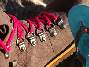
GOOD TREKKING SHOE & CHAPPAL
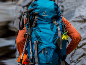
A GOOD QUALITY RUCKSACK
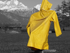
FULL RAINCOAT OR PONCHU
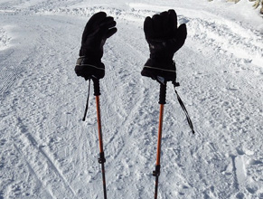
HIKING STICK & GLOVES
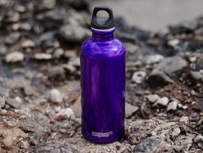
PERSONAL WATER BOTTLE
POWER BANK OR SOLAR CHARGER
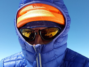
DOWN JACKET & SNOW PANT
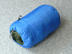
PERSONAL SLEEPING BAG
CAMERA KITS & SUNGLASS
2 SET SOCKS & WORM CLOTHS
Similar treks, mt. satopanth, altitude 7,075 m, cost 195,000.00, panpatia col trek, altitude 5,260 m, cost 70,000.00, altitude 5950 m, auden’s col trek, altitude 5,400 m, bali pass trek, altitude 4950 m, cost 20,500.00, dayara bugyal trek, altitude 3650 m, cost 8,500.00, dodital lake trek, altitude 4,145 m, cost 16,650.00, dodital yamunotri trek, cost 37,650.00, gaumukh tapovan trek, altitude 4,400 m, cost 19,500.00, nandanvan vasukital trek, altitude 4,850 m, cost 25,000.00, altitude 3,500 m, cost 12,600.00, chopta chandrashila top, altitude 4,000 m, cost 9,600.00, kedartal trek, altitude 4,550 m, cost 18,800.00, lamkhaga pass trek, altitude 5,200 m, cost 48,500.00, mt. shivling, altitude 6,543 m, cost 175,500.00.

NORTH HIMALAYAN HOLIDAYS
Gangotri national highway, uttarkashi, uttarakhand.
- +91-1374223281
- +91-9897100781
- [email protected]
QUICK LINKS
Recent treks, nelong- gartang gali travel guide, mayali pass trek, chardham yatra with gaumukh, gangotri & badrinath do dham yatra, kedarnath & badrinath, teen dham yatra, upcoming treks /trips expeditions 2023, the art of skydiving, wings over everest.
Get updates of our destinations, tours and many more!
FIND US ON MAP
© 2021 north himalayan holidays - all rights reserved.
DESIGNED BY WWINNOVATORS
- World Atlas /
- Western Siberia /
- Novosibirsk Oblast /
- Novosibirsk /
- Area around 55° 11' 31" N, 82° 31' 30" E /
Physical Map of Novosibirsk
This is not just a map. It's a piece of the world captured in the image.
The flat physical map represents one of many map types available. Look at Novosibirsk, Novosibirsk Oblast, Western Siberia, Russia from different perspectives.
Get free map for your website. Discover the beauty hidden in the maps. Maphill is more than just a map gallery.
- Free map
- Panoramic 4
Shaded Relief
Maps of novosibirsk.
Maphill is a collection of map images. This physical map of Novosibirsk is one of them. Click on the Detailed button under the image to switch to a more detailed map.
See Novosibirsk from a different perspective.
Each map type has its advantages. No map style is the best. The best is that Maphill lets you look at each place from many different angles.
Sure, this physical map is nice. But there is good chance you will like other map styles even more. Select another style in the above table. See Novosibirsk and Western Siberia from a different view.
What to do when you like this map?
If you like this Novosibirsk, Novosibirsk Oblast, Western Siberia, Russia map, please don't keep it to yourself. Give your friends a chance to see how the world converted to images looks like.
Share this map.
Use the buttons for Facebook, Twitter or Google+ to share a link to this physical map of Novosibirsk. Maphill is the largest map gallery on the web. The number of maps is, however, not the only reason to visit Maphill.
Get map of Novosibirsk for free.
You can embed, print or download the map just like any other image. All Novosibirsk and Western Siberia maps are available in a common image format. Free images are available under Free map link located above the map.
Is there anything more than this map?
Sure, there is. It has been said that Maphill maps are worth a thousand words. No doubt about that. But you can experience much more when you visit Novosibirsk.
Be inspired.
Western Siberia has a lot to offer. Each place is different. Each place is worth a visit. It will never be possible to capture all the beauty in the map.
Novosibirsk hotel deals.
If any of Maphill's maps inspire you to come to Novosibirsk, we would like to offer you access to wide selection of nearby hotels at low prices and with great customer service.
Thanks to our partnership with Booking.com you can take advantage of up to 50% discounts for hotels in many locations in the area of Western Siberia. Book hotels online and save money.
Novosibirsk hotels
See the full list of hotels in or close to Novosibirsk , the list of destinations in Novosibirsk , browse destinations in Novosibirsk Oblast , Western Siberia , Russia , Asia or choose from the below listed cities.
- Novosibirsk hotels »
- Hotels in Novosibirsk »
- Hotels in Novosibirsk Oblast »
- Hotels in Western Siberia »
- Hotels in Russia »
- Hotels in Asia »
Hotels in popular destinations in Novosibirsk
- Novolugovoye hotels »
- Kar'yer Mochishche hotels »
- Sadovyy hotels »
- Zavodskaya hotels »
- Matveyevka hotels »
- Pashino hotels »
- Nizhnyaya Yel'tsovka hotels »
- Michurino hotels »
- Berëzovyy Log hotels »
- Chemskiy hotels »
- Ozërnyy hotels »
- Cherbus' hotels »
- Katkovo hotels »
- Mochishche hotels »
Learn more about the map styles
Each map type offers different information and each map style is designed for a different purpose. Read about the styles and map projection used in the above map (Physical Map of Novosibirsk).
Physical map
Physical map illustrates the mountains, lowlands, oceans, lakes and rivers and other physical landscape features of Novosibirsk. Differences in land elevations relative to the sea level are represented by color.
Green color represents lower elevations, orange or brown indicate higher elevations, shades of grey are used for the highest mountain ranges in the world. Underwater topography is represented by blues. Darker blues are used for the deepest water, lighter shades of blue represent shallower water such as the continental shelf.
Geographic map projection
A map projection is a way how to transform points on a Earth to points on a map. This map of Novosibirsk uses Plate Carree projection. The Plate Carree projection is a simple cylindrical projection originated in the ancient times. It has straight and equally spaced meridians and parallels that meet at right angles.
All projections from a sphere to a plane are distorted. The drawback of the Plate Carree projection is that it doesn't make an attempt to compensate for these distortions. For the general view of Novosibirsk, this is not a significant problem. The detailed maps use the Mercator projection which preserves the shape of small areas better.
Locations near Novosibirsk
Destinations close to Novosibirsk sorted by distance.
- Zaton 4.7 km
- Bol'shaya Krivoshchëkova 7.2 km
- Kar'yer 8.0 km
- Bugry 8.3 km
- Kar'yer Mochishche 8.5 km
- Ust'-Inya 8.8 km
- Levoberezhniy 9.8 km
- Ozërnyy 10 km
- Kamenka 10 km
- Katkovo 11 km
Popular searches
A list of the most popular locations in Russia as searched by our visitors.
- Novosibirsk Oblast
- Ural Mountains
- Kabardino-Balkarian Republic
- Kaliningrad Oblast
Recent searches
List of the locations in Russia that our users recently searched for.
- Kursk Oblast
- Udskaya Guba
- Amur Oblast
- Bagaevskaya
- Pskov Oblast
- Ladozhskoe Ozero
The Maphill difference
It's neither this physical map nor any other of the many millions of maps. The value of a map gallery is not determined by the number of pictures, but by the possibility to see the world from many different perspectives.
We unlock the value hidden in the geographic data. Thanks to automating the complex process of turning data into map graphics, we are able to create maps in higher quality, faster and cheaper than was possible before.
Forever free
We created Maphill to make the web a more beautiful place. Without you having to pay for it. Maphill maps are and will always be available for free.
Real Earth data
Do you think the maps are too beautiful not to be painted? No, this is not art. All 2D maps of Novosibirsk are created based on real Earth data. This is how the world looks like.
Easy to use
This map is available in a common image format. You can copy, print or embed the map very easily. Just like any other image.
Different perspectives
The value of Maphill lies in the possibility to look at the same area from several perspectives. Maphill presents the map of Novosibirsk in a wide variety of map types and styles.
Vector quality
We build each map individually with regard to the characteristics of the map area and the chosen graphic style. Maps are assembled and kept in a high resolution vector format throughout the entire process of their creation.
Experience of discovering
Maphill maps will never be as detailed as Google maps or as precise as designed by professional cartographers. Our goal is different. We want to redefine the experience of discovering the world through the maps.
Fast anywhere
Maps are served from a large number of servers spread all over the world. Globally distributed map delivery network ensures low latency and fast loading times, no matter where on Earth you happen to be.
Spread the beauty
Embed the above physical map of Novosibirsk into your website. Enrich your blog with quality map graphics. Make the web a more beautiful place.
Maphill is the web's largest map gallery.
Get a free map for your website. Explore the world. Discover the beauty hidden in the maps.
Map graphics revolution.™
Today's Weather - Novosibirsk, RUS
- Weather Details
- Featured Videos
- Air Quality
- Top Stories More News
- Today's National Outlook
- Hurricane Tracker
- Allergy Forecast
- Cold & Flu
- Snow & Ski Forecast
- Fire Updates
- Traffic Cameras
- Weather Cameras
- Outdoor Sports Guide
Related Guides:
Novosibirsk
Novosibirsk maps and orientation, (novosibirsk, siberia, russia), maps and orientation of the city.
- Anzhero Sudzhensk - north-east
- Barnaul - south
- Berdsk - south
- Iskitim - south
- Kemerovo - east
- Kuybyshev - north-west
- Leninsk Kuznetskiy - east
- Tomsk - north-east
- Yurga - north-east
Map of Russia
Map of novosibirsk.
© Copyright TravelSmart Ltd
I'm looking for:
Hotel Search
- Travel Guide
- Information and Tourism
- Maps and Orientation
- Transport and Car Rental
- History Facts
- Weather and Climate
- Accommodation
- Hotels and Accommodation
- Popular Attractions
- Tourist Attractions
- Museums and Art Galleries
- Attractions Nearby
- Things to Do
- Events and Festivals
- Restaurants and Dining
- Your Reviews of Novosibirsk
- Russia World Guide
- Guide Disclaimer
- Privacy Policy / Disclaimer
IMAGES
COMMENTS
The Kalindi Khal Trek is a high-altitude trek in the Indian state of Uttarakhand that connects the holy sites of Gangotri and Badrinath. It is a multi-day journey that can be completed in 14 days and is all dependent on weather conditions. The journey is regarded as one of the most difficult in India. The expedition begins at Gangotri and passes through some of the most spectacular and remote ...
Kalindi Khal, also known as Khalindi Pass, stands as a high-altitude mountain pass linking various valleys like Gangotri and Ghastoli (Badrinath) at an elevation of 5942 meters (19495 ft). It ranks as the second-highest pass in the Himalayan Range. The ideal time for this trek or pass crossing is during May-June or September.
Kalindi Pass, a high altitude trek of 19,488 ft. demanding ultimate level mountaineering techniques and skills is one of the most famous, adventurous and challenging treks in Garhwal Himalaya starting from Gangotri to Badrinath and is considered to be the highest trekkable mountain pass.Be it the mesmerizing rivulets and peaks of Shivling, Baghirath, Meru or the challenging route that includes ...
Trek Description. Nestled in the heart of the majestic Garhwal Himalayas, the Kalindi Khal Pass Trek is a journey of adventure, spirituality, and nature's grandeur.It is a challenging odyssey that beckons those with a thirst for the extraordinary, taking trekkers on an unforgettable quest through some of the most mesmerizing landscapes and glacial terrains in the Indian Himalayas.
Ninth Day: Kalindi Base - Kalindi Peak (Kalindi Pass (5947 m) After breakfast at Kalindi base in the morning to reach Abri Kalindi Peak. After reaching here, your trekking is finally complete. Trekkers can rest here. PC: flickr.com Tenth day Kalindikhal - Raja Parva (4910 m / 16105 ft) trek (12 km / 6-7 hrs). After trekking in Kalindi, now the ...
Duration: 15 Days. Kalindi Khal Trek is an extremely challenging expedition-style traverse of the Kalindi Khal Pass in spectacular Garhwal Himalayas connecting Gangotri and Badrinath. The route involves a trek over rough glaciers, rocky screens, and crevassed snowfields. At times we need to rope up and require the use of ice axes and crampons.
Location of Kalindi Khal Trek . Kalindi pass or Kalindi Khal is a high-altitude mountain pass linking Gangotri and Gastoli. It is situated at 5,950 meters (19,520 ft) elevation and is arguably the most famous trekking pass of the Garhwal Himalaya. It is located in the Garhwal division of Uttarkashi district of Uttarakhand.
Badrinath. On the final day of the trek, hike for 16 kms to Badrinath, via Mana village with packed lunch. On arrival, visit the temple of Shri Badrinath Ji. Tour concludes. End. Download. Destinations: Gangotri, Bhojbasa, Nandanvan, Vasukital, Khara Patthar, Kalindi Base, Rajparav, Ghastoll, Badrinath Experience: Trekking (Challenging) Maximum ...
Altitude: Kalindi Khal Trek is one of the most challenging treks in Uttarakhand, reaching altitudes of over 19,000 feet (5,860 meters) above sea level. Location: The trek is located in the Garhwal region of Uttarakhand, India, and is part of the Gangotri National Park. Duration: The trek usually takes around 12 to 16 days to complete, covering ...
Kalindi pass trek is the Difficult trek in India Himalaya. Kalindi Pass Trek is 6000 meters above the sea level which lies in the Great Himalayas. The exhilarating trails demand enthusiasm and deep knowledge of trekking in high altitude treks. It is a connecting pass of Gangotri and Gastoli village or Badrinath Valley.
The Kalindi Khal trek crosses the Kalindi Pass at 5950 m between Gangotri and Badrinath and is one of the most challenging treks in the Garhwal, Uttarakhand. +91 8078656096 [email protected]. ... Detail Itinerary Map Photos Reviews. Kalindi Khal Trek. 14 Days. Group : 12 People. Guided Trek.
Kalindi Khal trek - Prerequisites: A trekker must have completed at least 5 high altitude treks going above ~ 4500 m/15000 ft. A minimum of 2 Difficult grade treks reaching beyond 5000 m/16500 ft e.g. Pin Parvati Pass, Ronti Saddle, Parang La etc. A trekker must be in excellent physical condition along with NO prior acclimatisation issues on ...
The highlight of the trek is undoubtedly the Kalindi Khal pass itself, a formidable and often snow-covered mountain pass that stands at over 5,950 meters (19,520 feet) above sea level. This journey is not for the faint of heart, but the reward is an indelible connection with the rugged, untouched wilderness of the Himalayas, making it a must-do ...
Altitude: 12,435 ft to 14,600 ft via 13,452 ft. Distance: 18 km. Time Taken: 10-11 hours. The windy trail of kalindi khal pass trek is blessed with the extravagant beauty of the majestic peaks of the Garhwal Himalayas and passes through the small streams filled with colorful aura around till Gaumukh.
The Kalindi Pass is one of the most difficult treks in the Garhwal Himalayas (5967m). A lovely combination of glacier travel and altitude trekking. Known as the Kalindi Khal trek. Trek Details . Area: Uttrakhand - Uttarkashi- Kalindi pass - Joshimath; Altitude: Min: Uattarkashi (1350Mts.) Kalindi Pass Max: (5947Mts.) Age: 16 years and above.
The Kalindi Khal Pass Trek lets you kiss the daily grind goodbye as you meander deep into the wild in the challenging, rewarding Kalindi Pass. The trek will have you hiking over fields blanketed in snow, by massive glaciers, and along bubbling rivers for the 99 km stretching between Gangotri and Badrinath Valley. ... This map from the US ...
Kalindi khal pass trek expedition covers some very remote and famous areas which are popular amongst the trekkers. First is from where the River Ganga originates Gomukh, explore the green landscapes of Tapovan with streams around and the remote area Vasuki Tal. Kalindi khal pass Trek Booking Open now for May-June 2024
Experience the thrill of crossing the Kalindi Khal, a high-altitude pass in the Himalayas. Book Kalindi Khal Trek, Uttarakhand online and get 20% off on this adventure.
Kol'tsovo. Koltsovo is an urban locality in Novosibirsky District of Novosibirsk Oblast, Russia, located about 10 kilometers northeast of Akademgorodok and 20 kilometers southeast of Novosibirsk's center. Photo: К.Артём.1, CC BY-SA 4.0. Ukraine is facing shortages in its brave fight to survive.
83° 0' 0" E. Minimal elevation. 64 m. Maximal elevation. 216 m. Land/Water. mainland. It's neither this physical map nor any other of the many millions of maps. The value of a map gallery is not determined by the number of pictures, but by the possibility to see the world from many different perspectives.
The Kalindi Khal Trek is a high-altitude trek in the Indian state of Uttarakhand that connects the holy sites of Gangotri and Badrinath. It is a multi-day journey that can be completed in 14 days and is all dependent on weather conditions. The journey is regarded as one of the most difficult in India. The expedition begins at Gangotri and passes through some of the most spectacular and remote ...
Want to know what the weather is now? Check out our current live radar and weather forecasts for Novosibirsk, Novosibirskaya oblast', RU to help plan your day
Maps and Orientation of the City. For many, finding your way around Novosibirsk can be a little daunting, although the actual city centre is really quite manageable and laid out in an organised fashion, being based around the Ploshchad Lenina. The main thoroughfare in Novosibirsk is the Krasny Prospekt, with intersects the Ploshchad Lenina and ...